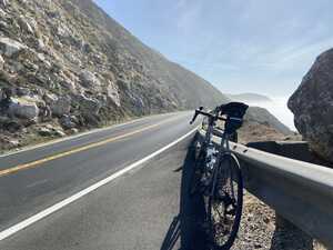
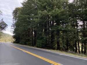
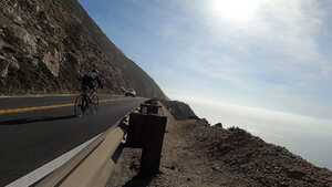
Highway 1 is a famous motor route that snakes along California’s Pacific coast. Not all sections of the highway are suitable for bicycle traffic, but luckily, the portion through Big Sur is indeed. According to various sources quoted in the Wikipedia article, it is “the greatest meeting of land and water in the world” and “one of the top ten world-famous streets, comparable to Broadway in New York City and the Champs-Élysées in Paris.” It’s easy to see why: miles upon miles of stunning coastline, green pastures, and redwood groves line the route. In my opinion, our natural beauty is one of the greatest assets of the United States, and few places show it off as well as Highway 1. Who needs Mallorca when you have this incredible gem just an hour and a half away?1
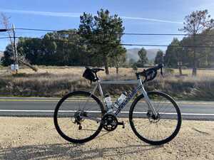
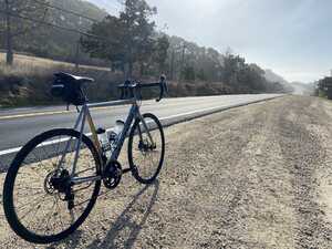
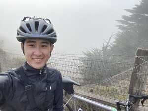
Aiming to take full advantage of California’s unfairly gorgeous January weather (here in the Bay Area, the forecast is sunny with a high in the 70s all week!), I drove down to Carmel-by-the-Sea at Monterey Bay, right outside the Point Lobos State Preserve. I then parked my car2 and headed south into the Big Sur region, aiming to complete at least a half century (50-mile, for the uninitiated) ride.
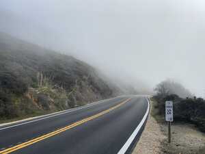
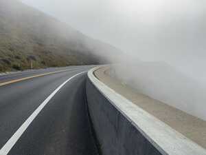
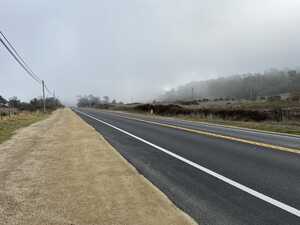
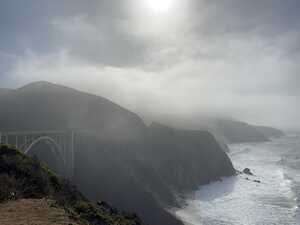
In the morning, there was a ton of mist covering everything, which made for a really cool effect. As I was heading south, there were these mist-covered hills to my left; to my right, the Pacific Ocean receded into a line of rolling fog. There was some motor traffic, but there were few enough cars that I would get periods of time when I didn’t encounter a single other person, and I could imagine that I was cycling alone through some fantasy landscape. I guess the appeal of cycling is part escapism for me. Actually, it brought to mind the mist in Kazuo Ishiguro’s novel The Buried Giant.
Later, as the route wound away from the shoreline and into some grassy fields (also coated in a layer of beautiful fog), I encountered some bovine friends! This was pretty cool.
One item in particular that was kind of cool was this small structure on a hill that just poked above the fog in the distance. It made me think of the “castle on a cloud” from Les Misérables.3 I don’t know if I got a picture of this.
Another pretty sight was the famous Bixby Creek Bridge. Regular readers of these ride reports will know how much I love riding over bridges, so of course riding over one of the iconic structures of the Big Sur coast was an absolute pleasure.
I treated myself to an early lunch consisting of my old ride favorite, the classic peanut butter and jelly sandwich on an everything bagel. (I love bagels, it offers plenty of calories, and when wrapped in tinfoil, it’s easy to stuff into a jersey pocket, so what’s not to love?) I normally use Trader Joe’s bagels, since this is one of the closer grocery stores to my apartment in Pittsburgh, but here in California, I got to use Costco bagels instead. In my opinion, Costco bagels are a little too dense if you just eat them cold, and obviously you can’t heat up a bagel on the roadside.
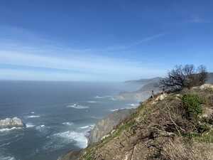
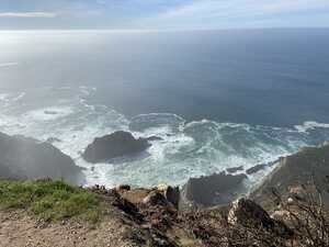
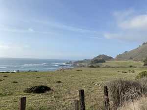
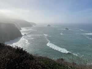
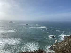
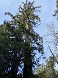
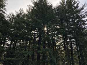
Later, the sun came out, and the fog disappeared. I’m actually not sure if I prefer the foggy morning scenery or the sunny afternoon. After many breathtaking views, I finally turned around 25 miles into my ride, at this point somewhere around Pfeiffer Big Sur State Park. (I passed the signs introducing the park, but I’m not sure exactly where I ended up.) There were a few small groves of the famous California redwoods by the roadside, which was really cool.
At one point, when I stopped to take a picture, a guy who had stopped his car at the side of the road to enjoy the view struck up a short (very socially-distanced) conversation. We really only exchanged a few words, but it makes me happy that there are friendly people on the roads.
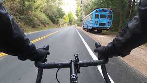
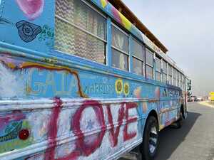
There was also an interesting blue school bus that was painted with various messages all over. I first saw it when I was heading into the Big Sur Valley (?) region, and I thought that it was an abandoned thing that people had drawn over with graffiti. But then when I stopped to take a picture on the northbound (return) leg of the journey, I saw the very same school bus pulling up behind me!
There was more climbing than I’d anticipated. Apple’s workout tracker computed 3,697 feet of elevation gain, but Strava’s computed 4,149 feet sounds more impressive, so we’ll go with that. Either way, I easily cleared more than 1 km of elevation gain (in the “sane” unit system), which is probably the most I’ve ever done in a single ride. It’s certainly not climbing Mont Ventoux, but it’s definitely not flat by any reasonable measure. There are no particularly steep climbs that I recall (well, relative to Canton Avenue in Pittsburgh, no climb is steep), but the climbing sort of just creeps up on you.
My uncle actually let me borrow his GoPro Hero 8, which I used to record footage. This slowed me down considerably, since I was constantly stopping to swap out batteries, adjust the camera angle, and change the camera mount, but I think it was worth it (after all, I’m there to enjoy the view, not set a personal record). As such, this ended up being one of my slowest half centuries, I think—the climbing didn’t help very much either. I stitched together a video from the GoPro footage and put it up on YouTube. I’m not a huge fan of using Google services to host content, but it’s the most convenient way to do so until I sort out the large file situation on my personal hosting site. I actually tried just using Keybase public files as well, but it was kind of slow.
Apparently, not many people agree…I saw only one other cyclist during the day, a guy on a very nice-looking Bianchi. To be fair, I chose a weekday morning precisely because I wanted to avoid traffic.↩︎
One of my favorite parts of cycling trips is finding sketchy parking spots at the side of the road.↩︎
And…now the song is stuck in my head. Les Mis songs have a tendency to do that.↩︎
Comments