California’s Sierra Nevada is a special place. It draws countless visitors to the crystal-clear waters of Lake Tahoe; it is home to the grandiose rock walls of Yosemite Valley; it contains Mount Whitney, the tallest mountain in the contiguous United States; it boasts General Sherman, the largest tree in the world by volume. As an East Coast resident, it almost feels unfair that this one particular mountain range on the West Coast was endowed with so much natural beauty.
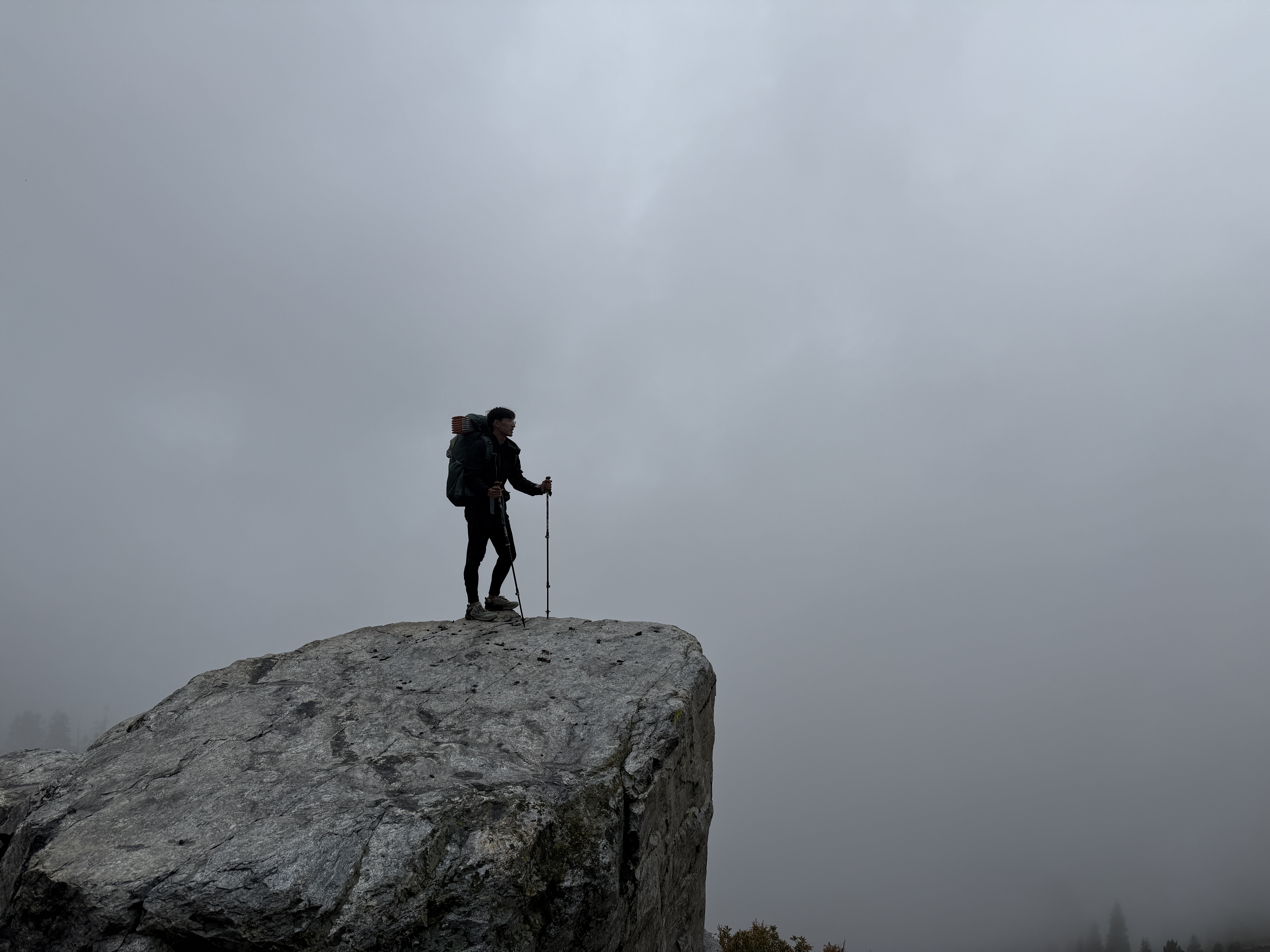
Perhaps more than anything else, I’ve long been jealous of the spectacular backcountry hikes that are available in the High Sierra. Alpine lakes, granite peaks,1 star-filled skies—all things that I could only dream of while sitting here in my Manhattan apartment. As one does, I naturally began scheming, concocting the rough outline of a backpacking trip and drafting up lists of friends I thought could be convinced to come. In the end, I managed to drag Ray, Ricky, and Richard out for five days of glorious hiking in Sequoia National Park. It turned out to be a great trip, full of jaw-dropping scenery, planning mishaps, and good fun. And now for your regularly scheduled REI advertisement trip report…
Anyone who has been on a trip with me knows that my planning process is a little bit hectic; I often figure out important details at the last possible moment. This time, I was forced to actually be on top of things, because the trail that I wanted to hike—the famous loop to Rae Lakes—requires a fairly competitive permit process that begins six months out from one’s intended start date. For instance, if you want to enter the trail on, say, August 1st, you have to apply on February 1st.2 So actually, I had to organize the basic outline of the trip (or at least secure the wilderness permit) all the way back in March. Wow, look: Eric is so on top of planning for once! What could go wrong?
The astute reader will notice that Rae Lakes lies, in fact, in Kings Canyon National Park, whereas I previously mentioned that we went hiking in Sequoia National Park. About that: I had thought that the most difficult part of planning this trip would be obtaining the wilderness permit. But although I got the permit without much difficulty, it turned out that Mother Nature had other plans; about three weeks before our intended start date, a major wildfire—the Garnet Fire—started up about thirty miles west of where we intended to hike. While it was very unlikely for the fire itself to spread eastward, if the winds became unfavorable, they could potentially blow smoke directly into us, making the air quality a bit suspect. We spent a stressful two weeks before the trip weighing our options: proceed and risk the air being unhealthy to breathe, cancel the trip, or find a backup hike somewhere.
On the backup front, it seemed like we would have to stick to somewhere within driving distance of Fresno, both because some people didn’t want to have to book new flights, and because a lot of the obvious options were also facing their own wildfire problems. My first thought was to hike somewhere in Wyoming’s Wind River Range, but the Dollar Lake Fire was currently wreaking havoc there. I’d heard good things about Utah’s High Uintas Wilderness, but the Beulah Fire thought otherwise. As an East Coaster, I was kind of shocked looking into this. Is the entire western United States just on fire every summer? Westward, look, the land is bright!
I made a habit of daily checking the fire and air quality reports, and reading every recent trip report on the r/seki subreddit. It seemed like in all likelihood, the Rae Lakes loop would stay clear of smoke, as the wind had consistently been blowing away from the lakes. But there was still a chance that the winds would turn against us, so we ended up deciding to go for a backup option a little further south, in the Mineral King district of the adjacent Sequoia National Park. Ray really carried the backup planning here, plotting out an alternative route for us to take, going out through Franklin Lakes and coming back through Timber Gap. It ended up being a really great route—similar mileage but a little more strenuous (in a good way, about 40% more elevation gain than Rae Lakes would have been), and just as scenic. But those two weeks debating what to do about the fire sure were stressful.
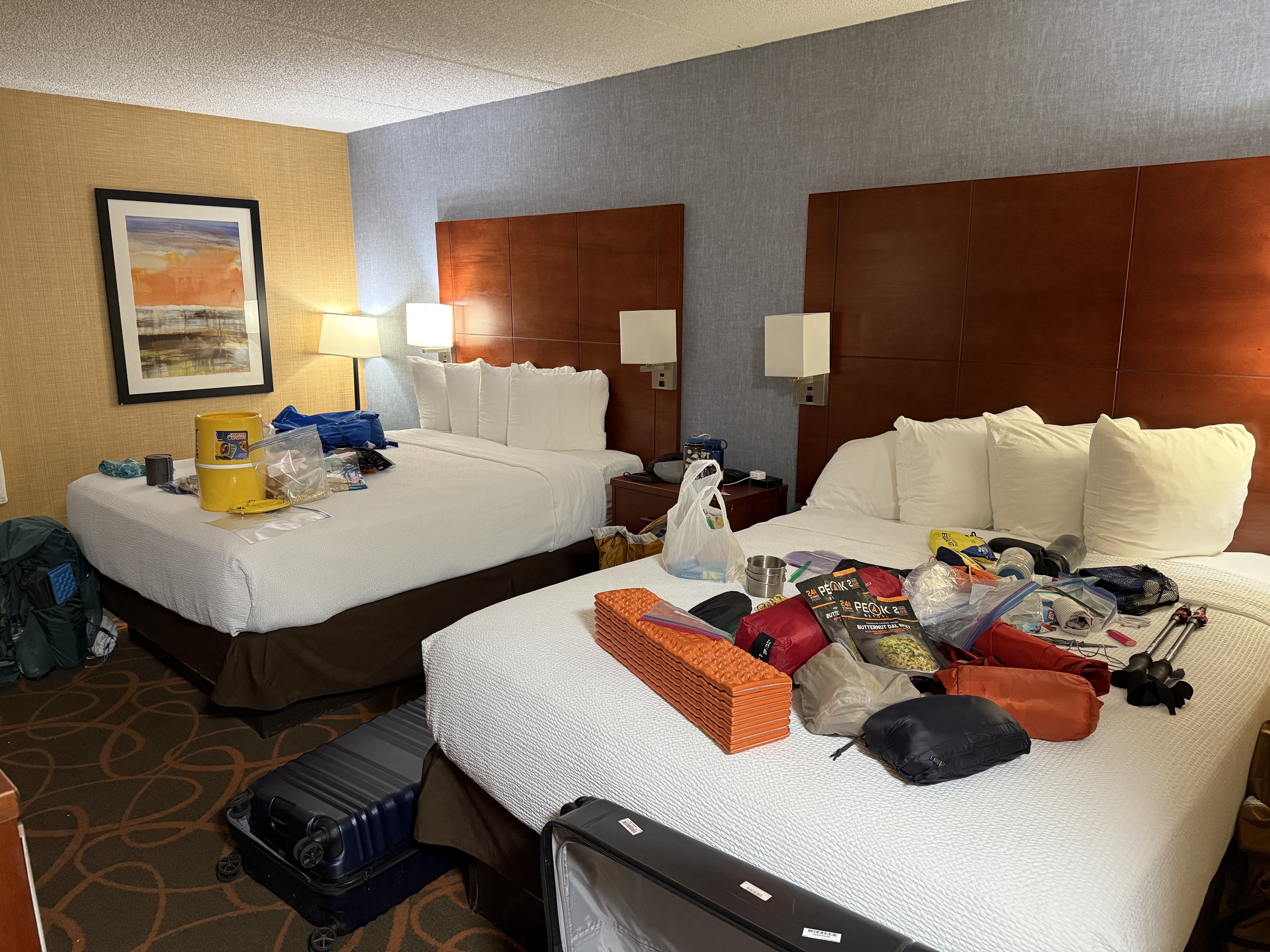
Though the hiking logistics ended up being quite complicated, the travel logistics for the trip ended up being fairly smooth. We flew into Fresno from New York on Saturday, meeting up at the Best Western, getting dinner at a fun local restaurant, and organizing our gear. The next day, we picked up some stove fuel canisters from REI, did some last-minute snack shopping at Walmart,3 and drove down to Sequoia National Park, where we were planning on spending the night at a frontcountry campsite before setting off onto the trail the next day. There was unfortunately not enough time to attend a local church service, which I would have really enjoyed.
The drive into the park was decently scenic. We started off driving through the dry and flat landscape of central California, passing by lots of farms and quaint little gas stations and convenience stores. We raided a few of these to try to find some decently non-perishable lunch for our first day of hiking,4 eventually walking away with some sandwiches. Richard and Ricky were apparently very amused to find “Italian brainrot gacha packs” at one of the convenience stores. I didn’t get it at the time, and after looking up what “Italian brainrot” is, I’m still not sure that I get it.
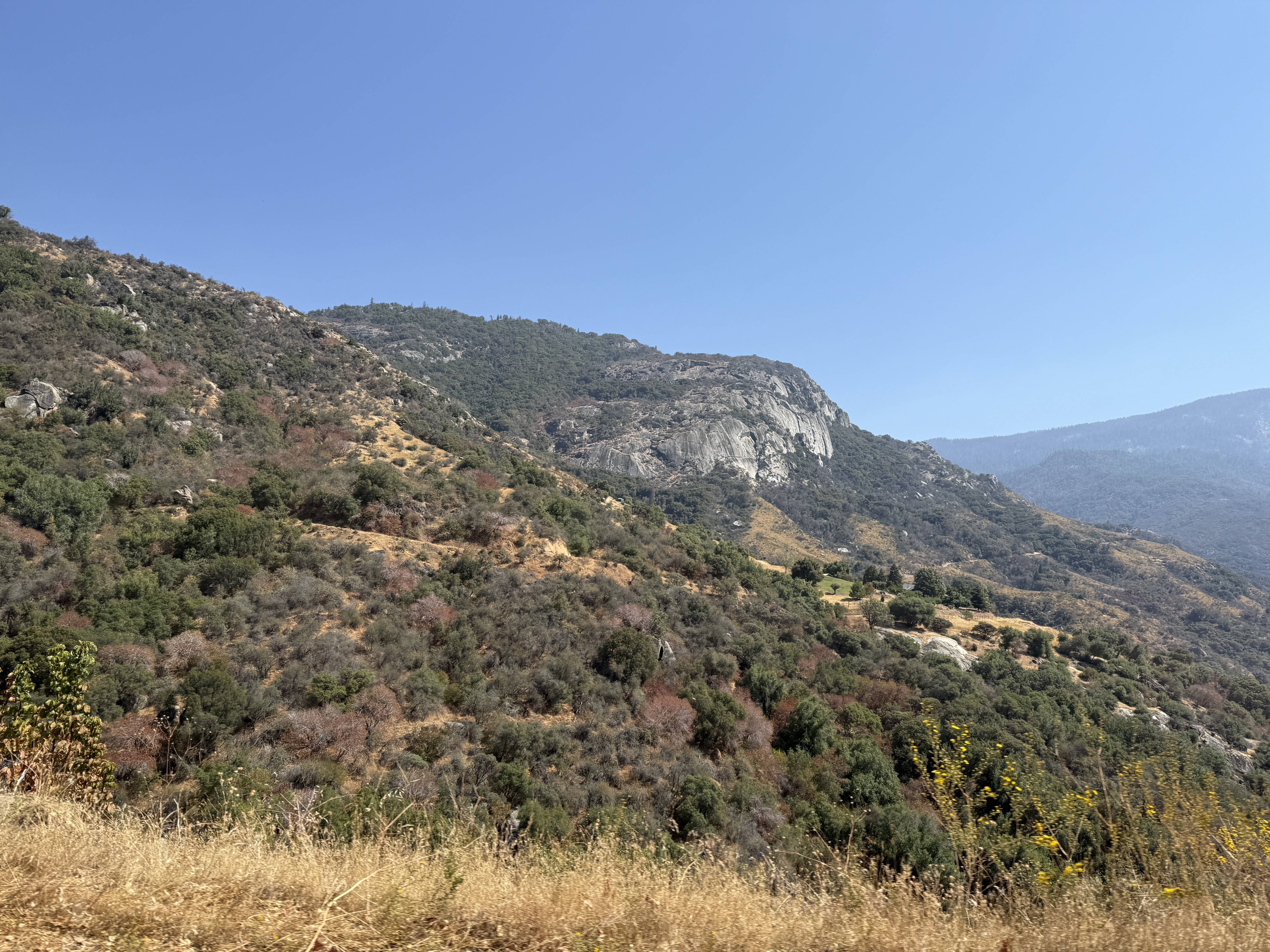
Anyway, after about an hour or two of driving through farmland, we hit the foothills of the Sierra and began ascending a narrow, winding mountain road. I have to say: although I sometimes glamorize high alpine environments, there’s something undeniably beautiful about the lower foothills as well—a place where grassy valley gradually gives way to steep stone cliffs as you climb up. This was also where our contact with civilization was cut off; once you enter the mountains, there’s very little cell service. When we started driving into the hills, I put my phone in airplane mode (to preserve battery) and didn’t reconnect to cell service until we left the park, a week later. Honestly, I kind of appreciated not having any cell service for a week—it made for a nice retreat from life. Maybe I should put my phone in airplane mode more often or something.5
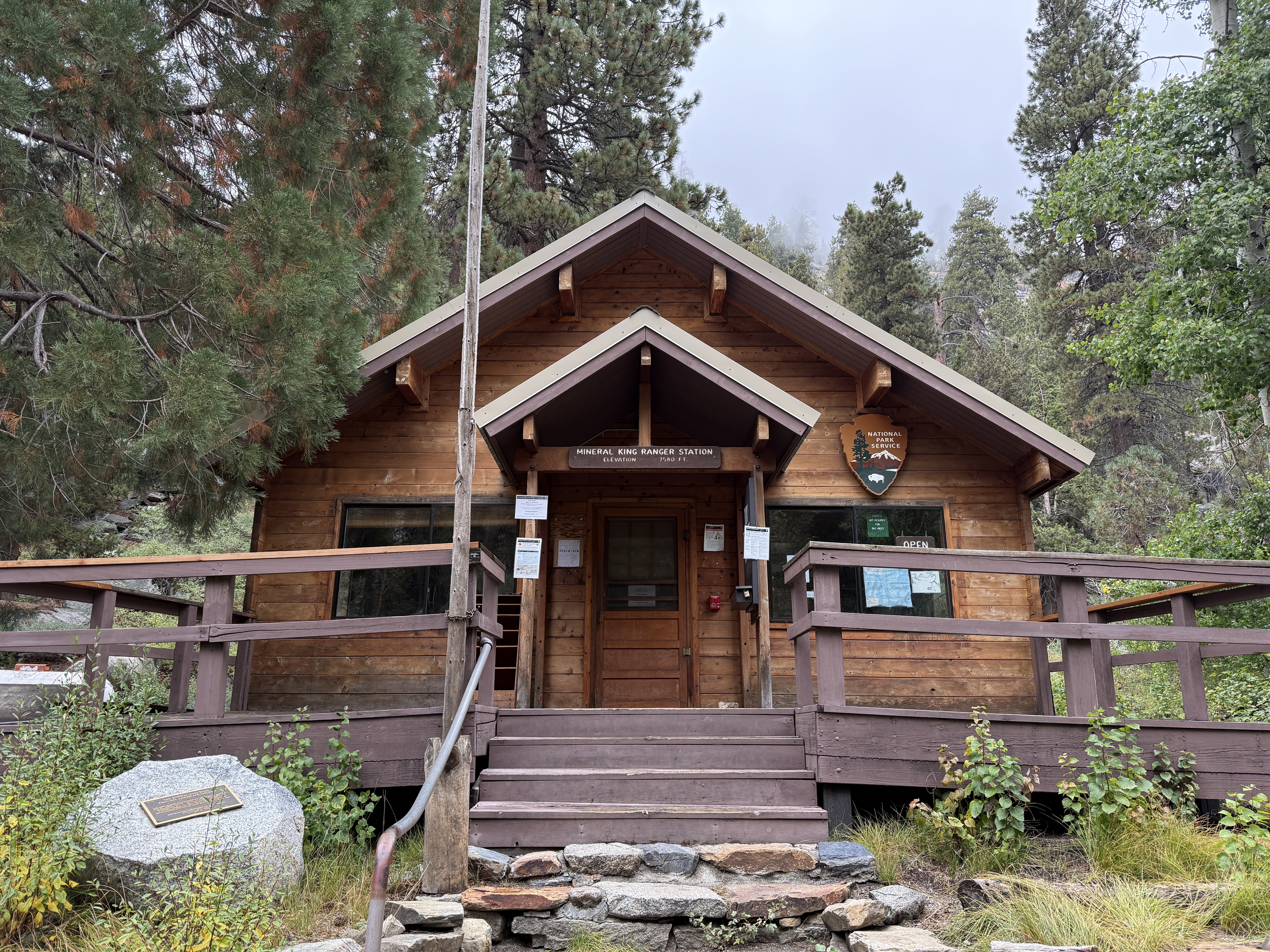
After about an hour of driving along this mountain road,6 we finally arrived at our destination: the remote Mineral King district of the park. We picked up our wilderness permit and bear canisters at the ranger station, where I was surprised to hear the ranger automatically ask us for our Garmin inReach number. (I don’t have one, but Ray has one.) In fact, most of the parties we passed on the trail seemed to have some form of satellite locator; I guess this is the new standard piece of safety equipment for backpacking.
We set up camp at a nice little campsite on a hill before driving back to the Silver City resort to get dinner at a restaurant—our last proper cooked meal before we set off for a week in the backcountry. We would not have such luxuries as “burger and fries” for the next five days.
I wish I could say that we started the next day bright and early, but that would be a lie, and I, of course, never lie. We took our time eating breakfast, breaking down camp, putting our scented items in a bear box, and enjoying our last poops on an actual toilet before finally hitting the trail at a not-super-early-but-still-respectable 9:30 am.
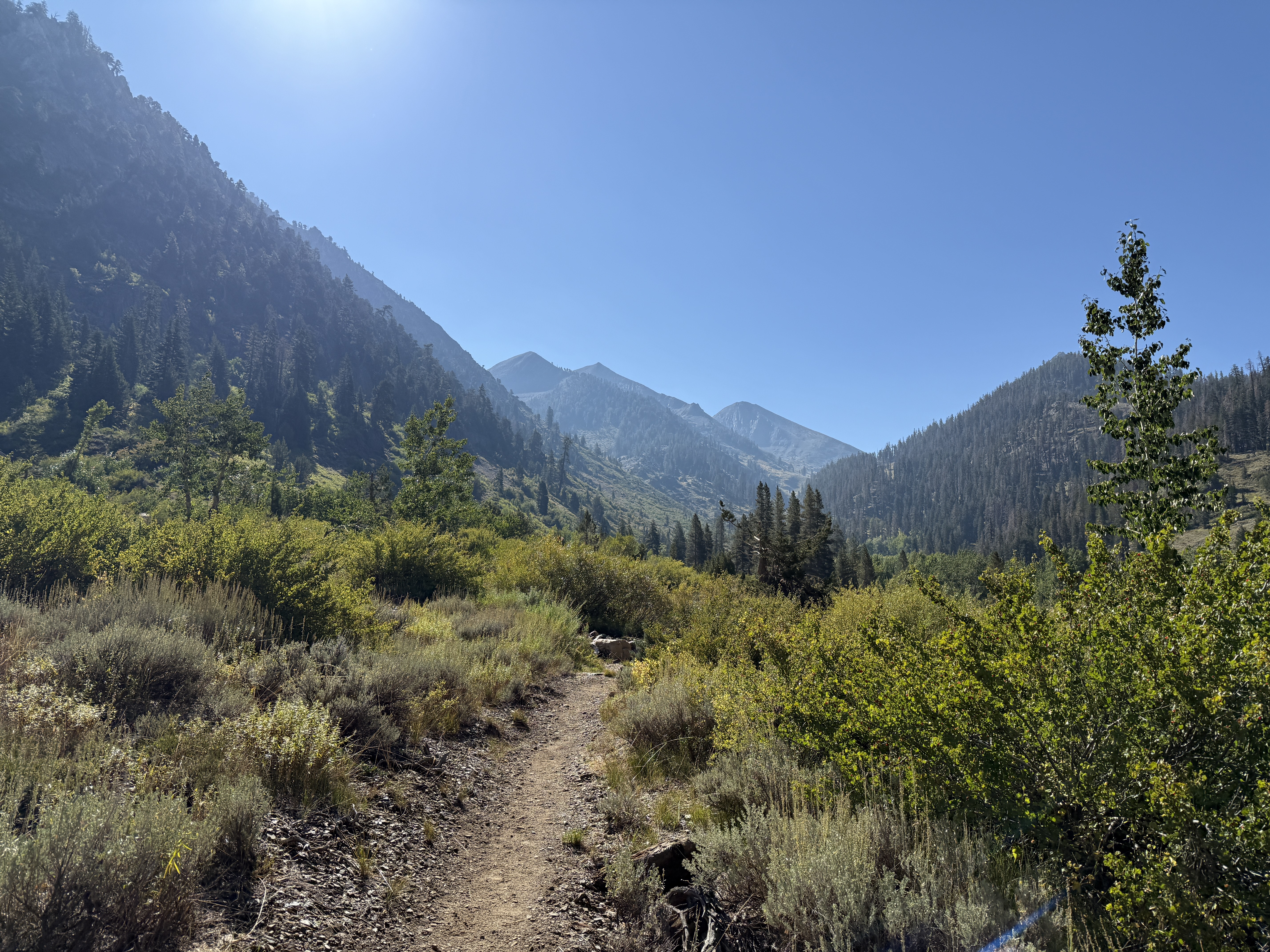
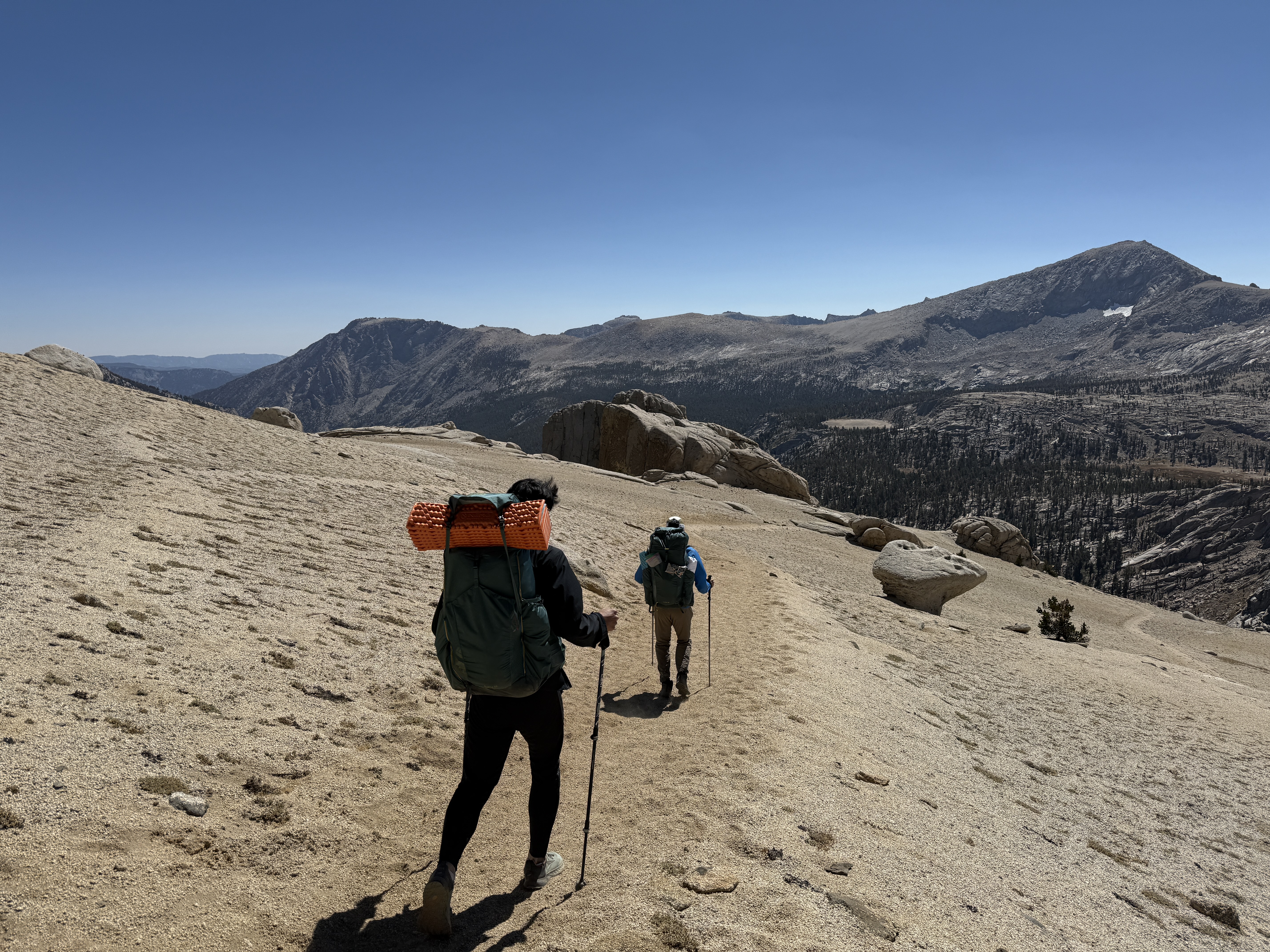
The trail started out fairly mellow, following a stream that gradually climbed out of the Farewell Canyon. Being still at comparatively lower elevation, the landscape was still dominated by yellow grass, a classic summertime sight in California. We passed a couple of parties on the initial climb, as well as a stable of horses in the valley, which would turn out to be foreshadowing for the occasional patch of manure that we’d later encounter on the trail.
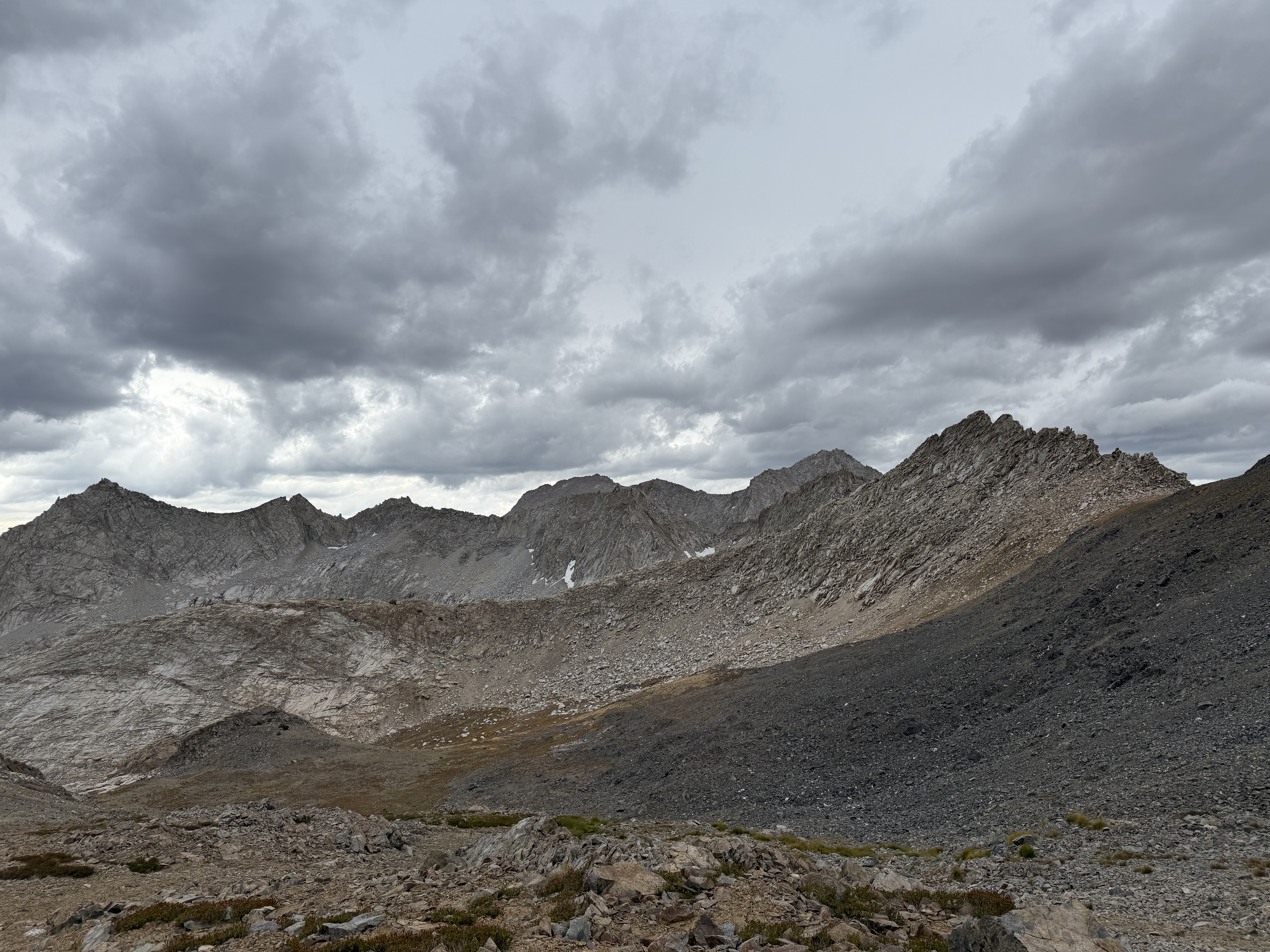
Eventually, the trees began to thin out, and we entered some really beautiful, rocky terrain. We went at a fairly easy pace and took plenty of breaks; each break was also an opportunity to look back and enjoy the view of the valley stretched out below us. To the north, we could see the other high peaks of the Sierra Nevada, although for some reason the air looked faintly hazy in that direction. My guess is that it was due to the wildfire smoke, but I’m not entirely sure.
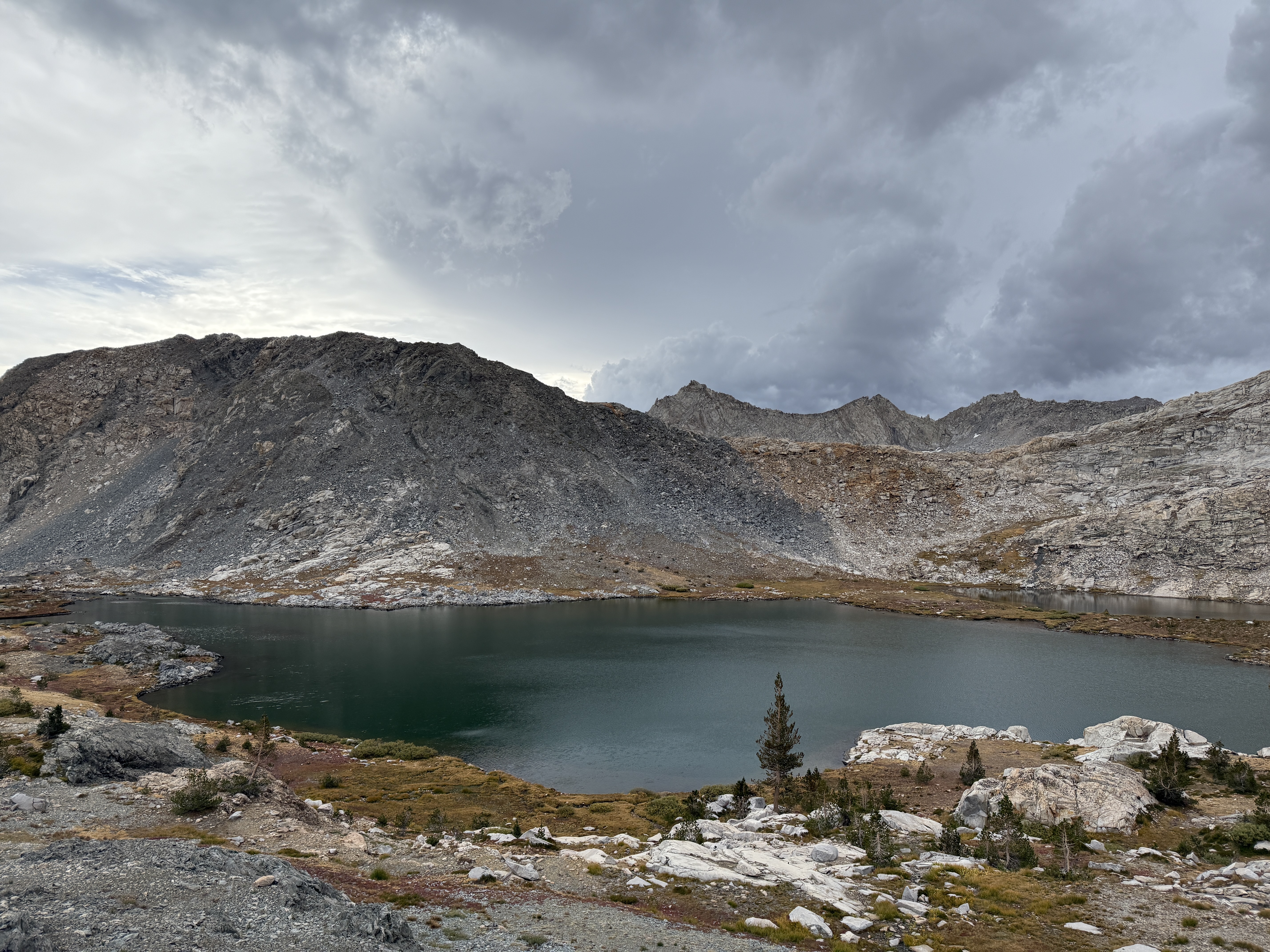
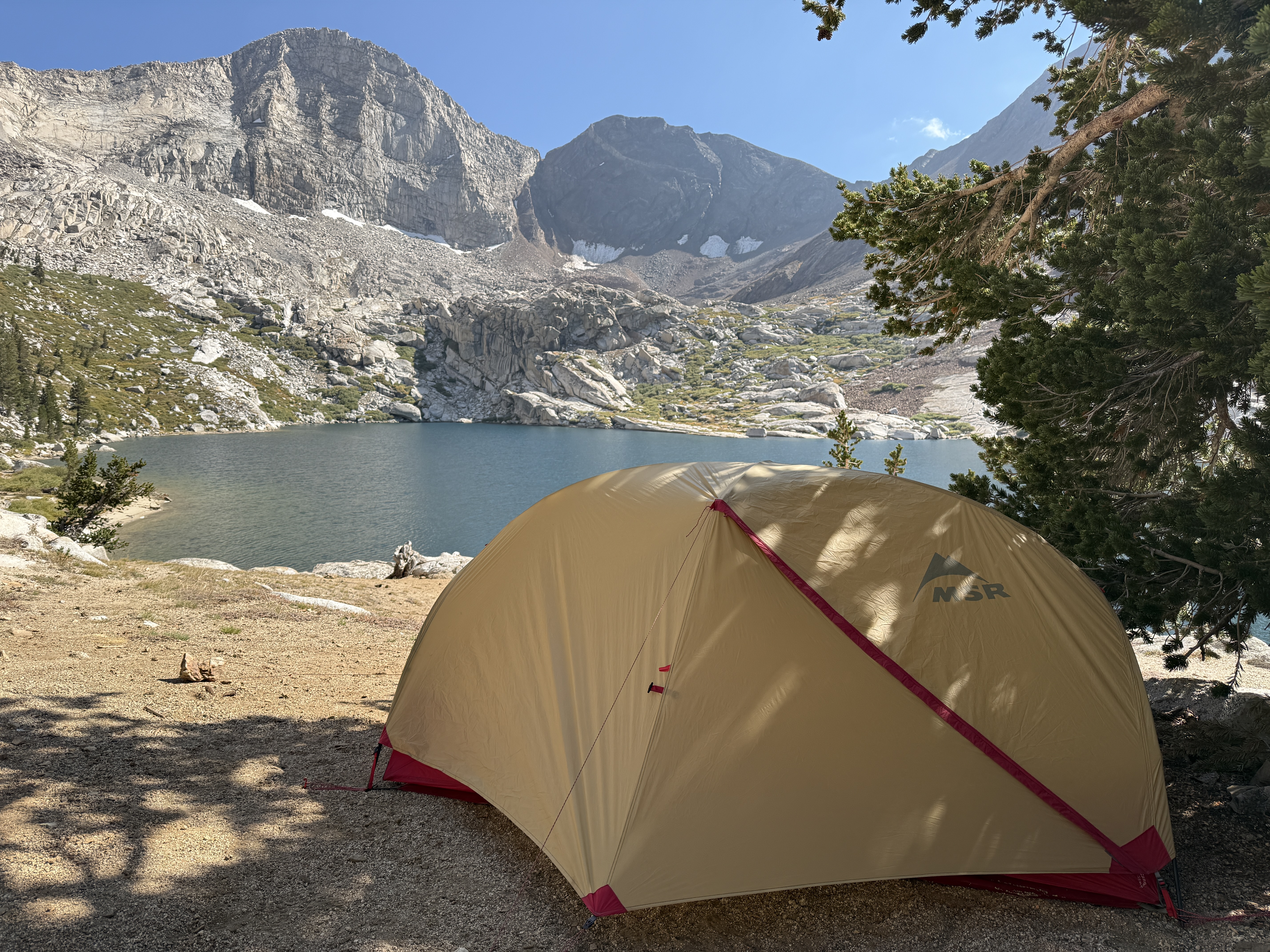
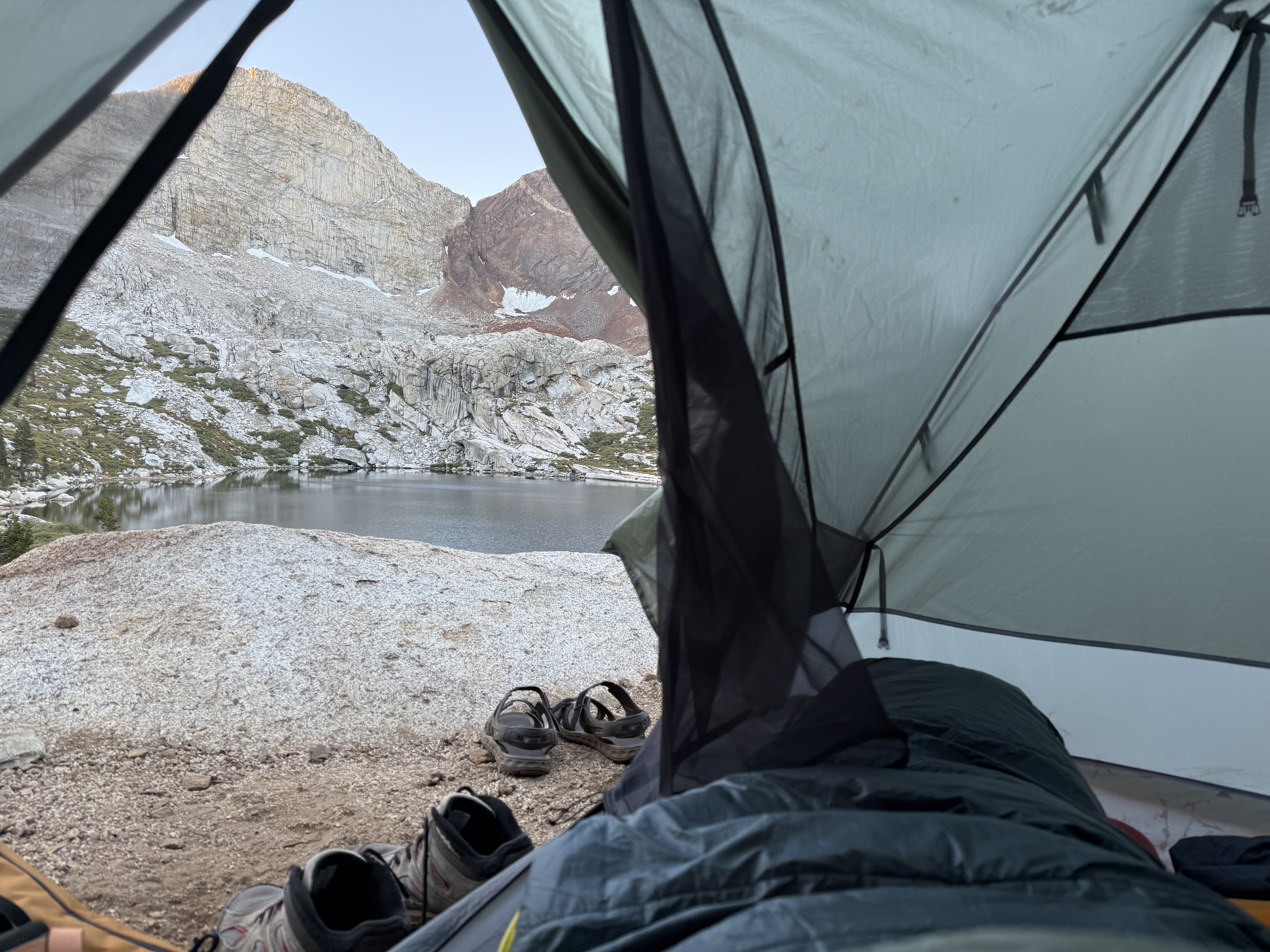
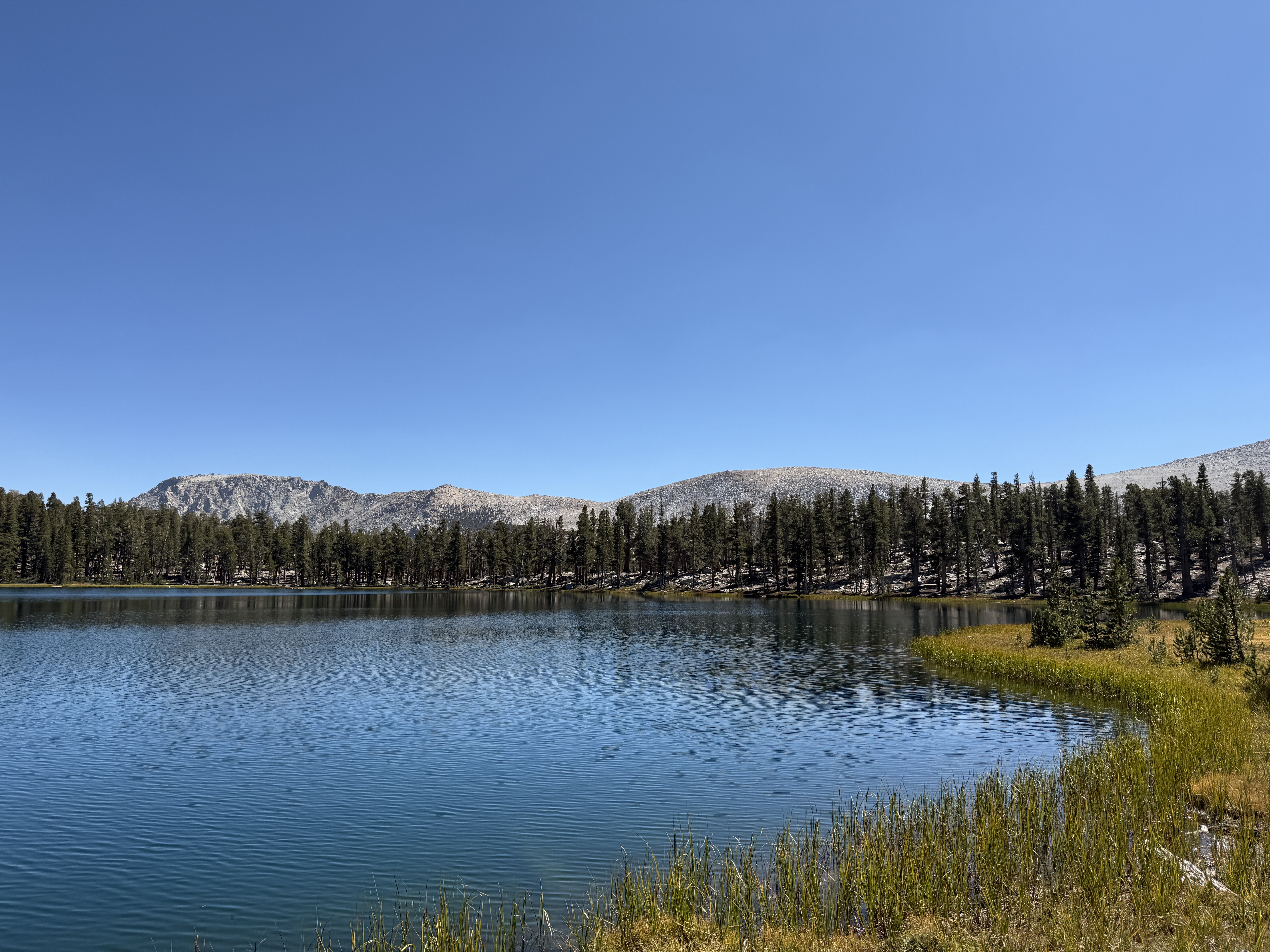
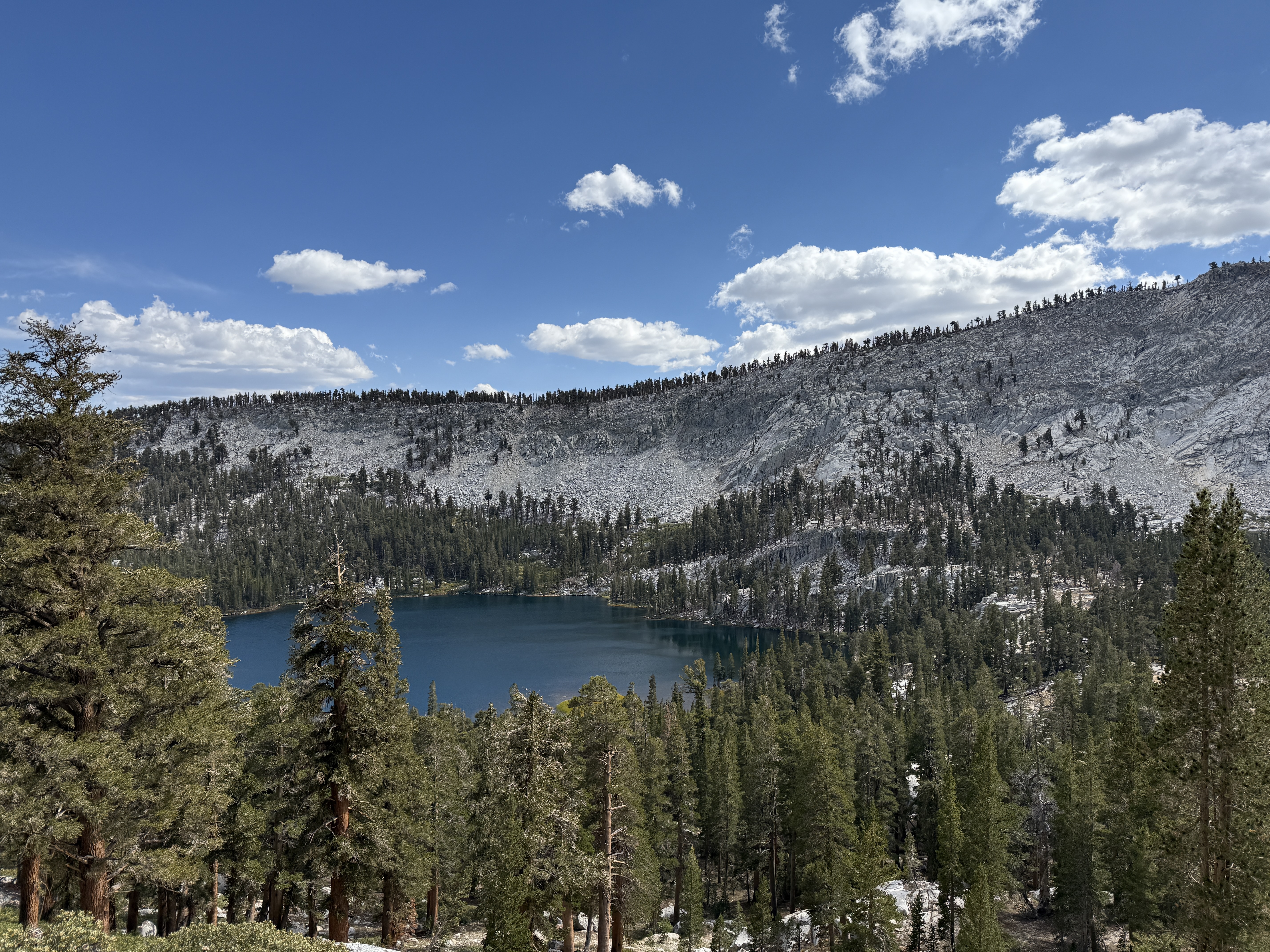
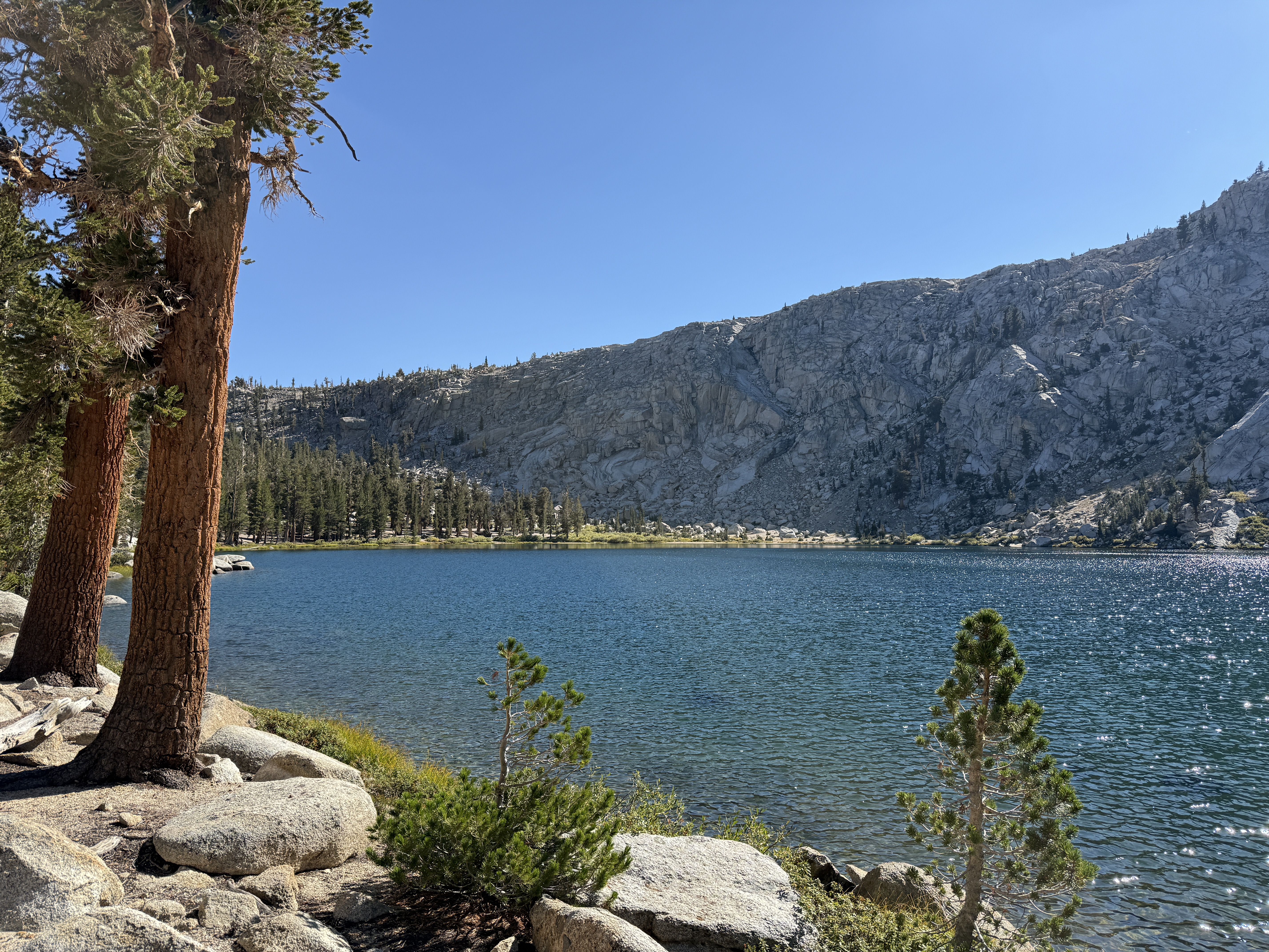
It turns out that gradient ascent really works: if you keep on hiking upward, you will eventually reach the top, or at least a local maximum! Pretty early in the afternoon, we arrived at our destination for the night: Franklin Lakes, a gorgeous pair of alpine lakes fairly high in the mountains. It looked like we were the first ones to arrive, at about 1:30 pm, so we had our pick of the campsites around the lake. We picked a pair of really nice sites with a great view of the lower lake and got to work setting up camp.
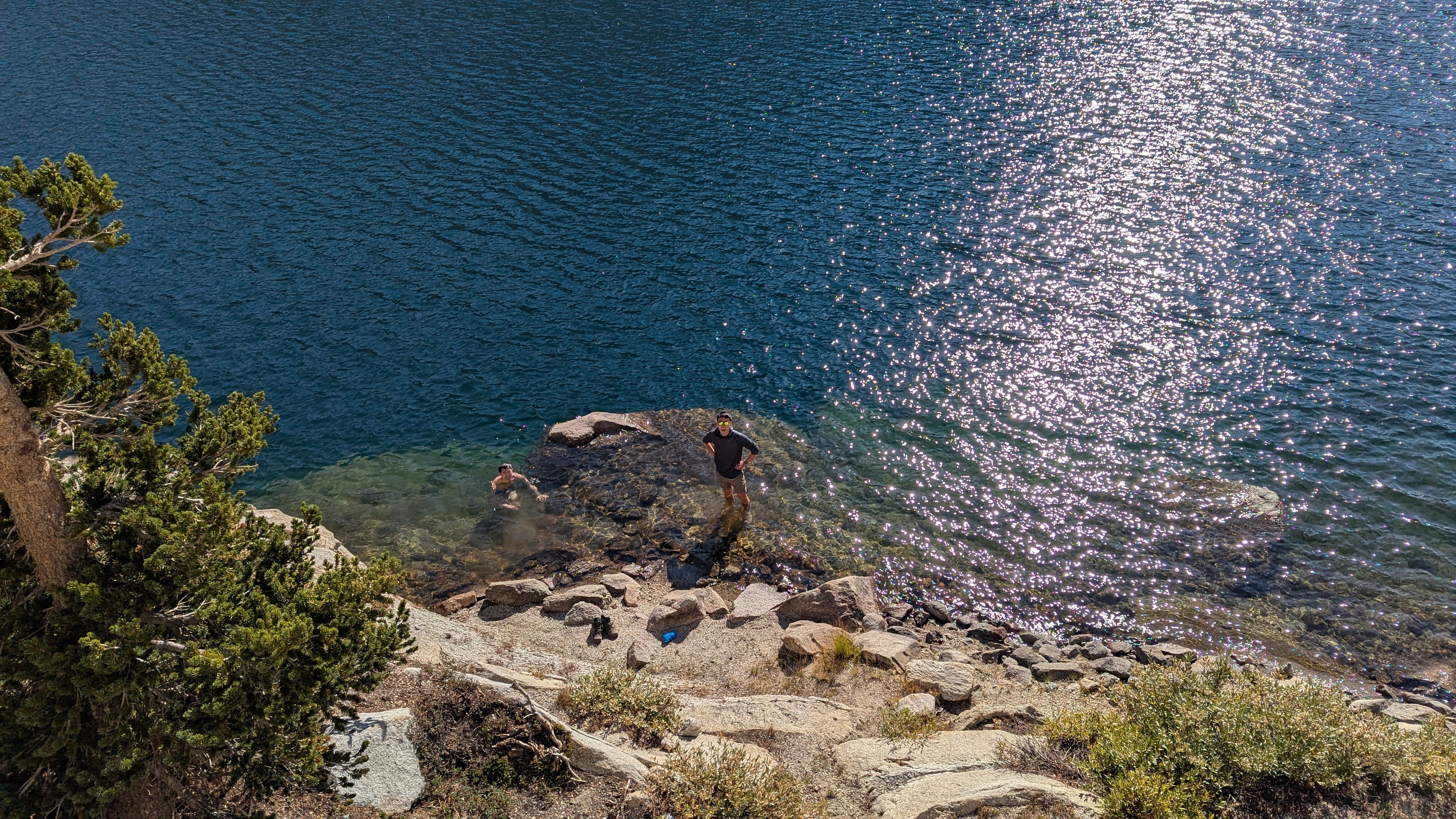
Afterward, we had the whole afternoon to lounge around the lake. Ray busted out his ultralight camp chair, which I will say was an absolute game-changer. Back support is actually really nice; I am now mildly considering buying one for myself. Also: as a famous alpine lake lover, it would have been a crime to spend an afternoon by the lake and not take a dip! I naturally had to submerge myself in the water, although it was so cold that I only stayed in long enough to snap a picture. Still, it was a very refreshing experience.
In general, the afternoon was a fun one, spent hanging out with friends by a beautiful lake. At dinner, I got to evangelize one of my favorite freeze-dried backpacking meals: the Peak Refuel Butternut Dal Bhat. It’s so good that I packed two of them for this trip! Seriously, it’s calorie-dense (great after a day of hiking, or I guess lounging by a lake) and super delicious, so what’s not to love? I promise I’m not sponsored by them or anything.
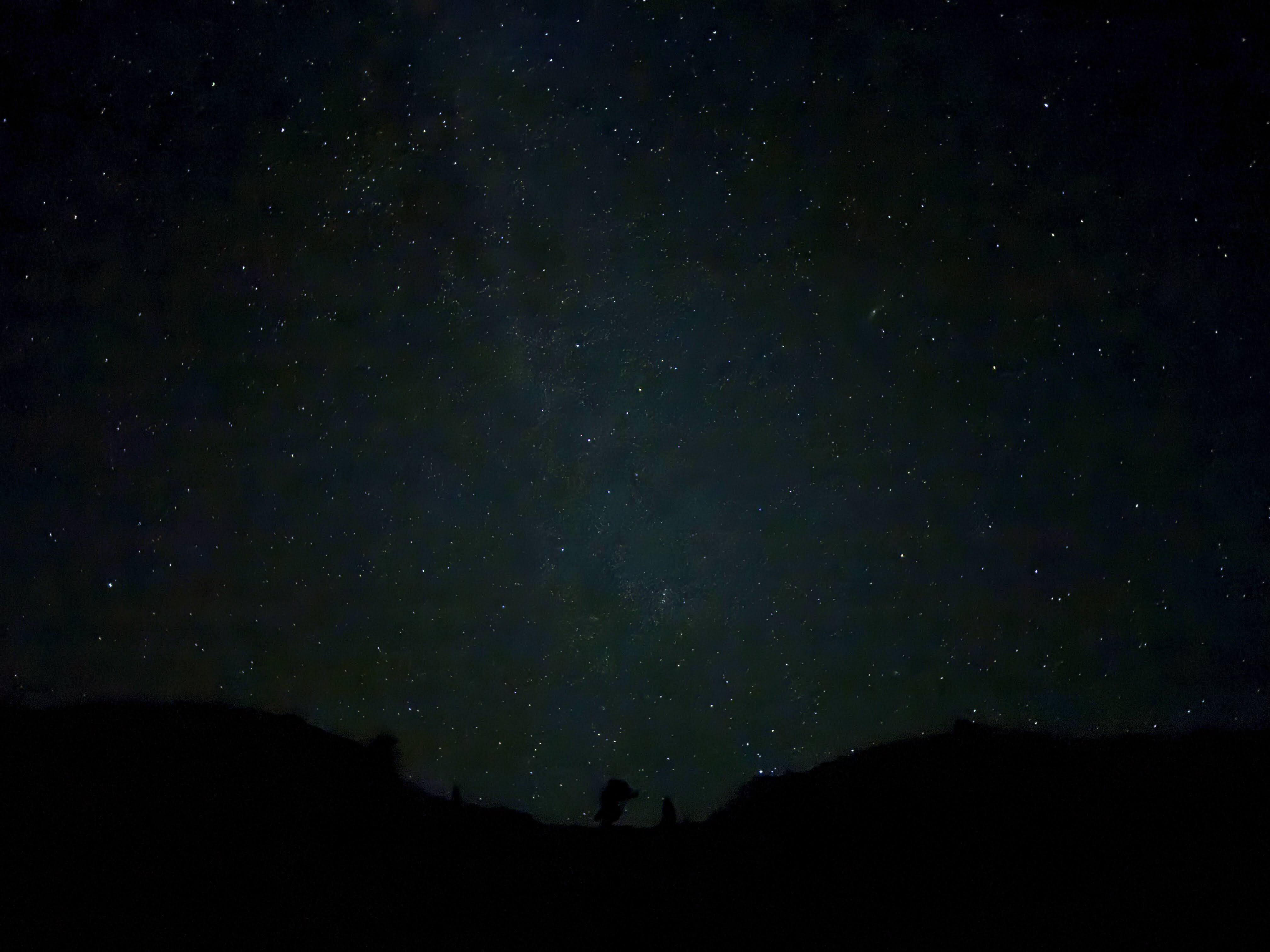
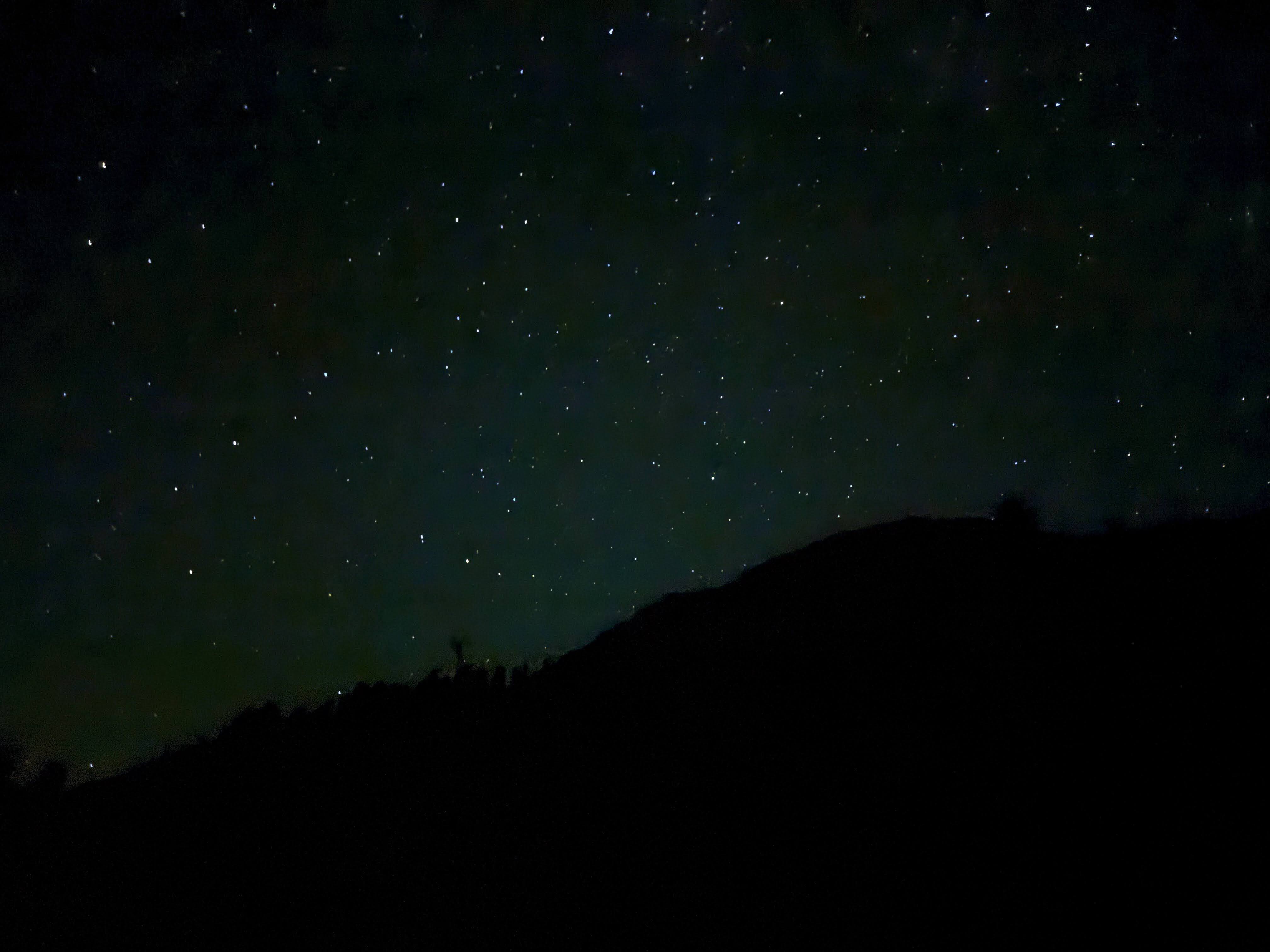
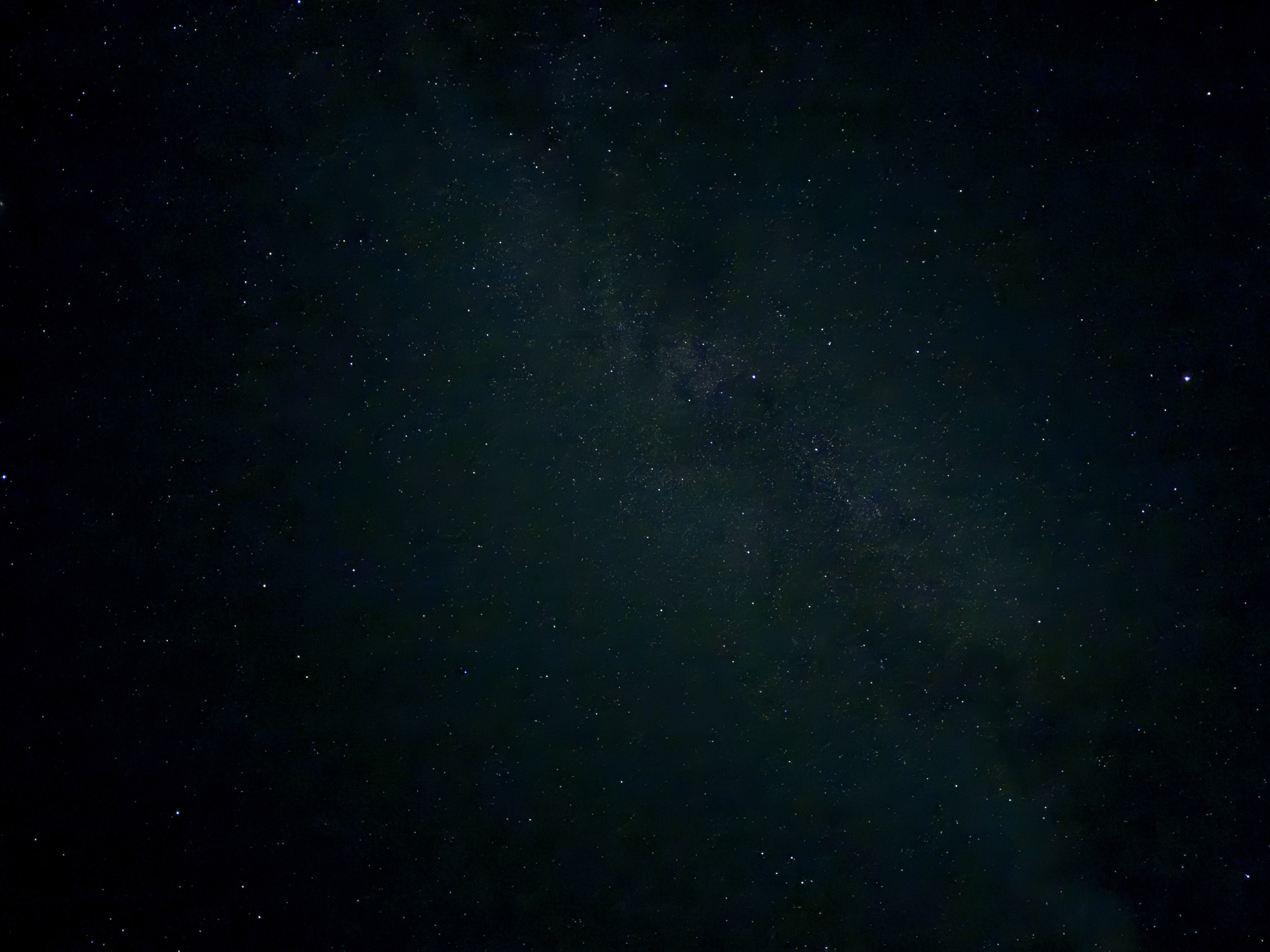
It gets pretty dark pretty quickly in the mountains after sunset, so after dinner and a few camp chores, we went to bed fairly early. This meant that I had to wake up in the middle of the night to use the bathroom, but I didn’t mind at all, because I was treated to one of the only things more spectacular than an alpine lake: the Milky Way above an alpine lake on a clear summer night! I tried to get the best pictures I could with my phone camera, but unfortunately I am a terrible photographer, so you’ll have to make do with my bad pictures. Any anyway, even if I were a good photographer with a fancy camera, there’s only so much that a picture can capture; we have not yet invented the technology to capture that deep sense of smallness you feel looking up at the universe and seeing “a thousand points of light” embedded in an indescribably large night sky.7 Though maybe the VR headset companies are working on it…
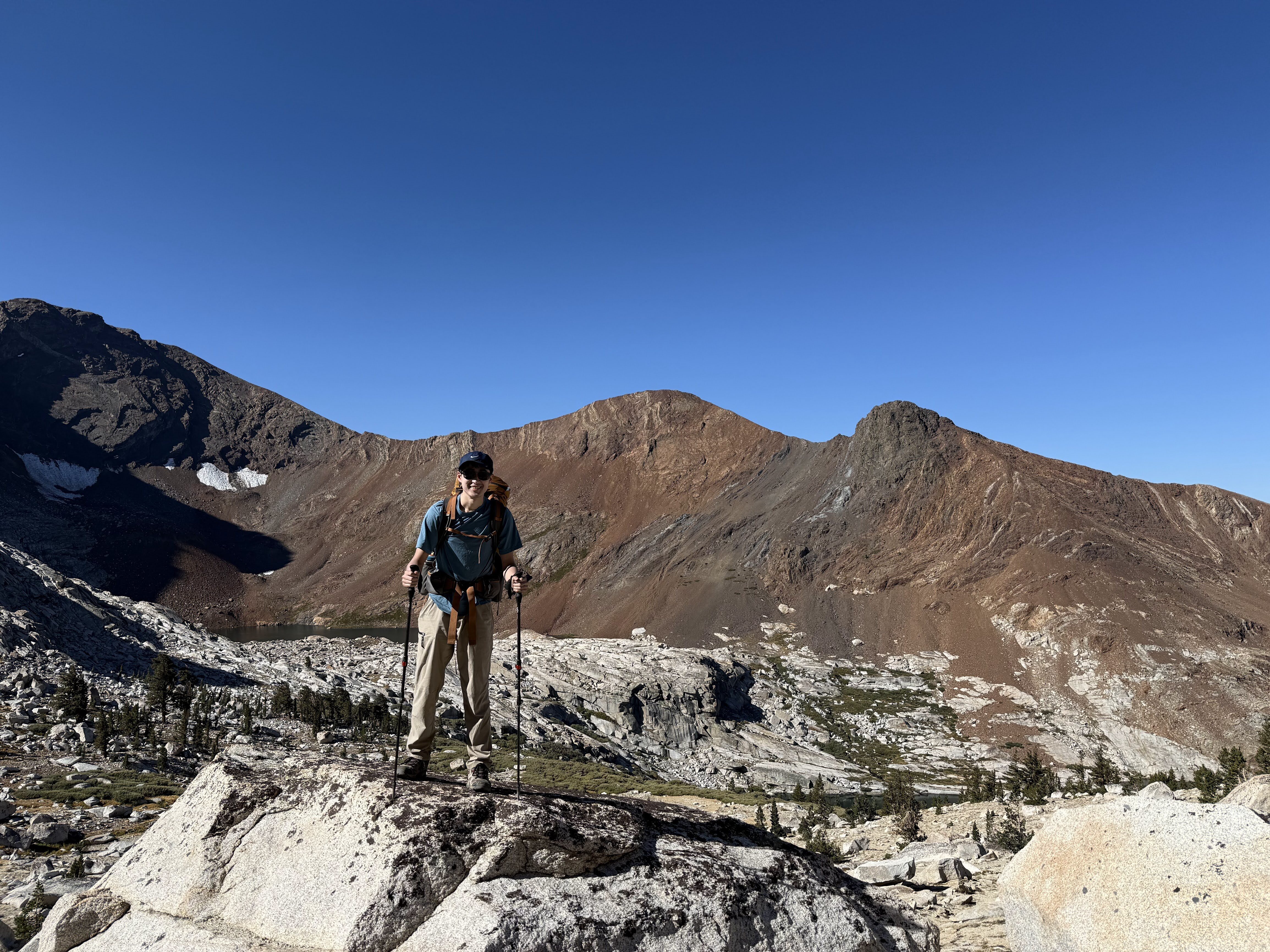
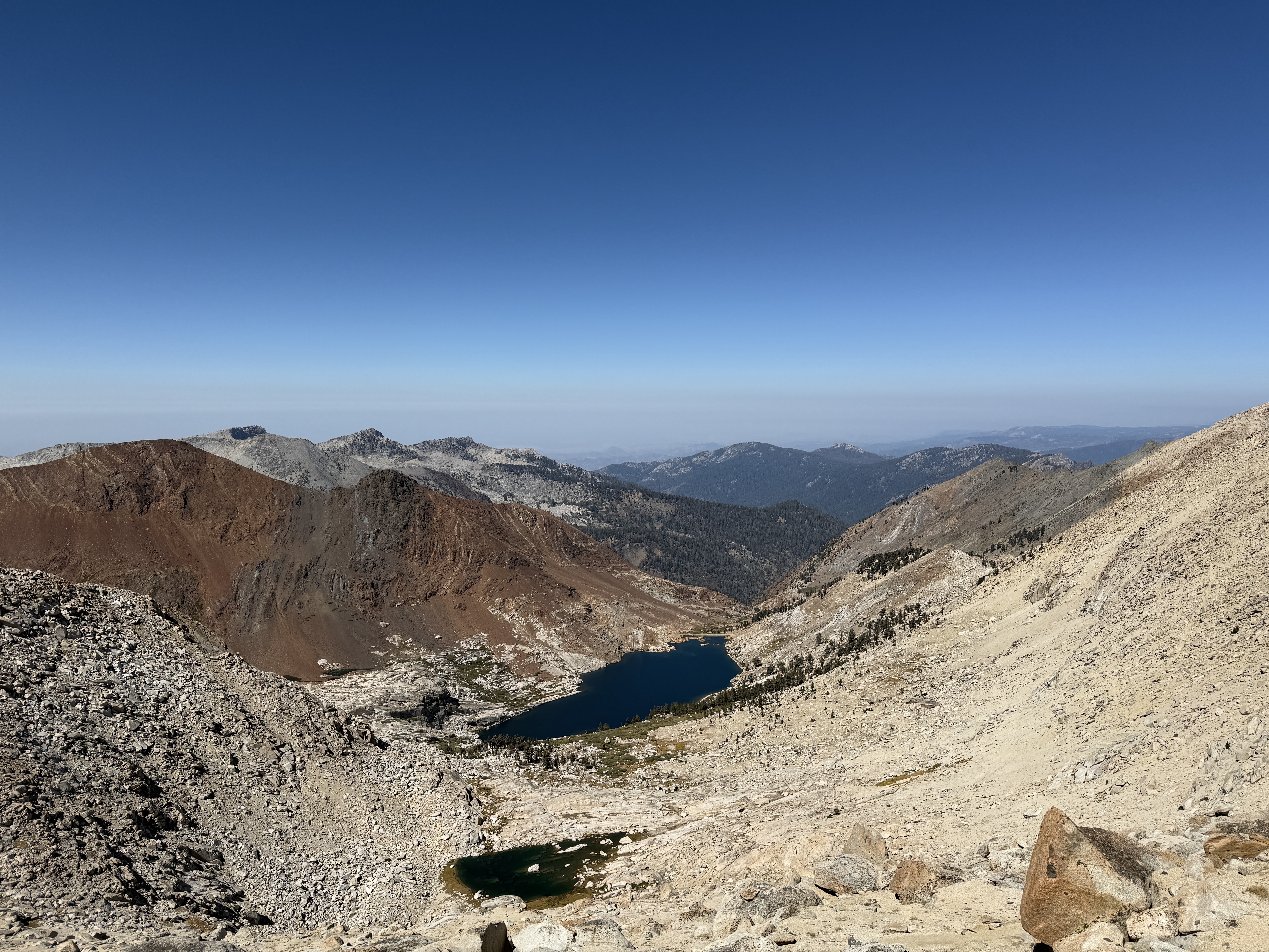
Whenever I’m on these trips, I always get a little carried away admiring the scenery on the first day, and by the second day, I get a little scared that maybe we’ve already passed the scenic high point of the trip and everything will be downhill from here. Now logically there must be some trails where this is the case, but this time my fears were definitely unfounded, because the beginning of the second day turned out to be even more beautiful than the first day, for the second day began with a climb up to Franklin Pass, one of the highest-elevation points of the entire trail.
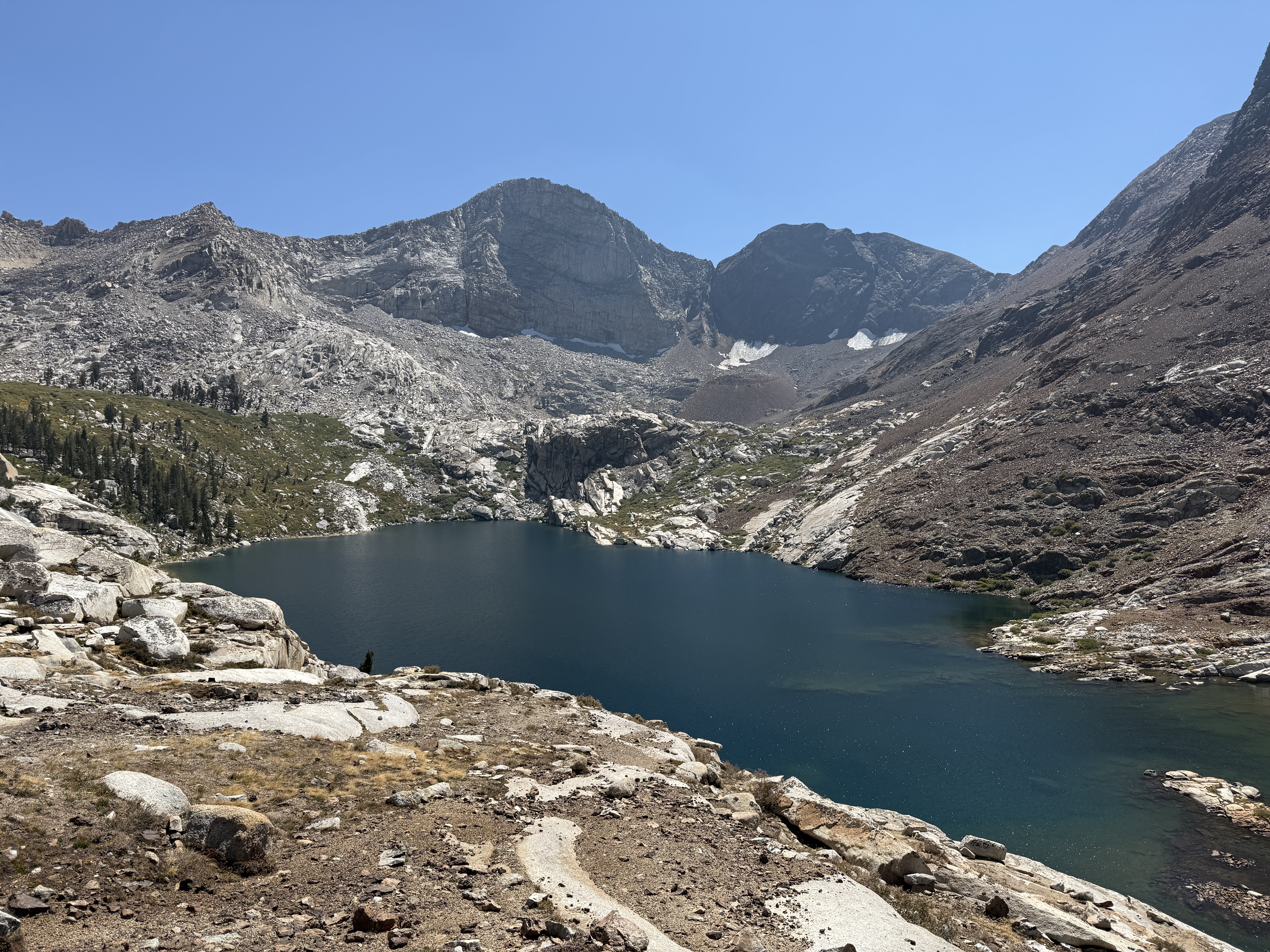
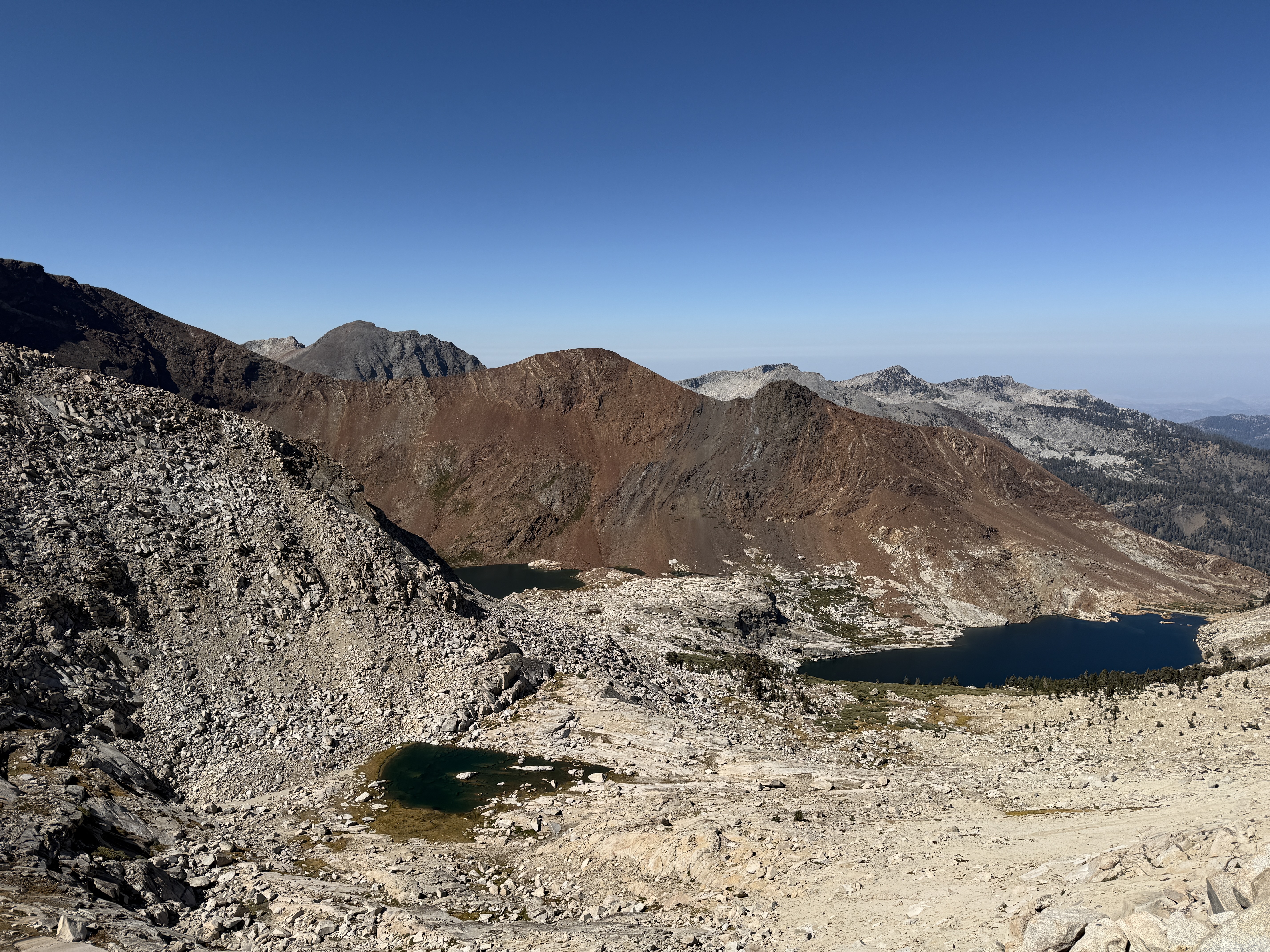
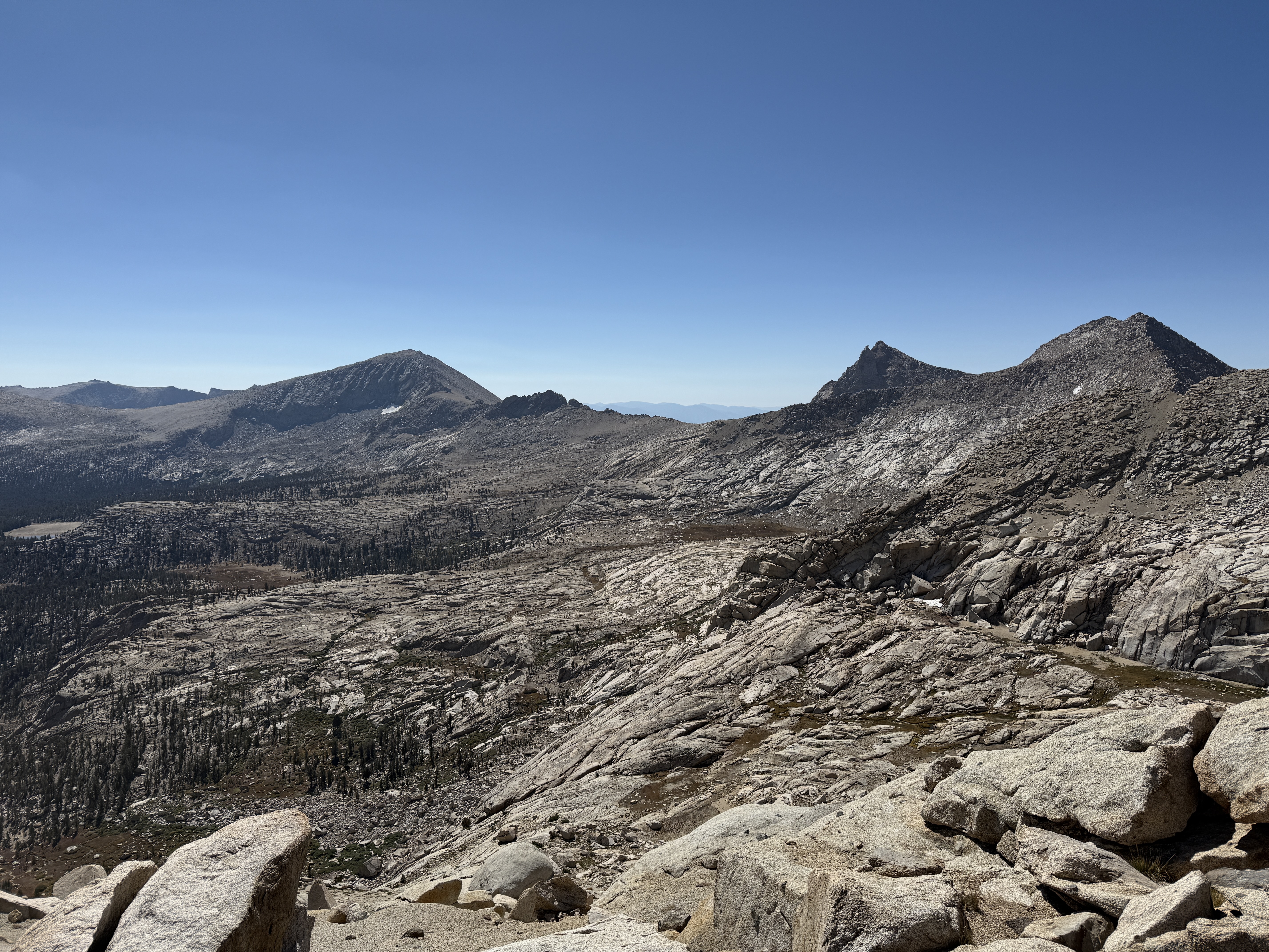
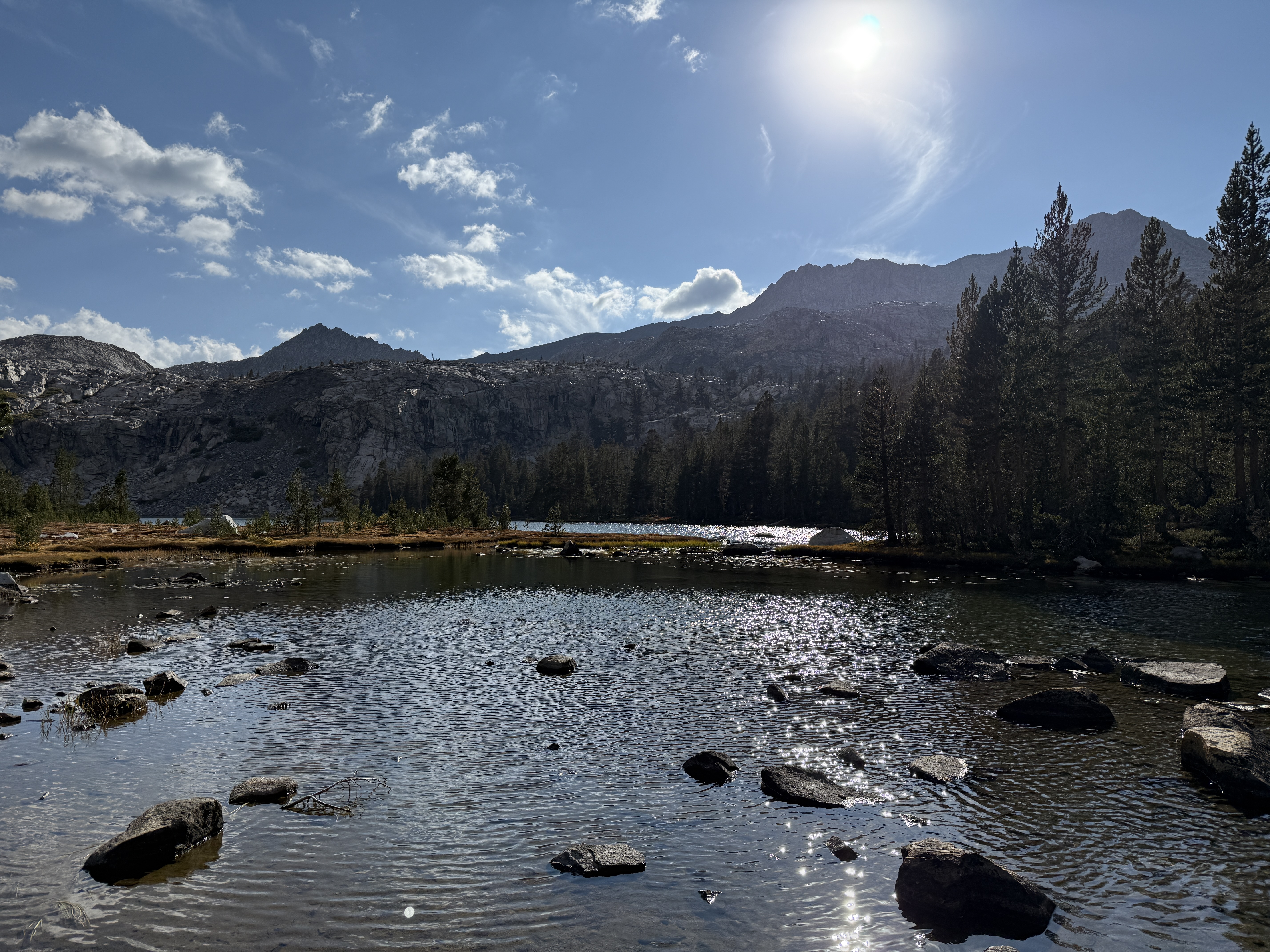
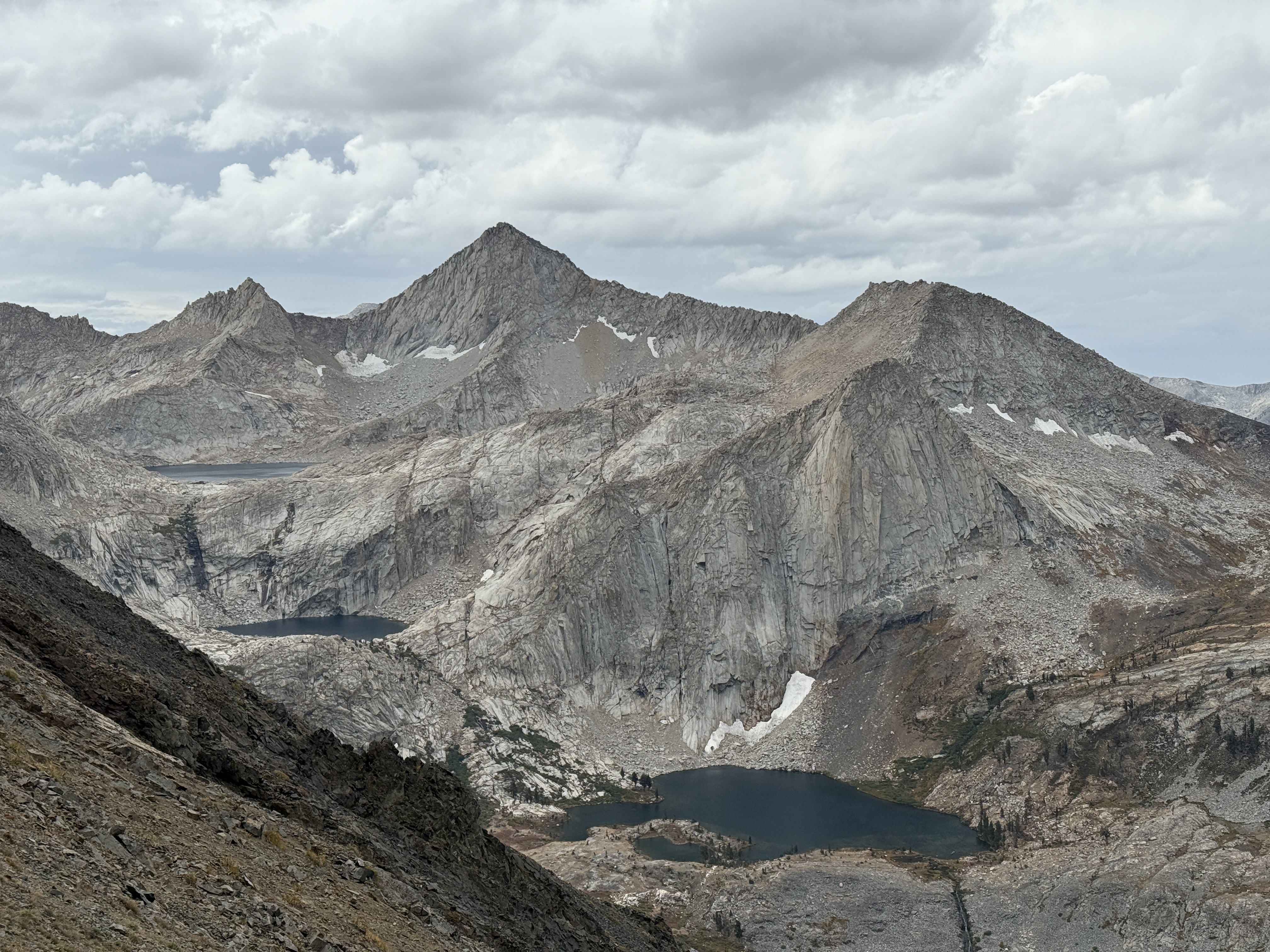
From our campsite the night before at the lower lake, the pass didn’t look all that high, but looks can be quite deceiving; we had to climb around two thousand feet to crest it. But what a beautiful two thousand feet! We stopped to look back often, enjoying the view of the lake below us. When we got high enough, we were able to enjoy a special treat: a view of the upper lake, which had been hidden from sight while we were down at the lower one. To top it all off, there was another small pond in view; the vista from the trail near the pass with all three lakes included was perhaps my favorite of the entire trip.
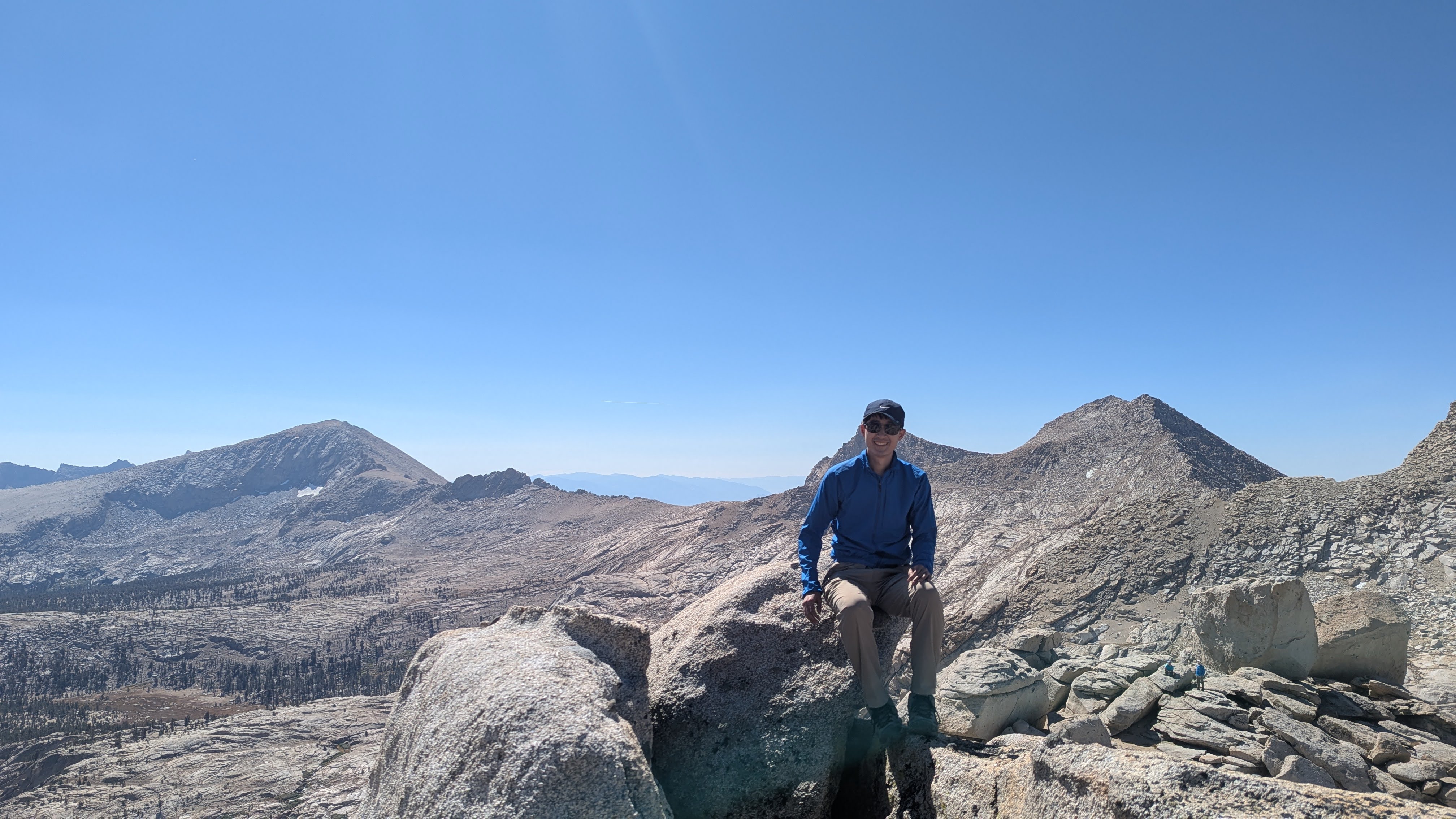
When we had reached the top of Franklin Pass, we lingered there for a while and did some fun, easy scrambles on the nearby rocks, marveling at the world around us: perched atop a stony parapet with nothing but blue skies above, pale rock below, and a silence broken only by the wind. Unless I decide to go skydiving someday, it’s perhaps the closest I’ll ever feel to flying. At such times, I like to think that I have indeed “slipped the surly bonds of Earth”—
Up, up the long, delirious, burning blue
I’ve topped the wind-swept heights with easy grace
Where never lark, or even eagle flew—
And, while with silent lifting mind I’ve trod
The high untrespassed sanctity of space,
Put out my hand, and touched the face of God.John Magee Jr., “High Flight”
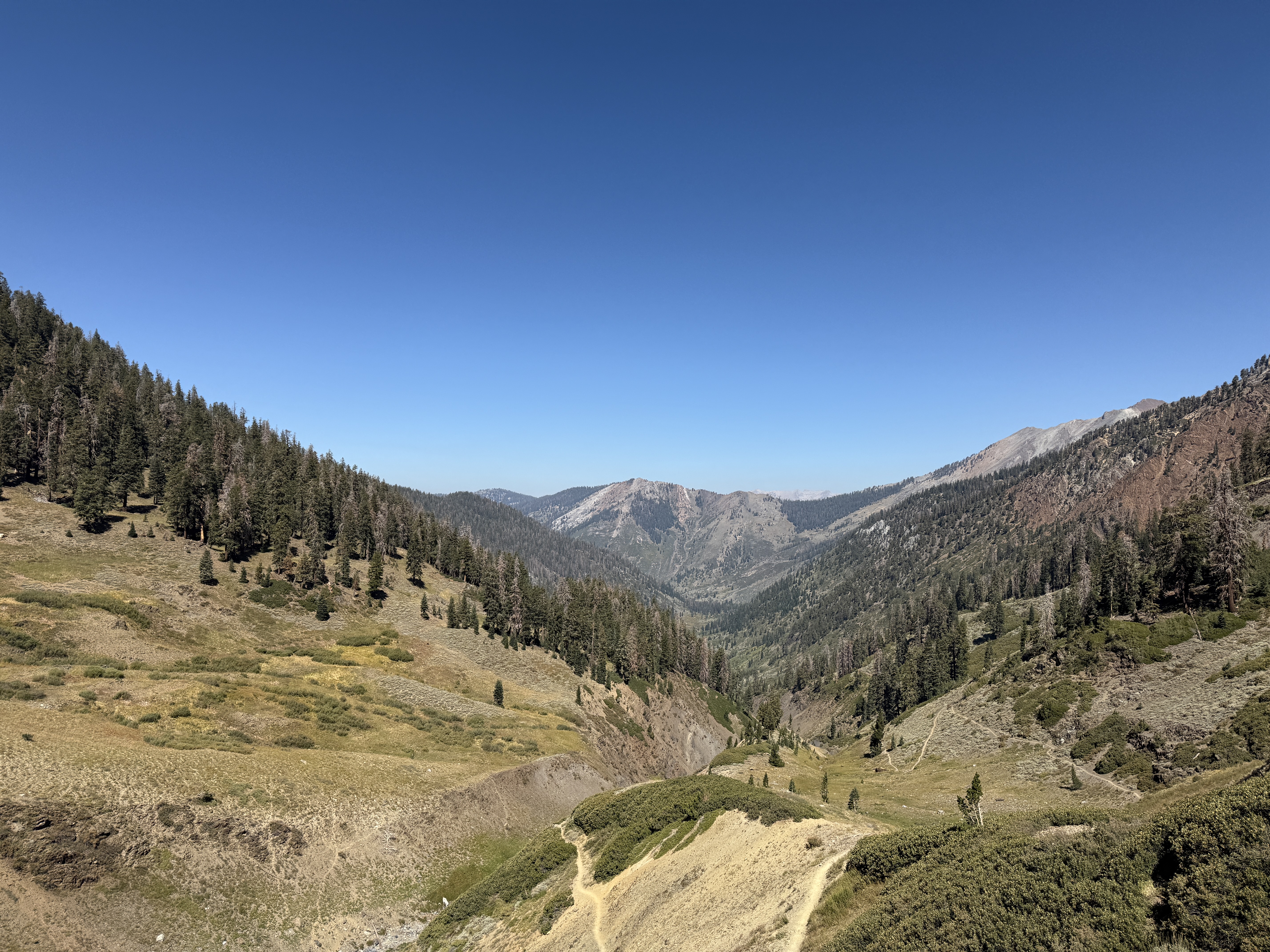
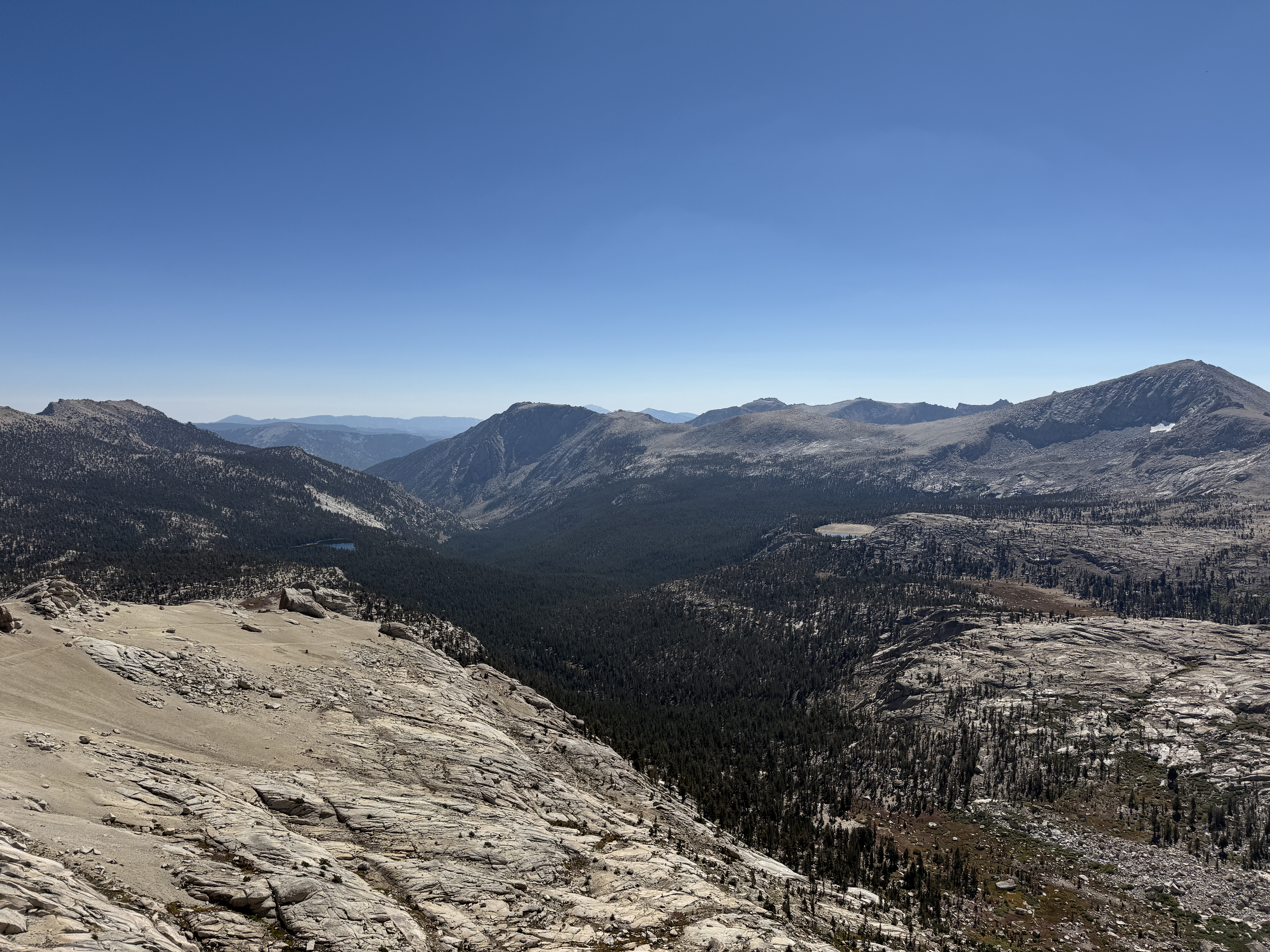
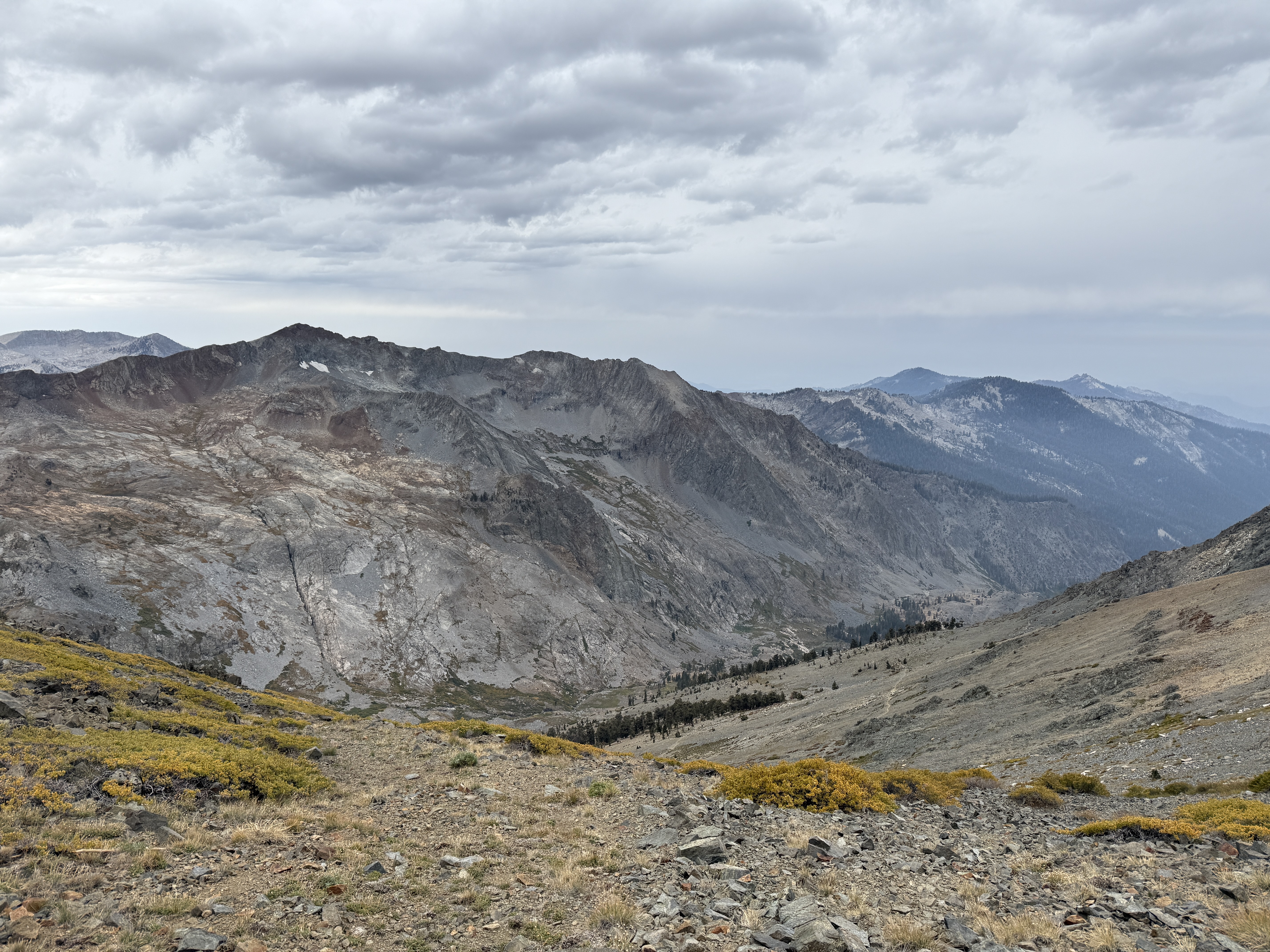
Poetry aside, we couldn’t stay at the top forever; we still had many more miles to cover before reaching our intended campsite for the night. So, we began my least favorite part of hiking: going downhill. At least there was plenty of pleasant scenery to look at; I enjoyed seeing the landscape around us transition from the barren, rocky mountain pass to pine forest and alpine meadow. We passed by a group of CCC workers doing trail maintenance. Those men and women are truly amazing—they hike in with shovels and pickaxes to do trail work!
We stopped for lunch at Forester Lake before continuing on to a brief climb then a descent past Little Claire Lake. Here, we hit a really scenic section of the trail, with great views of Sawtooth Peak and Needham Mountain to the northwest, and Mount Whitney to the northeast. The tall trees obscured much of the view, but every once in a while there’d be a gap in the trees, and we’d catch a glimpse of the spectacular mountains of the Mineral King area and beyond.
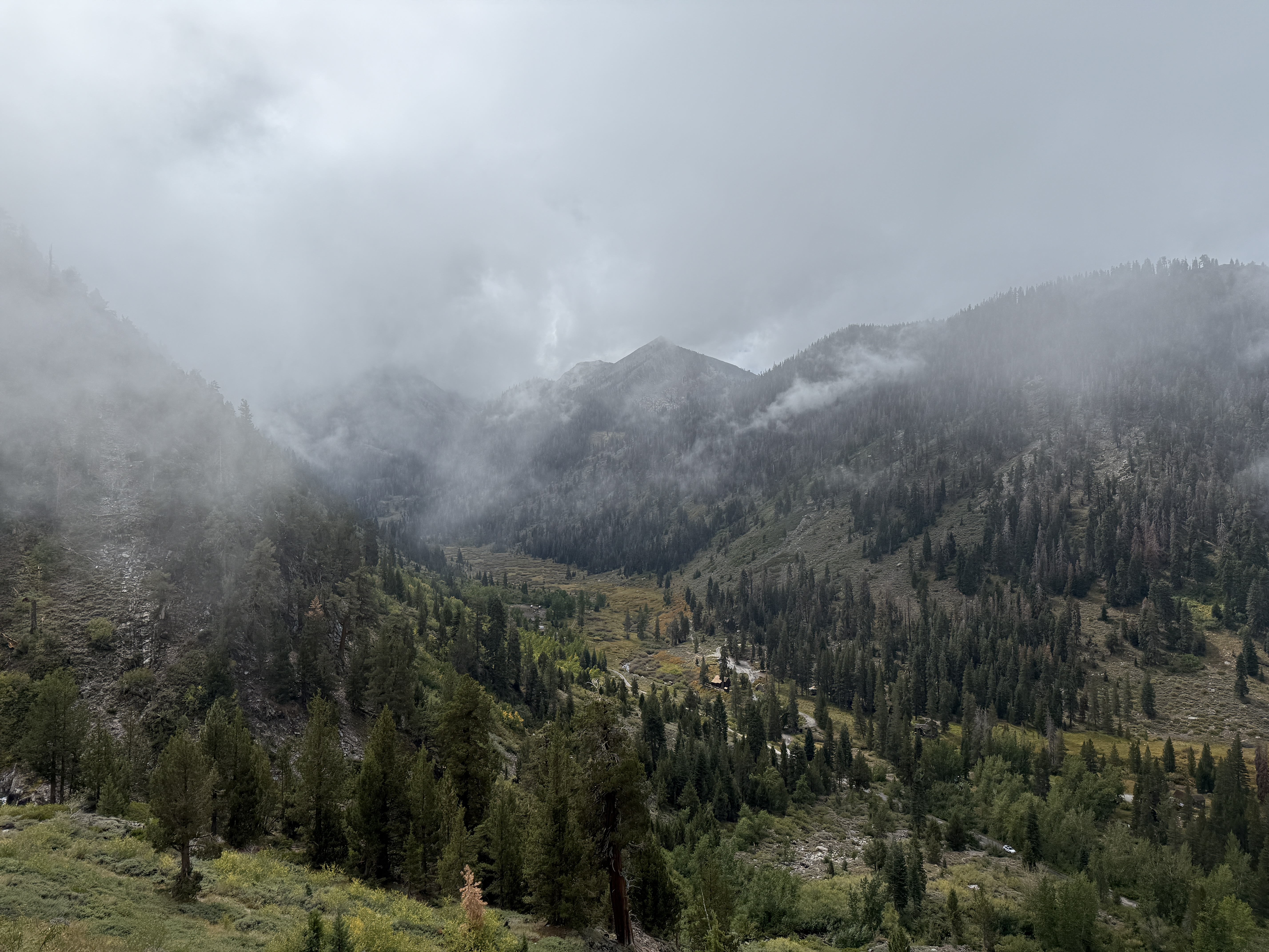
The rest of the day was spent following Soda Creek as it gently descended down a lovely canyon. At this point, it was clear that we had perhaps lingered a little too long on Franklin Pass, and it wasn’t realistic for us to make it to our intended campsite around the next trail junction before nightfall. Not wanting to hike through the night, we began looking for a suitable spot to set up camp as it grew closer to sunset. We ended up finding a decent spot in a rocky area of the canyon, with the only downside being slightly difficult access to the creek to filter water. Well, that and what appeared to be an anthill—or worse, a wasp nest—nearby, though fortunately it looked like nobody was home. But I won’t complain: it was a beautiful campsite, and before heading to bed we got to admire the alpenglow atop Mount Whitney in the distance.8 I regret not taking a picture, but I think Ricky got one.
Because we had stopped early the day before, we had extra mileage to make up during the third day. We decided to cut out a little excursion we had planned to see the upper Big Five Lakes, to focus on our goal of reaching the Little Five Lakes to set up camp for the night.
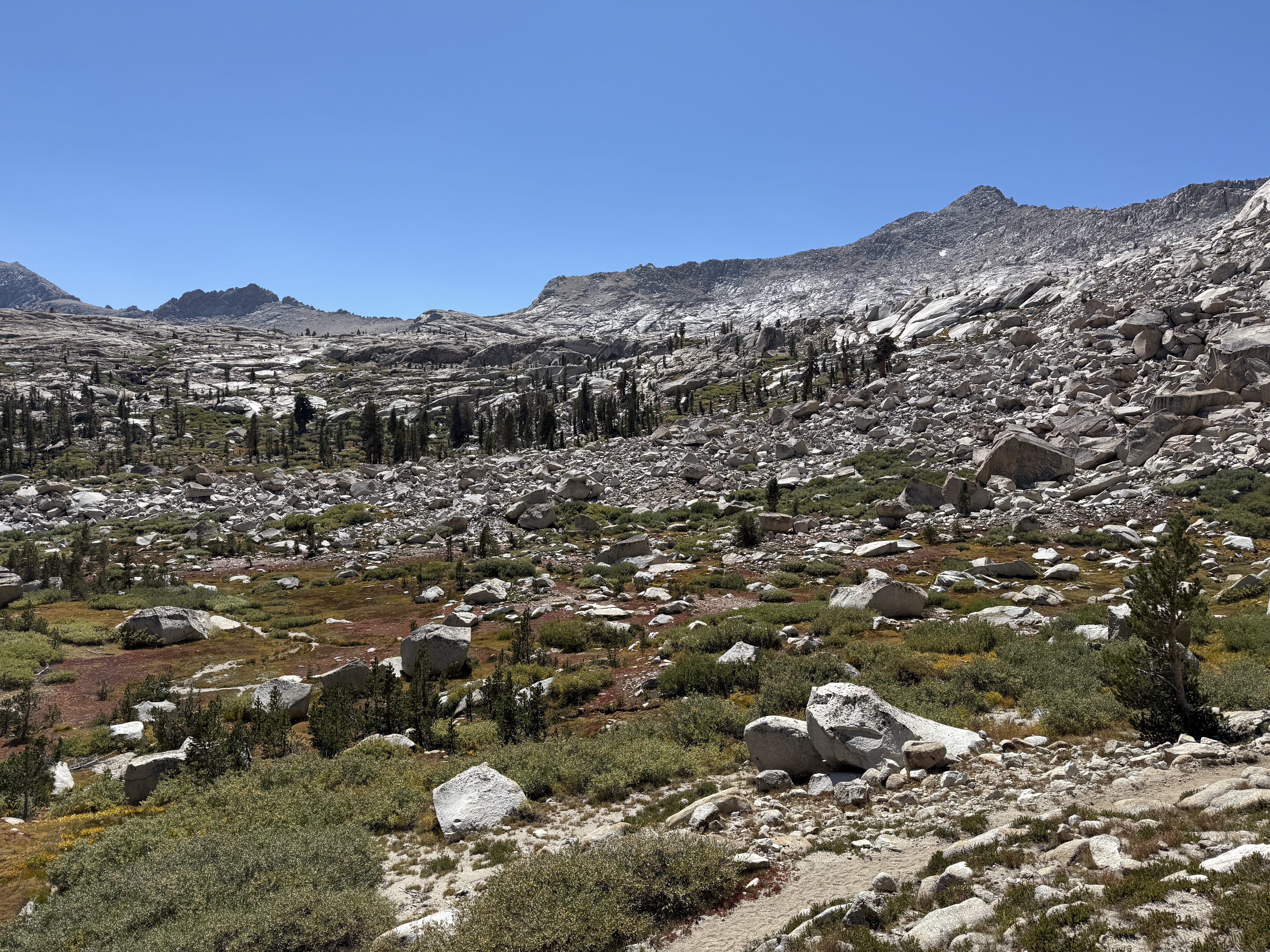
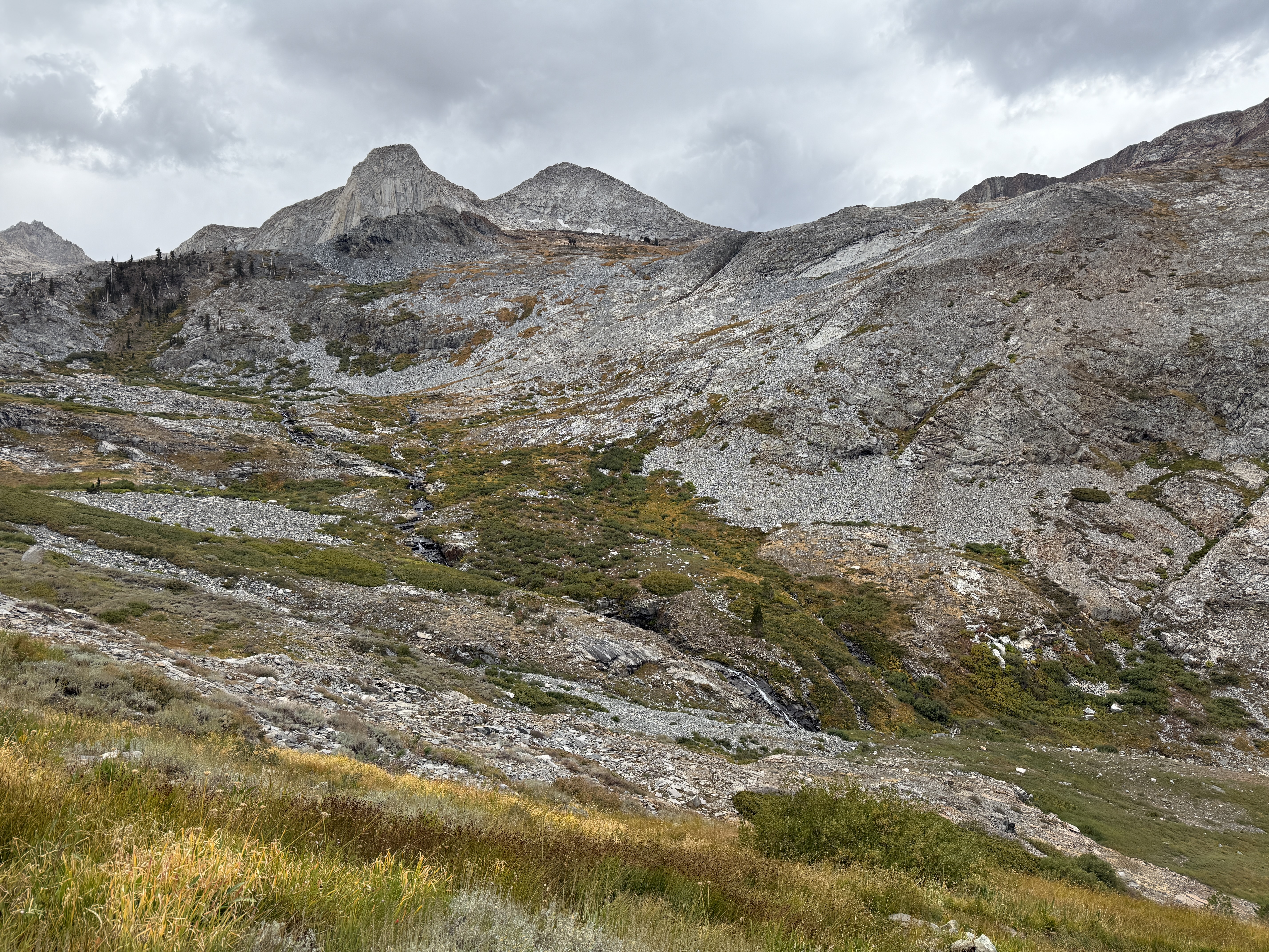
We started off the day by making up the mileage we had missed yesterday, continuing the descent along Soda Creek. When we finally hit the junction where we had originally intended to camp the previous night, we turned westward toward the Lost Canyon and began to climb again. This part of the hike continued to be scenic in very much the same way as the second day: granite peaks rising above the wooded canyon, with the occasional small lake and great views of the Kaweah Range to the north. We followed the canyon for a bit before climbing out of it, toward the lowest of the Big Five Lakes, where we stopped for lunch and to filter some water.
The rest of the day—a small climb out of the lake leading into a relatively flat section—was somewhat less scenic, with the highlight being continued views of the Kaweah Range. We did get to see some wildlife: a cool black lizard resting on a log, and a deer in the woods. Besides that, though, it was mostly uneventful, and we reached the Little Five Lakes without much incident. The campsite here was fairly established, with a nearby bear box and a ranger station. (We saw the ranger hiking in that evening and said hi.) Surprisingly, we only saw or heard one other party by the lake, despite most of the people we saw on the first day claiming that they were planning on camping by the Little Five Lakes. I guess there’s plenty of space to spread out at the lakes, although I feel like we took the “obvious” campsite near the trail.
I made a bit of a mistake trying to set up one of our tents: as I was hammering in one of the stakes, I hit a rock underground, but rather than immediately give up, I gave it a few more whacks for good measure. I reasoned that in a contest between metal and rock, surely metal wins, right? But as Richard wisely remarked from his years of experience setting up volleyball nets: no, it turns out rock wins every time; I ended up wrapping the head of the stake around the footprint cord so tightly that it’s now permanently attached. You know, looking back on this, I suppose there’s a reason they teach you “rock beats scissors” when playing rock, paper, scissors in elementary school…
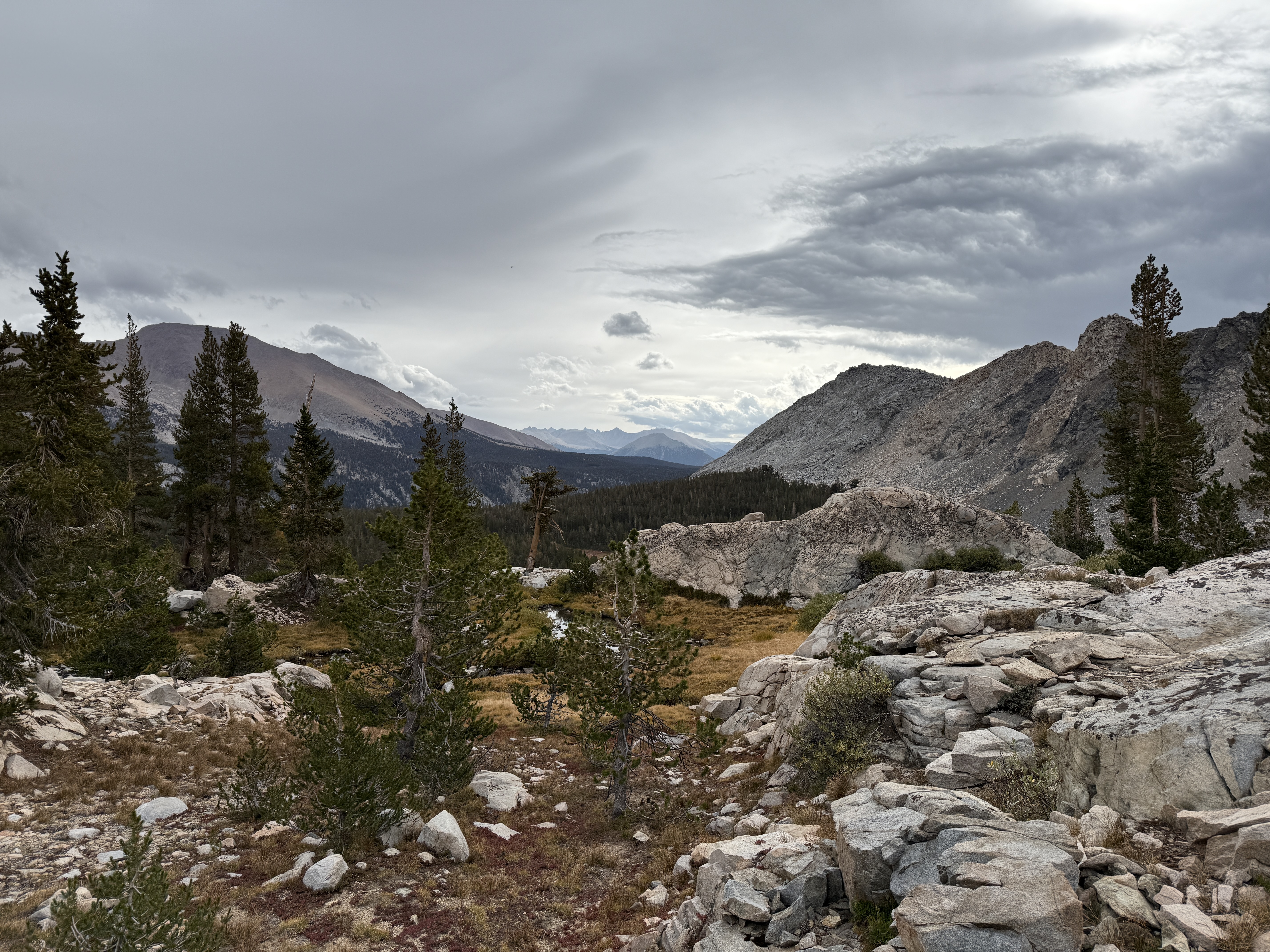
Other than this totally unforced error, the night was mostly pretty good. I continued my quest to try to become a back sleeper (which is much more comfortable when on a sleeping pad), although I didn’t totally succeed. The only real negative thing that happened the third night: in the evening, some pretty heavy cloud cover started to roll in, which did not bode well for the next two days of hiking. A weather report on Ray’s inReach confirmed that we should expect scattered rain throughout the rest of the trip. Oh well, I was not looking forward to having to set up camp in the rain the next day, but I guess you can’t call yourself a real adventurer if you only go out in fair weather.
As expected, we woke up on the fourth day to fairly overcast skies, although on the bright side, the clouds made for some really nice, diffused lighting for pictures. We ate breakfast, broke down camp, and set off in our rain gear.
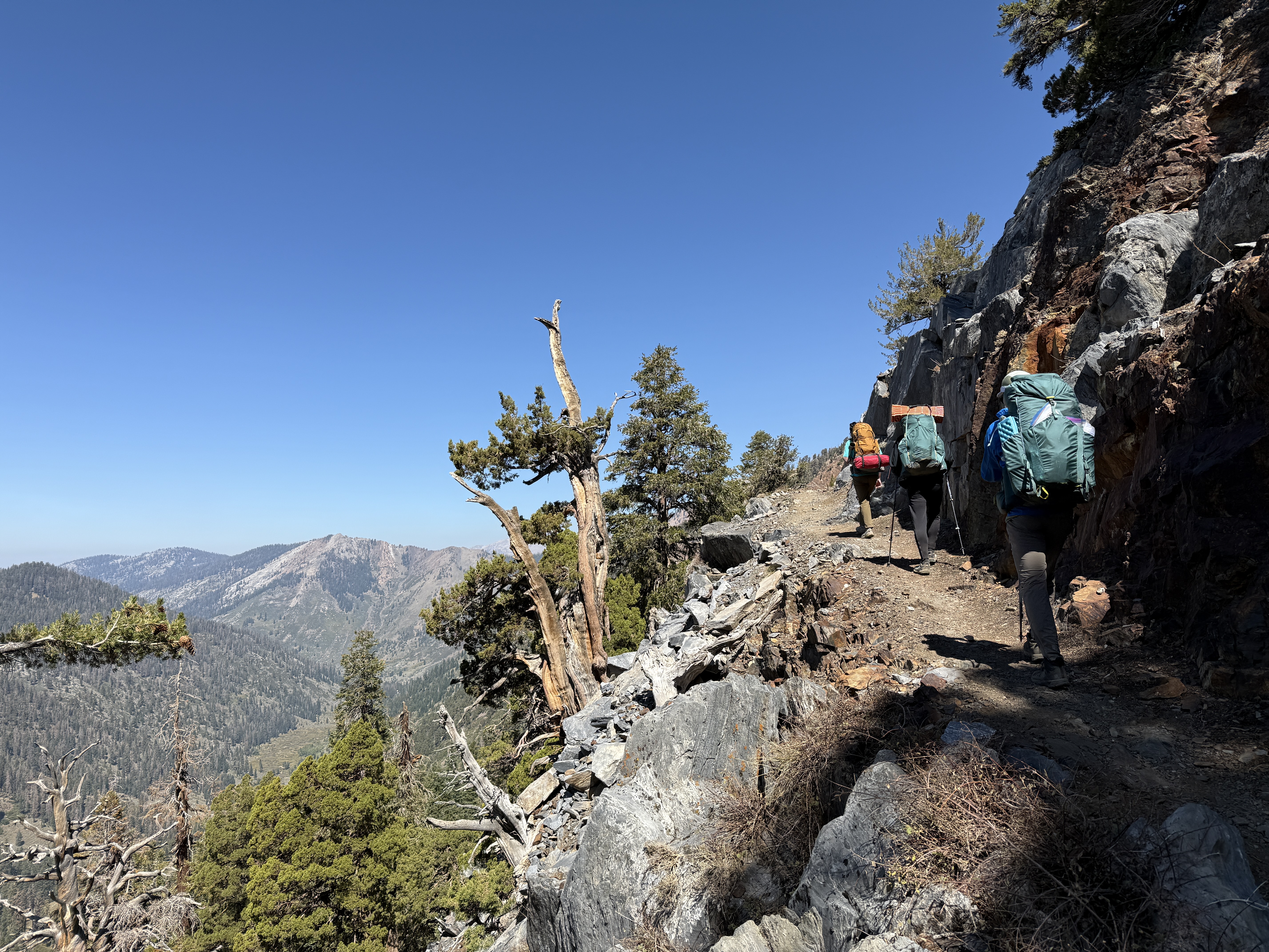
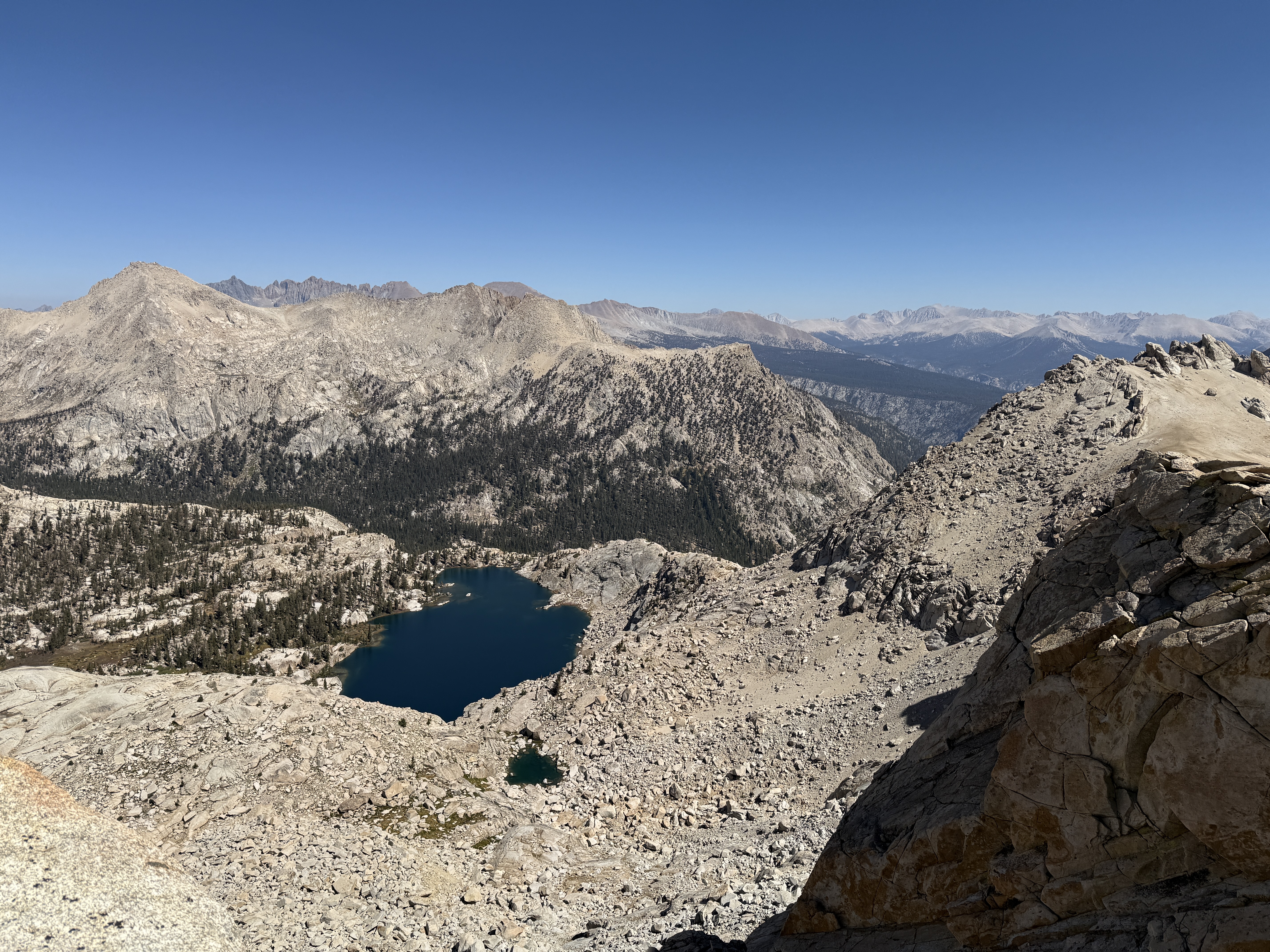
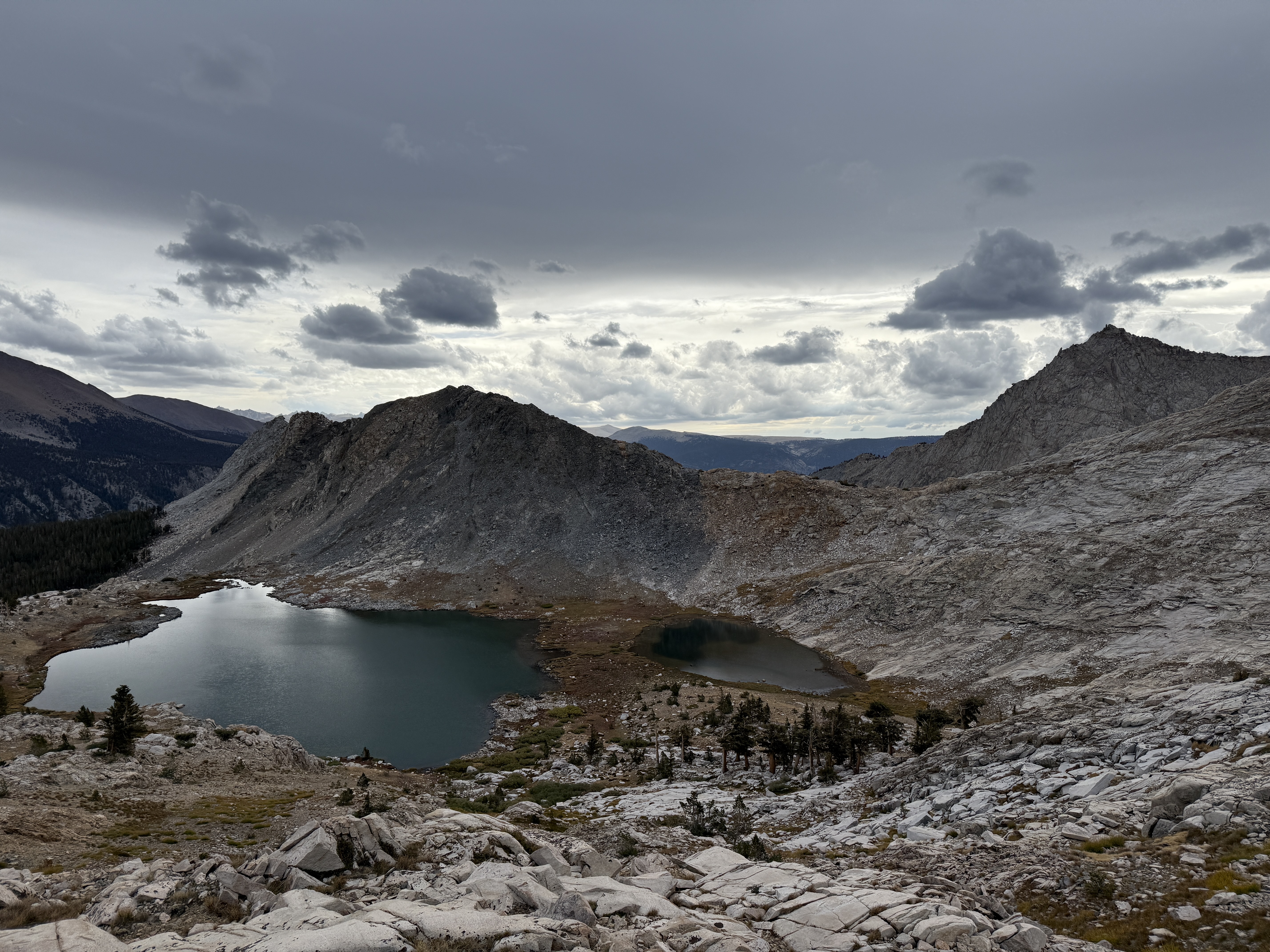
The day started with a really enjoyable climb up to Black Rock Pass from the east side. As we gained elevation and climbed up onto the exposed rock, we were gifted with incredible views of the remaining Little Five Lakes below, and more views of the Kaweah Range behind. I discovered a very curious thing during this climb: my lips were getting quite dry—not quite bleeding, but very uncomfortable. I tried licking my lips and drinking water more often, but to no avail. But then, I had an absolutely brilliant idea: I borrowed Ray’s ChapStick, and all of a sudden my lips were fine! It’s actually kind of magical how well that worked: apparently, if you put ChapStick on your lips, they stop being dry or something. I impress myself with my discoveries sometimes.9
Anyway, ingenious discoveries aside, I also really appreciated Black Rock Pass for its namesake unique geology: as the name suggests, the rocks are black. There’s a very sharp vertical line dividing the black rock at the pass from the pink and gray rocks around it, as if someone had come in and spray-painted this particular section of the mountain black. I’m not sure what causes it, but it was a pretty cool effect to witness.
Although the views from the top of the pass were pretty spectacular, we didn’t linger very long because the wind was picking up, making it a bit unpleasant to stay at the exposed crest. We began the descent westward into the valley below—a slightly intimidating descent, for according to the map, we were to spend the rest of the day going straight downhill for about five thousand feet. The early part of the descent was quite beautiful; once we got a little further down the mountain, we had an incredible glimpse of Sawtooth Peak to the left, with not one, not two, but three alpine lakes nestled among the granite walls: Columbine, Cyclamen, and Spring Lakes. Though it was an incredibly beautiful sight, it also made me a little bit sad knowing that this was to be our last view of the mountains: the rest of the hike was to be spent at lower elevation, mostly among pine forests.
We stopped for lunch at Pinto Lake, a small pond about halfway down the mountain. There was an amusing (in retrospect) incident here: Ray went into the bushes to try to find a path to the lake to filter some water. A short while later, we heard a loud yell and then saw him emerge from the bushes shouting: “There’s a bear there!” I was a little curious and kind of wanted to see the bear for myself, but I also acknowledged that it would be a little foolish for me to go into a thicket to see a bear, and that it’s always best to leave wildlife alone. One wouldn’t want to radicalize a bear, after all.10 Plus, if I really want to see a bear, I can always go to the Bronx Zoo.
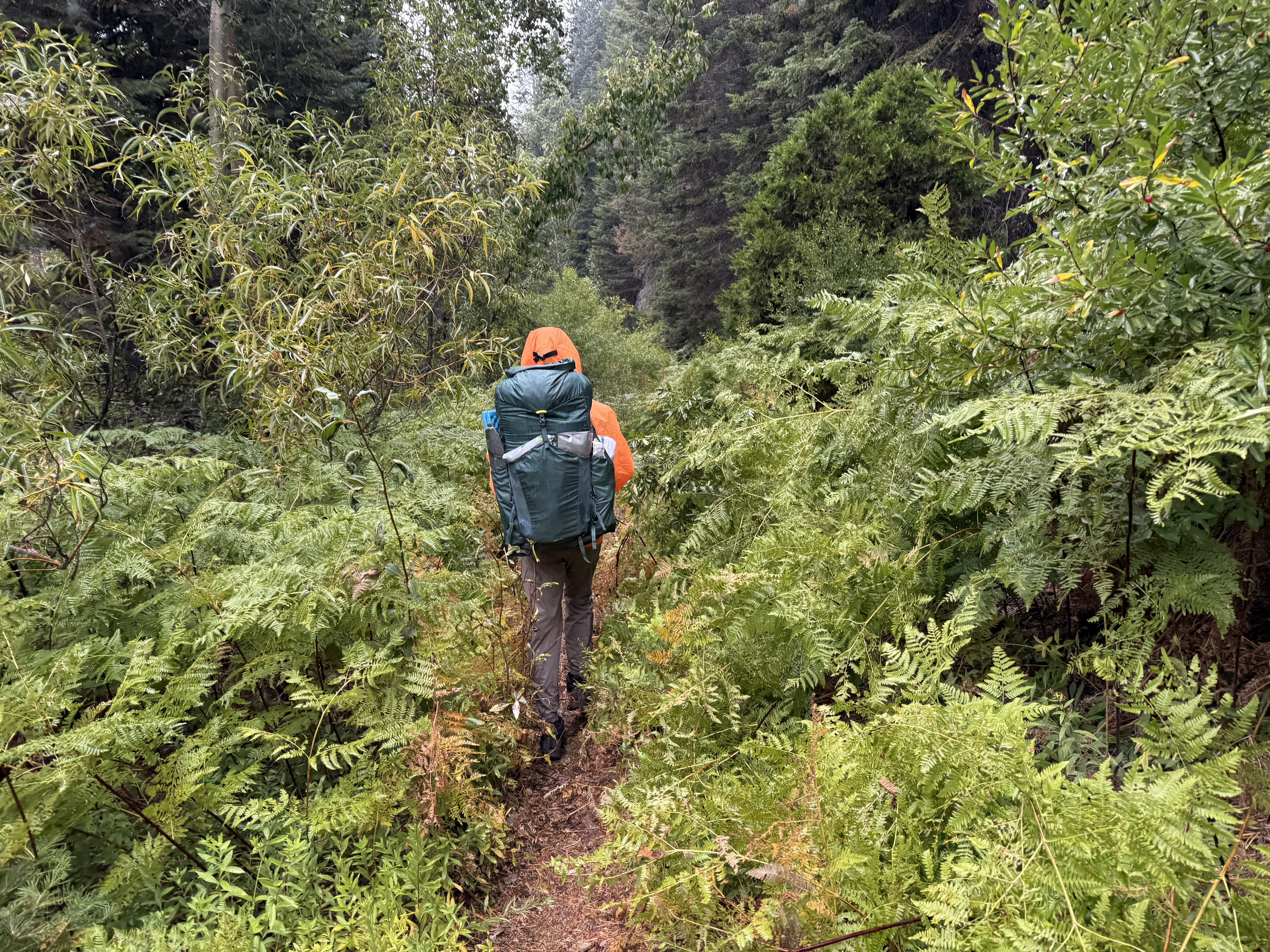
After a bit of a sad lunch consisting of the remainder of our tortillas and pistachio butter, we continued the hike down the valley, encountering some on-and-off precipitation. As we got lower in elevation, the trail became a lot more lush, with the trail somewhat overgrown at times. This was quite annoying, both because of the occasional thorn bush and because it was impossible to avoid brushing against the dense vegetation, which was really wet because of the rain. Ray bravely led the way in this section, leading to his pants getting completely soaked.
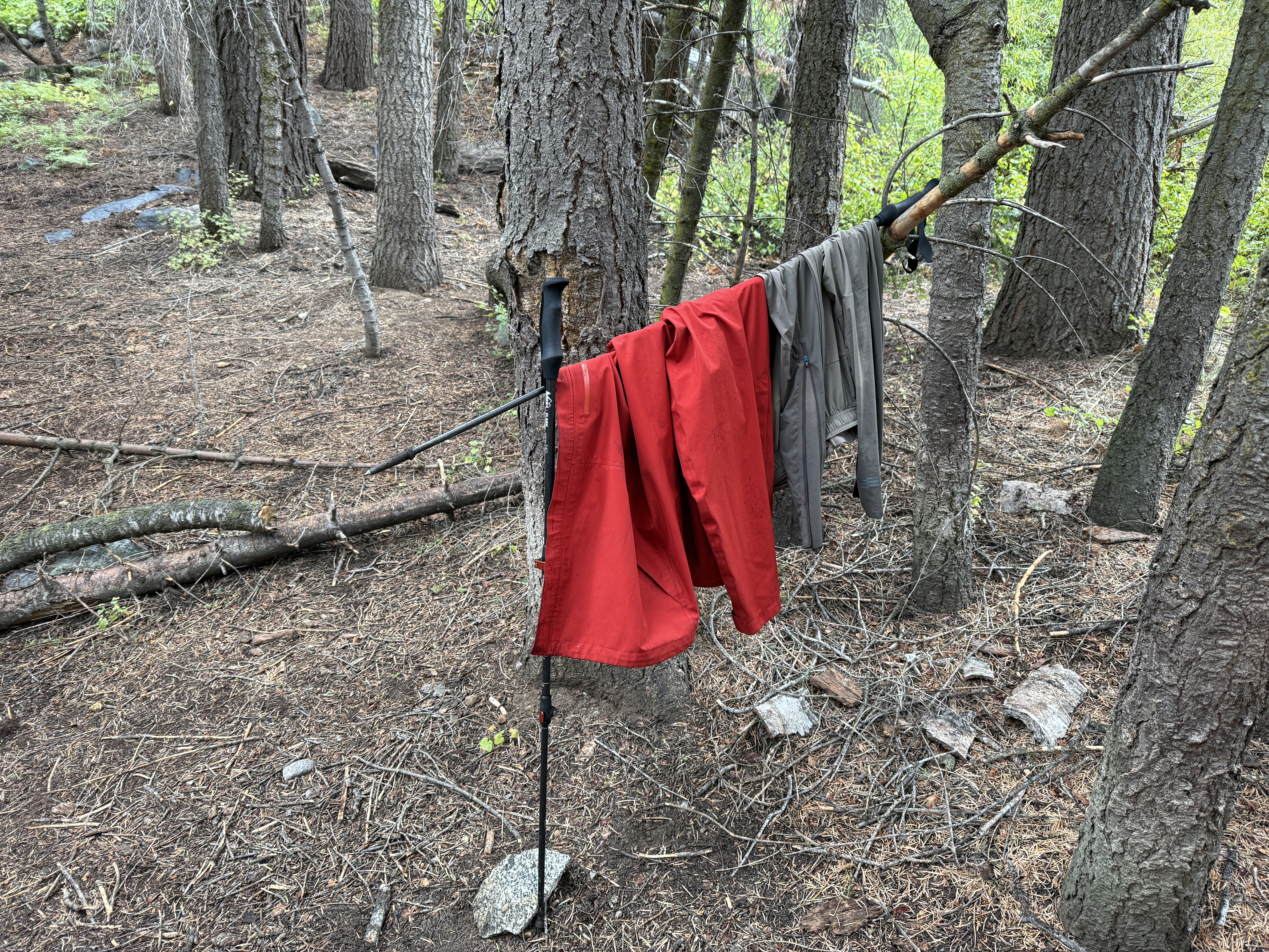
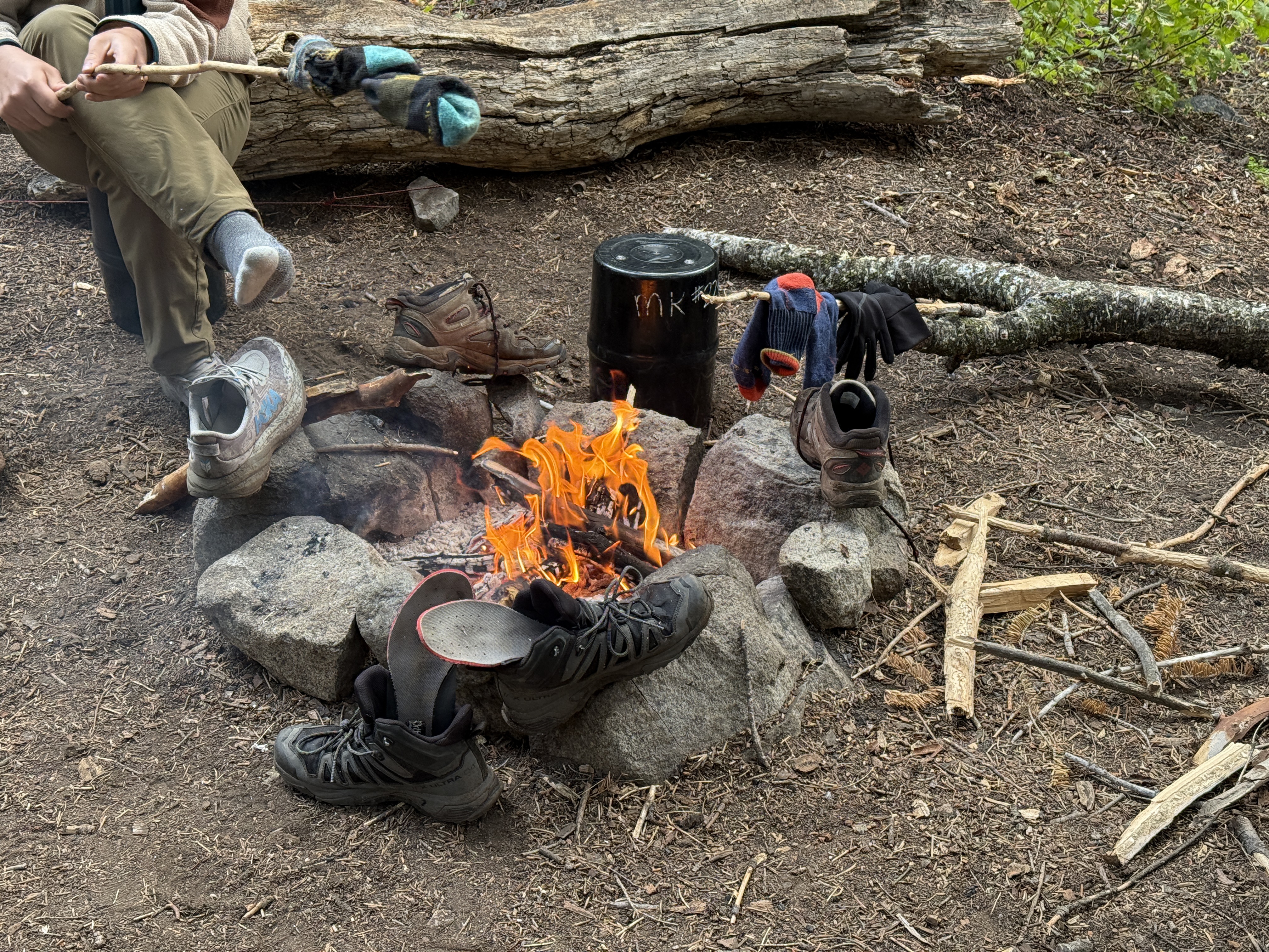
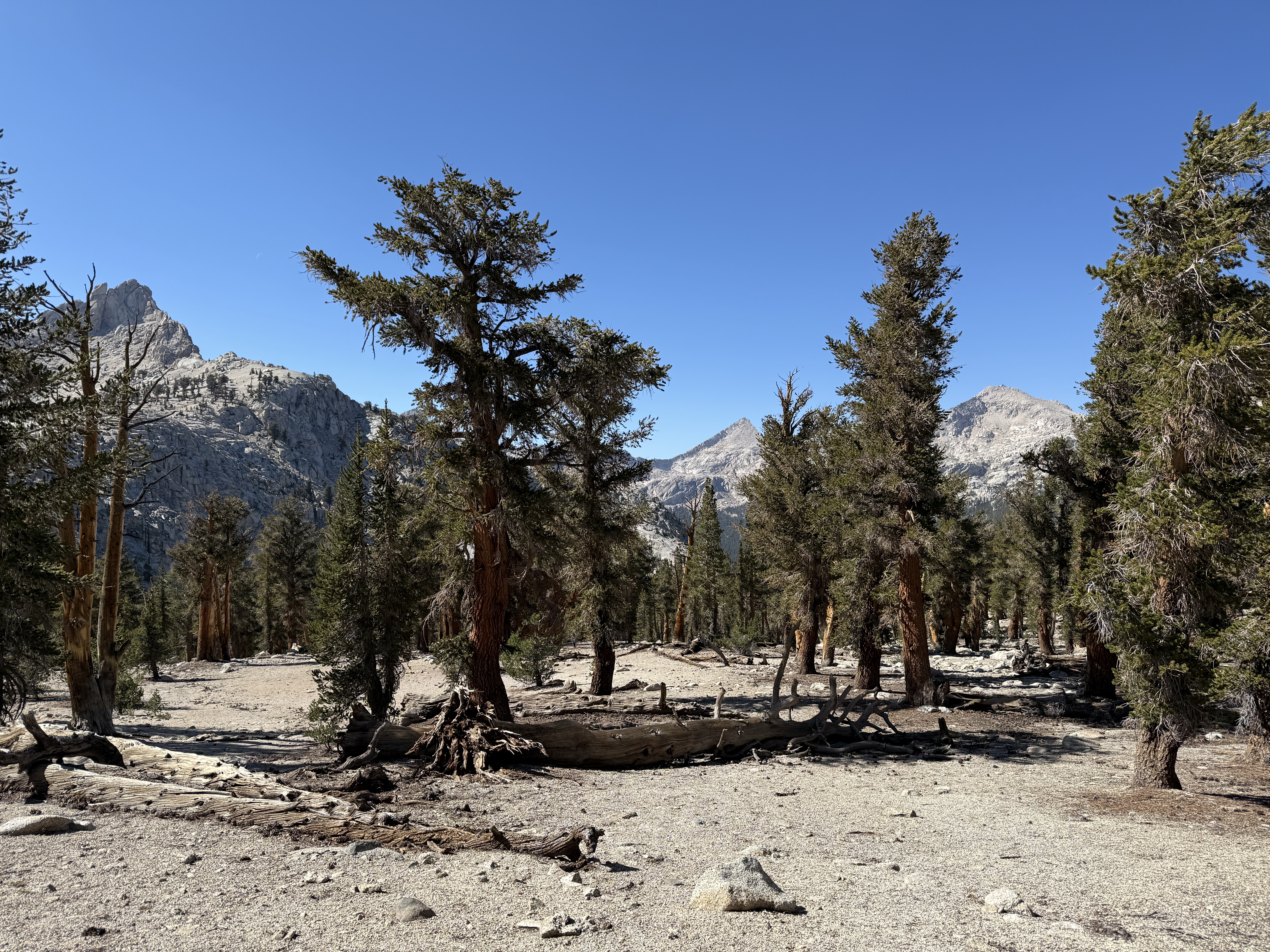
We were much cheered when we finally arrived at our campsite, situated at the junction of Cliff Creek and Timber Gap Creek. It really was a wonderful campsite: earlier, we had been a bit concerned about water availability because we had hiked along a dry creek bed for a bit, but this fear turned out to be entirely unfounded. The creek was flowing quite well, the access to the water from the campsite was very easy, and the water was clear and fast-moving to boot. We also had a bear box at this campsite, and we were fortunate to be under the shelter of several tall trees, such that the ground was actually entirely dry in some places despite the on-and-off rain throughout the day.11 But best of all: we were at an elevation low enough that we were allowed to have a campfire! There are very few things in life more fun than sitting around a campfire after a long, wet day of hiking, especially when someone in your group had the foresight to pack hot chocolate.12
With our gear all wet from the rain, we came up with increasingly ingenious ways to dry our clothing off. I was quite proud of my first contraption: I propped up my trekking poles against a tree to create a drying rack on which we hung a jacket and a wet pair of pants. Then, after gathering dry firewood and starting the campfire, I propped up a stick against a log to form a drying rack for my socks over the fire. Finally, I remembered that I had some paracord in my pack, so I strung some up between two trees near the fire to hang more clothes to dry. Really, they should give me an honorary doctorate in civil engineering or something to celebrate my amazing accomplishments.
To understand our plan for our fifth and last day of hiking, you first have to understand the road closure situation in the park. There’s only one road into Mineral King—the narrow, winding mountain road that we had driven on our way in—and this road gets closed on most days in order to allow for construction. On these days, vehicles are only allowed to pass at set times, the relevant ones for us being 1pm, 4pm, and 7pm. We had planned to make it back to the trailhead in time to catch the 4pm passage time, but if we missed it, we would have to wait until 7pm to leave the park. Conversely, if we managed to make very good time, we might plausibly make the 1pm exit, which was desirable because it would enable us to get back to Fresno sooner and eat In-N-Out.
Standing between us and In-N-Out was a climb up Timber Gap from the north, and then a plunge back into Mineral King Valley, where we had parked the car at the trailhead. I don’t think we explicitly discussed it, but we had an implicit plan of attack: Ray and I were the fastest climbers, so we would lead the climb up to Timber Gap, setting a decent pace. Richard was the fastest descender, with knees apparently made out of titanium (seriously, this guy doesn’t use trekking poles!), so he would lead the descent. With this plan in place, we woke up early, ate our oatmeal, and set off, enticed by the idea of a shower and a burger.
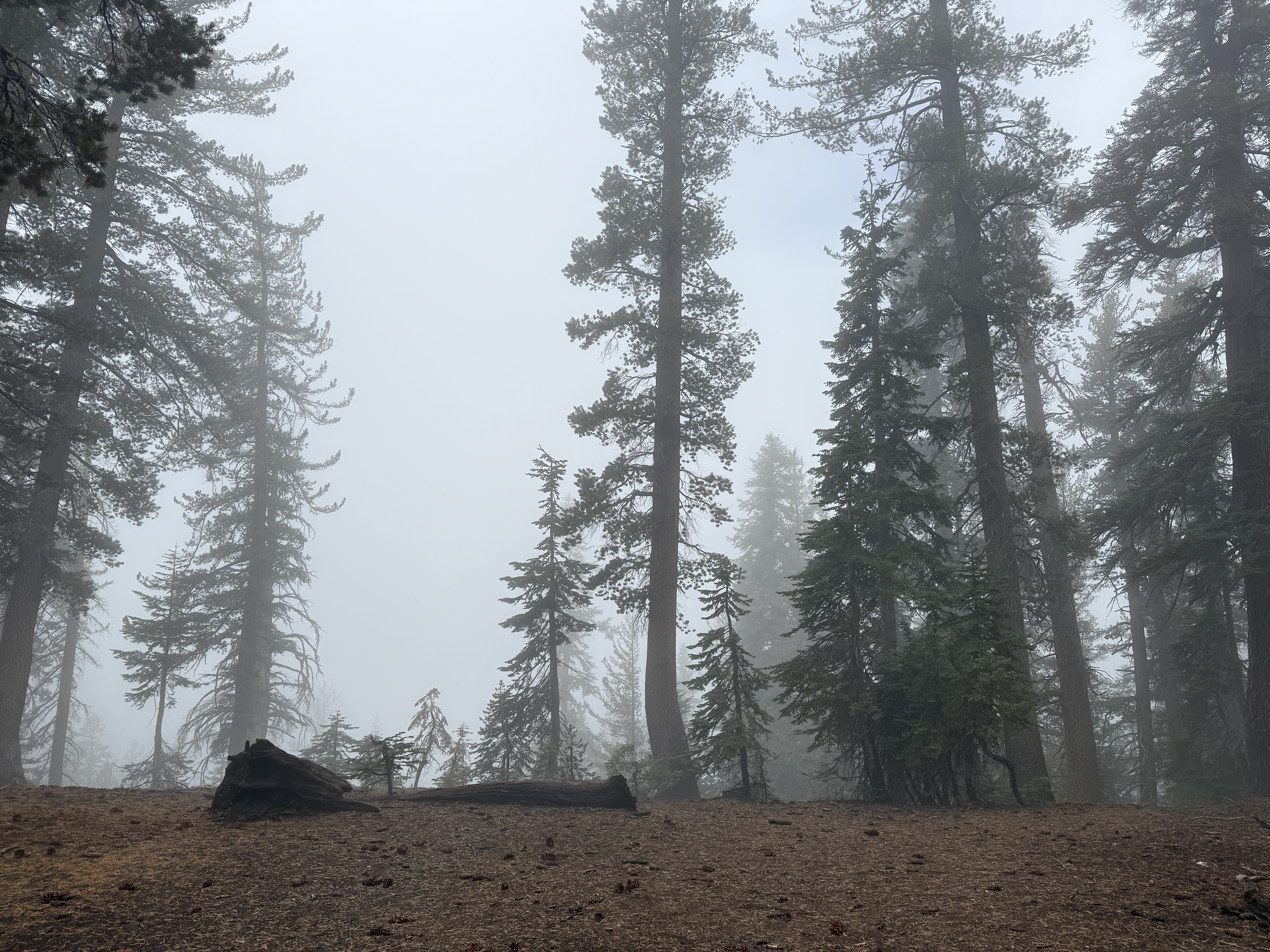
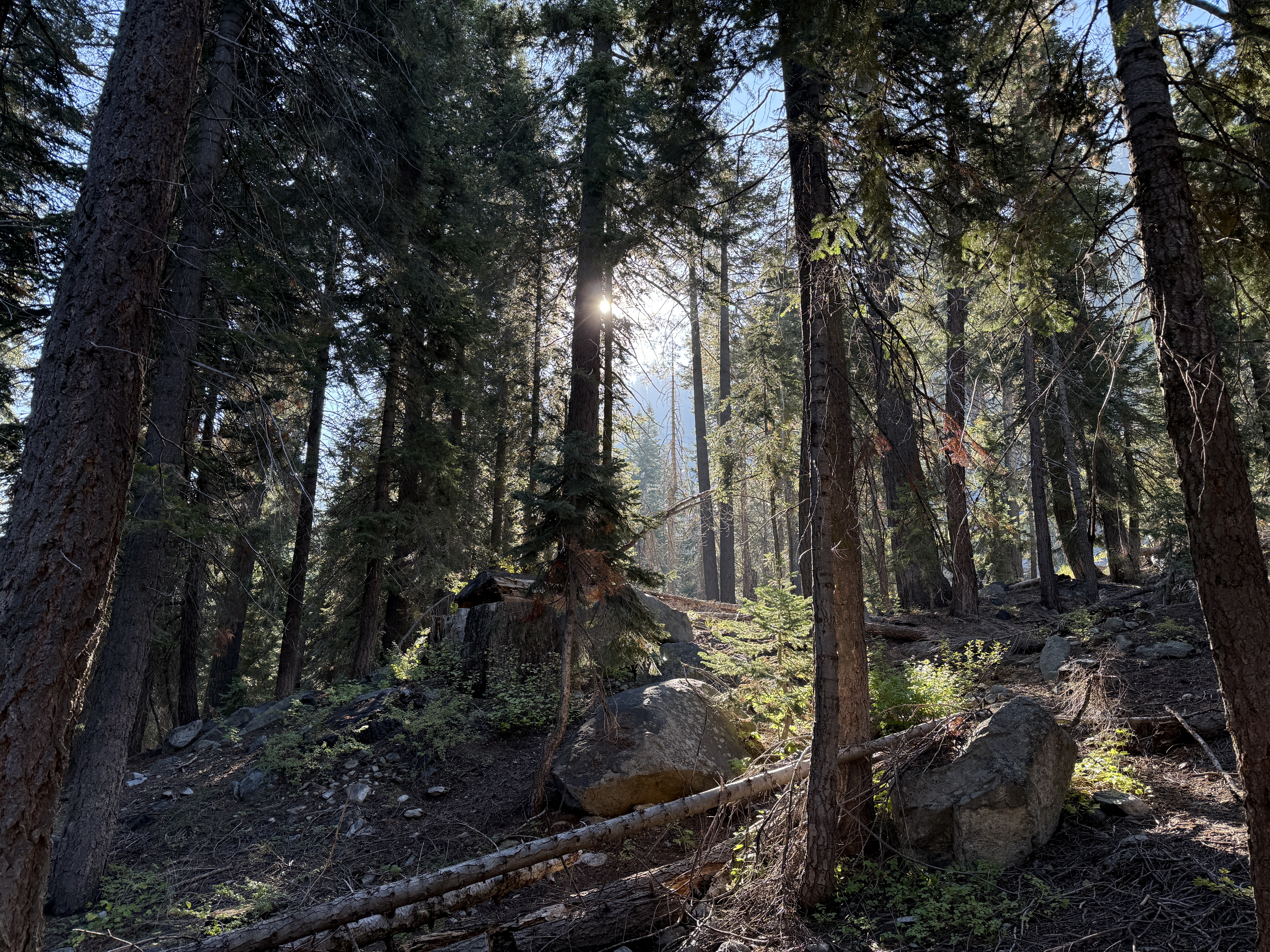
It was still a very cloudy and overcast day, but I actually kind of liked it this time, because it produced a very eerie and mysterious sort of ambiance. As the name suggests, Timber Gap is wooded, and it’s kind of a vibe to hike through a forest in the fog. If you’ll forgive yet another Tolkien reference, it makes you feel like you’re a hobbit journeying through the depths of Mirkwood, never quite sure what sort of strange and fantastic creature will emerge around the next foggy corner. Ricky, our native Seattleite, confirmed that this was basically what it was like to hike in the Pacific Northwest, so now I can say that I’ve basically been there.
When we reached the top of Timber Gap, we didn’t linger long, forgoing a formal lunch on the trail in favor of a quick snack break and getting back to the car faster. With snack supplies running low, we started up a barter economy for the remaining good morsels; I got a good price from Ricky for one of my last pieces of dried mango (which was definitely the best snack). Then, led by Richard, we booked it down the descent, stopping only to take some pictures. We made short work of the remaining miles of trail and were soon rewarded with out first glimpse of civilization in five days off in the distance: a road, a handful of small buildings, and—most importantly—the parking lot! Buoyed by the sense of near-completion, we hurried down the mountain and finally made it back to the car just before noon, with plenty of time to spare before the 1pm exit time. I kind of wanted to linger a bit and enjoy our last moments in the park, but also I kind of wanted a real meal, so I didn’t complain about the rush to get on the road.
After a quick visit to the ranger station to return the bear canisters we had borrowed, we began the arduous drive out of the mountains and back toward the civilized world. The poor visibility due to the fog made the drive down the mountain a little scary at times, but fortunately it cleared up fairly quickly as we lost elevation, and we made it out of the mountains fairly smoothly.
Our first stop after leaving the park was an ice cream place that Ricky had noted on our way in. I didn’t get any ice cream, but I bought a deck of cards from a nearby convenience store as a souvenir, and I finally turned off airplane mode on my phone to see what I had missed over the past week. (Apparently, the Fed cut interest rates by twenty-five basis points, and I missed a bunch of texts.)
The next stop interested me a bit more: a glorious post-hike meal at an In-N-Out in Visalia. Probably the place would lose its charm if I actually lived in California, but as a visitor, I always love stopping by to get a burger whenever I’m on the West Coast. After this, it was my turn to drive, and we went back to Fresno to check in at our new hotel and finally shower for the first time in five days. I was much amused by my facial hair—I think this was the first time in my life since I started shaving that I haven’t shaved for more than two days—and decided to keep it until I got back to New York.
Dinner that night was pho, which was really good but also really filling; I thought that my hiking-induced hunger would help me easily finish the bowl (perhaps with room to spare for the amazing-looking taco truck across the street), but alas, I barely managed to finish the noodles and meat.13 Besides dinner, there were a few more chores to do that night: dispose of our half-used fuel canisters (thankfully, the Fresno REI accepts them), reorganize our luggage, and say our goodbyes. Well, Richard is the only one of us who doesn’t live in New York, and he’s not really one for goodbyes, so I guess there weren’t too many of those.
Traveling back to New York was a bit of an ordeal because of the length alone; we departed from Fresno at around 7am, but I didn’t get back to my apartment until after 11pm, in large part due to a delay at Los Angeles. (Maybe I should invest in one of those fancy credit cards with lounge access for such situations.) The flight itself was pretty uneventful; a highlight was seeing the Hoover Dam out the window as we crossed the border between Nevada and Arizona. Of course, I had mixed feelings about being back home: while it was nice to see my mattress again, I also kind of missed the simple rhythm of being on the trail, of waking and sleeping with the sun. My personal friends know that my sleep schedule is, uh, not quite so healthy during normal times. Plus, after the rain on the trail, I had a wet tent to unpack, and that always sucks.
Whenever I write one of these trip reports, I find that the ending is inevitably the hardest part to write. Why shouldn’t it be? On a trip, setting off is always much more fun than returning home; it’s more enjoyable to pack than it is to unpack. And when I relive the trip in my head as I write it up, the opening always comes more easily to me than the closing.
I wrote earlier of the difficulty of capturing the splendor of the night sky in a photograph. I think it is just as hard to capture it with words. Perhaps I merely lack talent as a writer—after all, I write code, not prose,14 for a living—but I always find that, no matter how carefully I choose my words, they never quite fully embody the sense of wonder that I feel at being outside. There is so much beauty in the world around us; how could you ever bottle it all up into a handful of paragraphs?
My dad once asked me: Eric, if you’ve hiked all the famous, beautiful places in the world while in your twenties, what will you do when you’re older? You know, he kind of has a point—maybe I should save the Tour du Mont Blanc as a retirement project—but to be honest, if I ever run out of beautiful trails to hike, I think I can consider my life well-lived. And anyway, I think there is no shortage of beauty in the world; there is surely enough to last a lifetime.
As is customary, here’s a brief section with some thoughts on my gear choices this trip. I’ll only list the new things that I tried this trip, rather than everything:
I brought an actual down jacket, reasoning that it would be warmer than my synthetic one.15 In fact, I also brought the synthetic one to hike in, but I think it was pretty unnecessary to do so. I guess the down was a bit warmer, but I’m not sure if it’s worth the extra expense and care over the synthetic jacket + a fleece.
I used an inflatable sleeping pad this time, the Big Agnes Rapide SL. It was much more comfortable than my old foam pad, which was important to me. It’s also rated for much lower temperatures, although it didn’t end up getting too cold this trip. Another big benefit is that it’s much more compact, being able to fit inside my pack rather than having to be strapped to the outside.
The only real downside is that it’s annoying to inflate and deflate each day, but I think that downside is worth it, and I plan to continue using the inflatable pad in the future.
I slept in Ray’s tent, a Durston X-Dome. I don’t think it was that different from my tent, but I did appreciate the ability to pitch it fly-first, and the magnetic clasps for opening the vestibule were a nice, premium-feeling touch.
After griping about the battery life in so many past trip reports, I finally decided not to bring my Apple Watch on this hike, opting for an old quartz watch instead. It was so liberating not having to worry about keeping the watch charged during the week, and honestly also not having to remember to pause and resume the recording for Strava.
Conversely, I was really impressed by the battery life on my new phone! It turns out that new iPhones just have really great battery life. If I had turned off my phone overnight, it’s possible that I wouldn’t have had to charge my phone at all during the week, which was mind-blowing. (It would have been really close, though.)
By the way, I’d like to officially set the record straight: I was right about granite being an igneous rock! While on the trail, we were engaged in a geological dispute, and my friends all claimed that granite was a metamorphic rock. There was no way to check out in the wilderness, but I now feel vindicated.↩︎
I did make a rather embarrassing mistake in this part of the planning process: I wanted to get a permit for a Monday, but I failed to realize the first time that just because (say) February 1st is a Monday, that doesn’t necessarily mean that August 1st is a Monday…↩︎
Being the first to arrive in Fresno, Richard bought the bulk of our snacks from Costco. The dried dates were a questionable choice (way too sticky), and personally I think I would have preferred more nuts, but the beef jerky and dried mango were absolutely inspired choices, so I’ll overlook those minor mistakes.↩︎
Since the first day’s food doesn’t have to fit in the bear canister, you can afford to pack something a little more luxurious for lunch.↩︎
Fun story: back in high school, I actually used to power off my phone during the school day, reasoning that I had no use for it. One day, my mom came to school to drop something off for me; the front office assistant suggested that she text me to let me know it was here. They were quite stunned to find out that they had at least one student who kept his phone off during the day!↩︎
If you can call it a road…some places were so poorly paved that it might have been better for them to be unpaved.↩︎
No comment on George H.W. Bush and his policies, but you have to admit that “a thousand points of light” is a beautiful phrase.↩︎
While hiking, I never know which mountains are which; I only ever piece it together after the hike, as I’m going through pictures and consulting the map.↩︎
This reminded me of a story from my high school days: one winter, my knuckles got really dry and started bleeding a bit. I took the obvious route to solving this, and kept a cup of water at my desk to periodically dip my hands into. This sort of worked but was a bit annoying; it was only years later that I discovered that the canonical solution to this problem is something called “lotion.”↩︎
Sorry, inside joke from the trip.↩︎
Ricky posed a question “to the chat”: ought we to thank God for the shelter, or curse him for the rain? We agreed that the answer was: we ought to thank him for both the shelter and the rain.↩︎
Thanks, Ray.↩︎
Richard pointed out that this is a bit of a recurring pattern with me: I get hungry after some physical activity, order a huge quantity of food, and proceed to realize that intense physical activity doesn’t actually expand the volume of one’s stomach. The most notorious episode of this happened on a bikepacking trip, when I order two dinners and only got through one and a half.↩︎
Haha, I originally wrote this last October, before the advent of Claude Opus 4.5. Little did I know…↩︎
Listen to this completely original joke I just came up with: “everyone always asks about the down jacket, but no one ever asks about the up dog…”↩︎
Comments