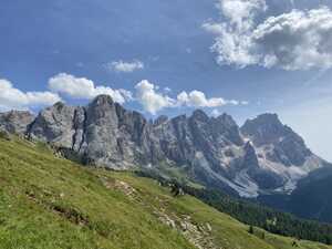
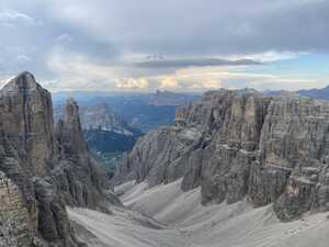
The Dolomites are a beautiful mountain range in the north of Italy, a sub-range of the Eastern Alps. While not as tall or dramatic as some of the better-known mountains in the Western Alps (where the famous Mont Blanc and the Matterhorn are located), the Dolomites have their own charm. Centuries-old villages dot the valleys, and the slopes are lined with pastures where sheep and cows graze, ringing their cowbells constantly. I feel like I should have a pretty picture up-front to pique the interest of any potential readers, so here you go. (I kept the best ones for later, though, so keep on reading!)

In August 2024, Richard and I did a trek on the Alta Via 2, one of the many long-distance hiking trails that pass through the Dolomites. Along the way, we saw spectacular sights, ate lots of good food, ate some bad food, shredded our knees, and met some cool people. He did the entire trail from Brixen to Feltre; not wanting to take too much time off work, I joined him only for the first seven days, leaving the trail at the Rifugio Rosetta. If you’d like to follow along from the comfort of your own home, here are the Strava activities1 corresponding to each day:
The most important thing to know about the Alte Vie (and many other famous long-distance European trails, such as Spain’s Camino de Santiago and France’s Tour du Mont Blanc) is that, unlike the famous American trails, they tend to be quite developed, with staffed huts offering meals and accommodations for trekkers all along the trail. As such, people travel much lighter than your typical American thru-hiker: there’s no need to bring a tent, sleeping bag, sleeping pad, stove, or food. Hiking one of these European trails is much more akin to being a medieval pilgrim rather than a wilderness backpacker.2 It’s a very different kind of experience, but still a very enjoyable one.
I am a serial procrastinator, especially when it comes to planning for trips. As such, it was a massive scramble to book all of my travel and assemble all of the necessary gear before the trip. I took about fifty million trips after work to the NYC Soho REI in the weeks leading up to my departure; I’m sure the REI staff were amused by how many times I came in to buy things, particularly the staff member who was helping my indecisive self try on backpacks.3 And of course, I stayed up late the night before packing and printing out hard copies of all the items in my itinerary. Here’s the obligatory gear pic:
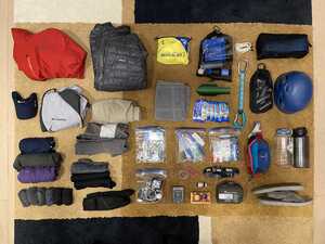
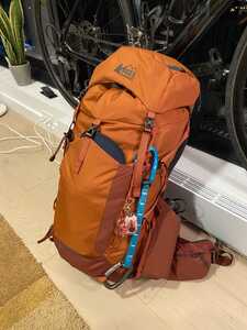
Anyway, after a long night of packing and last-minute planning, I was set for the adventure: the plan was that I’d take the afternoon off work on Thursday (August 8), then take a direct overnight flight from JFK4 to Venice. I’d then take the train from Venice to Verona, and then from Verona to Brixen, where I’d meet up with Richard (who was traveling from Pittsburgh and flying into Milan) on Friday night so that we could start the hike on Saturday. A pretty jam-packed first day of travel!
The flight itself went fairly smoothly. At first, I was worried that there might not be enough space in the overhead bins for my backpack (I really didn’t want to check it in), but this turned out to be fine. I didn’t do much on the flight; I just tried to get as much sleep as I could, wanting to be well-rested for the week of hiking ahead. Upon landing in Venice, I immediately knew that we were in a touristy area because of the Chinese-language airport signage. I took a bus to Venezia Mestre railway station, where I had a piece of focaccia for lunch. (This was partly an attempt to spend most of my loose coins before hitting the mountains.)
I had a couple of hours to kill before my train to Verona would depart. From there, I was scheduled to wait an hour before getting on the train to Brixen. But after walking around the area near Venezia Mestre for a bit and not finding anything particularly interesting, I made a spontaneous decision: I decided to buy an earlier ticket to Verona, so that I could kill the extra time in Verona rather than on the outskirts of Venice. After all, I would have plenty of time to explore Venice after I was done hiking.
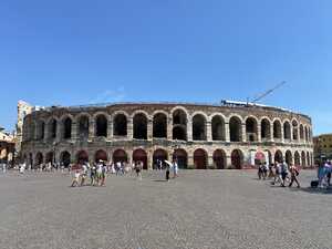
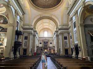
The earlier ticket to Verona was fairly cheap: about ten euros for a youth ticket, which I felt was well worth it to be able to check out a different Italian city. This plan almost backfired spectacularly on me when I fell asleep on the train and almost missed my stop, but I fortunately woke up just before we pulled out of Verona (to head back to Venice.) I ended up with about an hour to spend in Verona’s old city, which I think I put to fairly efficient use. I saw the famous arena, walked into random churches, and bought an overpriced fruit cup at a market in a continued effort to rid myself of loose coins.
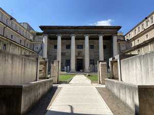
Of course, I had to visit the most famous attraction in Verona: the great anti-monk5 site of Juliet’s house! Shakespeare’s Romeo and Juliet is famously set in Verona,6 and in particular this one house previously owned by the Dal Cappello family has long been associated with the play. I went to see the infamous balcony (“O Romeo, Romeo, wherefore art thou Romeo?”), which was located in an absolutely jam-packed courtyard.
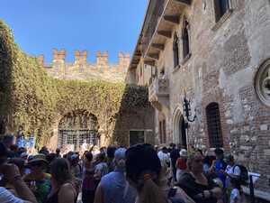
Of course, I wasn’t here merely (or even primarily) to tour great anti-monk sites. Rather, I had a train to catch to meet up with Richard, so after snapping a quick picture, I headed back to the train station, stopping every so often to admire interesting statues or nice squares.
The train ride itself was just fine. Curiously, no one ever checked my ticket, though maybe the conductor came around while I was asleep and didn’t want to wake me. Another interesting observation from the train ride: at some point, the signage in the stations that we were passing by started to have German as well as Italian. There’s a large German-speaking population in northern Italy, which is near the Austrian border, so this was entirely expected, but it was still a neat reminder of the linguistic complexities of Europe. In fact, my destination for the night had two names: Brixen (in German) and Bressanone (in Italian).
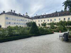
Brixen itself is quite a nice town nestled in the foothills of the Dolomites. In the winter, my understanding is that there’s a lot of skiing in the area; in the summer, hiking is the sport of choice, perhaps with a bit of mountain biking mixed in. I walked from the train station to the Hotel Elephant, where Richard had booked our accommodations for the night. Along the way, I stopped by a random garden in a courtyard with a cool entryway through a dark corridor covered in thick, arched vines. I also filled up my water bottle from a nearby public fountain. Our hotel turned out to be surprisingly opulent, with a Michelin-starred restaurant attached. I had assumed that we were staying in the local youth hostel, so this was a pleasant surprise.
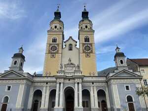
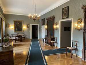
After meeting up and recuperating a bit in the hotel from the long journey to get here, we headed out to walk around town and grab dinner. We ended up getting pizza at a local shop, which Richard rated as about equal to the famous Mineo’s Pizza in Pittsburgh. We made the mistake of sitting outside next to some plants, though, and we spent all of dinner fighting off insects. After a bit more walking around town, we returned to our hotel to retire for the night and (hopefully) get some sleep before the hiking began in earnest the next day. One unfortunate circumstance: despite the fancy trappings, it turned out that the hotel was not equipped with air conditioning, so the night was not exactly pleasant. Still, we survived, ready for the adventure to unfold.
We woke up and got ready for the day, savoring our last few moments in civilization before heading into the mountains. After packing our bags and double-checking everything, we headed downstairs to breakfast, where we were greeted by a delightful spread, truly a breakfast of champions. Seriously, this thing was a work of art:
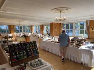
From here, the hike began in earnest. Now there are several options here: typically, one spends the first day hiking the whole way from Brixen to Rifugio Plose, spending the night there. Alternatively, some people choose to take the bus and cable car up to Plose, then hike on the rest of the day, typically to the Rifugio Genova. Now you see, Richard trolled us slightly here: we attempted to do the second thing (i.e. take the cable car), but we did not know about the bus, leading us to hike uphill for about five kilometers from the center of Brixen to the base of the cable car. This wasn’t even particularly pleasant hiking, either, as we were just walking along the road. And the worst part: thinking that it was an easy stroll to the cable car, I didn’t turn on my Strava recording, so now I have no record of this herculean effort. (Okay, fine, I’m being a little melodramatic.) At least there were some nice views to console us.
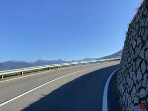
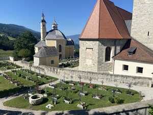
At last, we arrived at the cable car base station, where we then realized that we’d trolled ourselves a second time: our hotel room supposedly came with free lift tickets, but we hadn’t picked them up, so we had to buy new ones. We were really off to a great start. After taking the cable car, we arrived at a cute little clearing packed with tourists doing day trips from the valley below. From here, our hike finally officially began: I started my Strava activity, and we continued on to the Rifugio Plose, gaining about 400 meters of elevation straight away. We stopped at the hut for lunch, which actually turned out to be really good; I’ve decided that one of my favorite Italian dishes is pasta with garlic, olive oil, and pepper. We met and chatted a bit with a Frenchman whom we would later run into a few other times on the trail. He had hiked up all the way from Brixen in the morning, although he was staying the night at the Rifugio Plose.
After a hearty lunch at the rifugio, we pressed onward, and here the landscape began to truly open up to reveal the wonderful beauty of the Dolomites. We walked past pastures with grazing cows, sounding their cowbells as they moved. The trail was easy here, with great views of the Odle d’Eores to the south. Though for some reason, the guidebook’s pictures look better than mine…
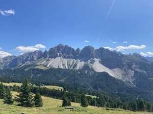
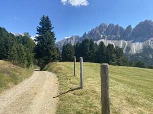
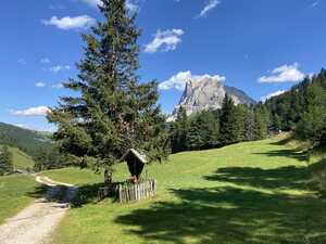
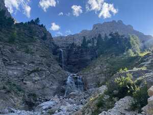
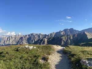
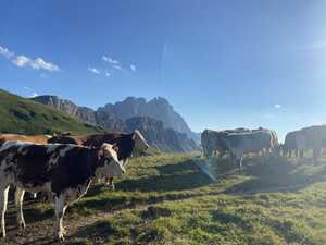
The day continued on like this: lots of pleasant alpine views, some uphill and downhill, but all very clearly within the confines of civilization. We had yet to reach some of the more remote parts of the Dolomites. There were many picture-perfect timber chalets in the valleys, and lots of well-maintained pastures on the slopes. The valleys and passes were dotted with crucifixes, a reminder that this is a deeply Catholic part of Italy. All told, the place felt very European. Eventually, we arrived at the Rifugio Genova, where most hikers decide to stay. However, as we had booked rather late, we were not able to reserve bunks here; rather, we’d made our reservations at Gampenalm, maybe 250 meters below in the valley.
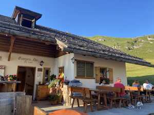
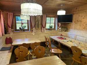
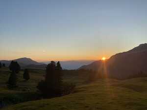
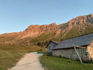
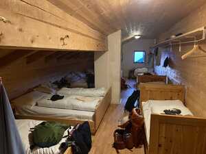
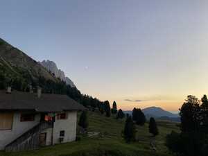
I will say: Gampenalm was quite good in terms of food and general conditions. Perhaps we were just famished after a long day of hiking (around fifteen miles—the Strava recording doesn’t include the initial three-and-change miles going uphill), but the local “dumplings” were quite good. I put dumplings in quotes because I feel like it’s a somewhat loose English translation…they lacked any sort of filling, which in my mind is the defining characteristic of a dumpling. Anyway, since this hut is fairly low-altitude and has car access, the accommodations are relatively luxurious: we were treated to unlimited (free!) warm showers, and the wifi was actually pretty decent. As it was a clear night, I stayed up a bit to watch the sunset and do some stargazing. (My cell phone camera can’t take star pictures, so sadly I have none to post.) I considered waiting until after moonset in order to see even more stars, but I figured it made more sense to get some rest before the next day of hiking.
The day started out with a nice little “warm-up” climb: we had to reverse the previous afternoon’s descent into Gampenalm from the Rifugio Genova. This wasn’t so bad; after we caught our breaths, the trail continued south, gently descending on some grassy slopes with great views of the Puez group, which we would be climbing later.
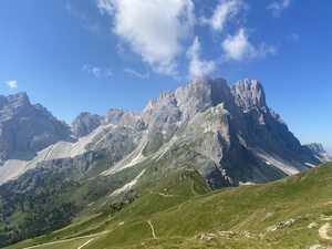
We passed by a small hut, the Medalges Alm,7 but as it was still fairly early in the day, we decided not to stop for food or to fill up our bottles. This turned out to be a bit of a mistake, as later events would show.
From here, the trail began to climb up to the Forcella della Roa: at first, gradually, but then very much not gradually. The initial section along the grassy slopes was not so bad; it was gentle, and there were excellent views into the valley below. We stopped at a nice rock outcrop to take some pictures. The upper sections, through scree, were somewhat more challenging, although we made it to the fork without much difficulty.8
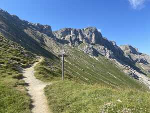
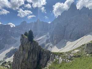
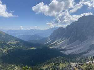
Sadly, here was where Richard and I were to split up for the day. Since we had booked our accommodations so late,9 we weren’t able to get two beds in the Rifugio Puez, the hut where most hikers end the day. (I suppose the early bird catches the worm indeed.) Instead, the plan was that we’d split up—I would go to the Rifugio Puez while Richard would spend the night at the Rifugio Firenze, and then we’d meet up again the next day at the Passo Gardena. I didn’t really like the idea of splitting up, preferring to just both go to one hut and seeing if there was a free bunk (worst case I figured one of us could just sleep on the floor), but Richard preferred sticking to the original plan.
After bidding farewell to him, I headed east, taking a shortcut through the via ferrata at the Forcella Nives. For those not aware, vie ferrate are cable-aided sections of trail found mostly in the Alps, tracing their history back to the steel cables that soldiers affixed to the rocks during the First World War to facilitate movement through the mountains. Today, they’re a fairly popular form of leisure in the area, with difficulties ranging from moderate rock scrambling to easy sport climbing. For some reason, the discipline is not particularly popular in the United States; I only know of one via ferrata route in West Virginia and a couple in Colorado. Most trekkers on the Alta Via 2 bring some equipment for the vie ferrate—the essentials are a helmet, climbing harness, and specialized lanyard kit. I had also brought a basic climbing quickdraw with me, with the idea being that I could clip myself onto the steel cables to rest if needed. (This turned out to be entirely unnecessary.)
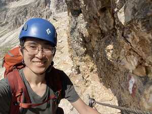
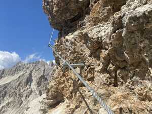
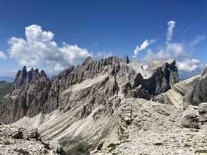
To be completely honest, this particular via ferrata was kind of a letdown. It was really a not-too-difficult scramble; I didn’t even need to use the steel cable to help myself up. Still, I had some fun, so I can’t really complain.
After climbing the via ferrata and hiking a bit, I came across another fork in the trail, with one side leading up to a fairly accessible-looking mountain summit; some other hikers were going up the mountain. From consulting the map afterward, it seems like this was the Piz Duleda (2909 m), although I can’t be too sure because I didn’t take a picture. I was fairly tempted by this, although in the end I decided it would be unwise to make a summit attempt, as I was running dangerously low on water. You see, Richard had decided to only bring one 500 mL bottle on the trip. As a result, I needed to refill his bottle several times earlier in the day, acutely depleting my own supply. (Richard is a great friend, but I made him purchase another bottle after this.) I instead decided to head to the hut as quickly as possible, to avoid running out of water.
The route to the hut was fairly scenic, passing through some grassy slopes with the mountains on my left and a view of Vallunga—a particularly nice valley—to my right. However, my enjoyment of this part of the trail was somewhat hampered by my continually dwindling water supply; at one point, I had just a few sips left. But then, I heard one of the sweetest sounds a parched man can hear: the sound of a brook making its way down the mountain. Excited, I soon caught a glimpse of the tiny stream with a few miniature waterfalls. I stopped to filter some water and wow, I have rarely had water that refreshing. In general, natural water is a scarce resource in the Dolomites, a problem exacerbated by the use of lots of high-altitude grassland as pastures (you, uh, don’t want to drink water downstream of where a herd of cattle have been). As evidence of the scarcity of water, I noticed that someone had used a hose to divert some of the stream water to a nearby cattle trough. Refreshed by this precious water, the remaining twenty minutes to the hut were a breeze.
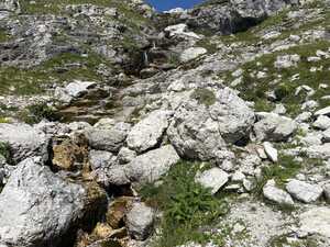
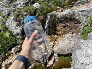
The hut itself was nothing much to write home about. The Rifugio Puez, while not being extremely far from civilization, is inaccessible enough that it’s only reachable by foot or by helicopter. As a result, most supplies have to be flown in, leading to rather spartan accommodations. The dorms were stuffed to the ceiling with three-level bunk beds; fortunately, I had arrived early enough to snag a bottom bunk. The food was not particularly impressive, especially compared to the Gampenalm, and the worst part: they charged five euros for a three-minute shower! (Even worse still, they ran out of water for showering later on in the night, although luckily I had already showered by then.) Still, it was a warm bed after a long day of hiking, so I couldn’t really complain. As I was on my own, I was forced to socialize a bit; I ran into the Frenchman from the previous day again—apparently, he had done a massive hike all the way from the Rigufio Plose to the Rigufio Puez, which most hikers split into two days. I also met an Australian whom I’d run into again a few times on the trail, as well as a young Dutch couple who were doing a shorter hike.
One fun adventure at the Rifugio Puez: I did my laundry! I had organized my backpack with a couple of medium-sized bags cannibalized from my bikepacking setup. It turned out that these bags were waterproof, so I filled them up with water, let my dirty clothes soak, applied some of my bar soap, swished the whole thing around, and then soaked again in plain water. It really led me to appreciate the marvelous wonder of washing machines. After all these chores (and sending a few pictures to my family over Starlink), it was time for bed. I wanted to be relatively well-rested, as the next day was supposed to be quite difficult.
At least on paper, the third day seemed to be the most physically grueling day; Strava computes over 6,000 feet of elevation gain over 10.7 miles. This is largely because we went a bit further than the standard guidebook stage, including an extra climb up to the Rifugio Boè whereas most spend the night at the Rifugio Pisciadù. But in return, the scenery promised to be spectacular: we were finally well and truly into the dramatic, rocky mountain scenery that we had been promised.
The first order of business was hiking to the Passo Gardena to meet up with Richard, who was planning on taking the gondola car in from the Rifugio Firenze. We had said that we’d meet at noon, but going solo, I made fairly quick time, unexpectedly arriving more than an hour ahead of schedule. The hike was quite a nice one: there were some small climbs to contend with, but nothing truly difficult. I passed by my first alpine lake, the Lago di Crespëina; any regular readers of this blog know just how much I adore alpine lakes, so this was a real treat. Unfortunately, it was sadly depleted, with much of the lake bed exposed.
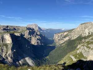
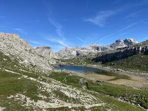
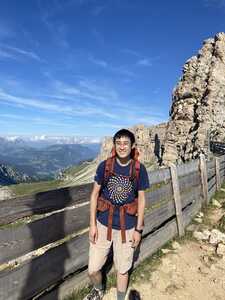
The Passo Gardena lies on a major scenic highway, meaning that there’s a fairly developed small town in the pass, with many day tourists. (It tripped my proxy for tourism development: I saw some Chinese tourists!) It’s not hard to see why they built a scenic highway here: it’s perfectly situated between the Puez-Odle group and the Sella group.
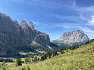
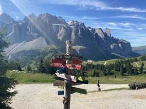
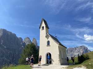
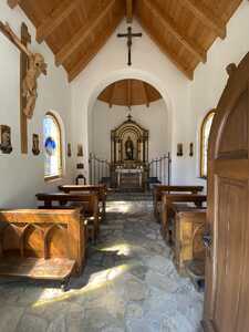
The descent into the town from the Puez group massif was fairly long, but my still-fresh knees were more than up to the task. As I had arrived fairly early, I had time to wander around the small town a bit. I mailed some postcards to family and checked out the quaint little chapel. I also found one of those sign posts with arrows pointing in the direction of a bunch of major cities, with the distances to those cities spelled out. It said that there were 6,578 kilometers to New York—a long way from home!
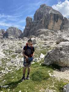
Finally, after meeting up with Richard, we set out on the next stage of the adventure: the hike up to the Rifugio Pisciadù. This climb was rather formidable: the raw elevation gain was no joke, and it was topped off by yet another via ferrata section. During the climb, we passed by our first snowpack, a nice reminder that we were indeed in the mountains. This via ferrata was also not superbly challenging; I had fun free climbing most of the scrambles, although we often had to wait due to traffic jams. Eventually, we arrived at the top, where it was an easy walk to the Rifugio Pisciadù, where we stopped for a late lunch. I discovered the joys of potatoes, egg, and speck: a seemingly simple course, but it was an absolute revelation in terms of taste. (Or maybe I was just famished after a long day of hiking…) The beverage—a local favorite known as skiwasser—was also quite good.
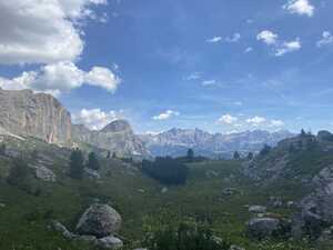
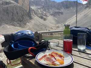
A funny anecdote: just as we were about to hit the hut, I remarked to Richard that this would be a wonderful spot for an alpine lake, nestled among the rock walls. Almost immediately afterward, the Lago Pisciadù, adjacent to the hut, came into view!
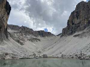
By now, it was around three in the afternoon, but sadly, this was not to be the end of the day. There was yet another challenge in sight: we would still have to undergo the arduous ascent to the Rifugio Boè from here, involving yet another via ferrata and many more meters to go. It was a bit demotivating because I really wanted to make sure we arrived in time for dinner, but thankfully it turned out that I didn’t have to worry.
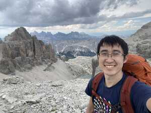
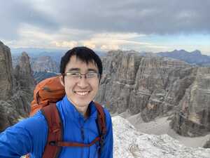
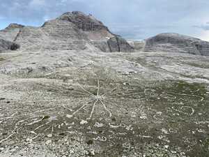
At the top of the first part of the ascent, there was a rather pitifully small pool of water, evidently formed by snowmelt. But upon further ascending, a spectacular landscape opened up, offering wonderful views of the rock walls. There were, of course, also views of the lake below. Amusingly, someone (or many someones) had arranged the stones to look like crop circles on one flat area, almost as if aliens had been here! We also met the Australian again around here; we chatted a bit and took some pictures for each other.
Arriving at the Rifugio Boè, we found it surprisingly modern despite its remote location. There were glass walls and relatively clean accommodations, although the showers were unfortunately not free. (They charged one euro per minute of hot water. I took the fastest shower of my life, at two minutes.) The hut also had a couple of feline friends walking around!
I will say: despite the rather new building, the Internet connection was not particularly strong. It only really worked passably well in one particular corner of the building, and I think I ended up consuming all of their bandwidth using my Google Photos backup job. You see, I was trying to settle our tab by card, but their card reader kept on timing out. After I discreetly shut off my backup job, the card reader magically started working again…
After breakfast, the next day started out with a surprise: there was a helicopter parked outside of the hut! I couldn’t really tell if it was a supply helicopter or a rescue helicopter, but whatever it was, it was fun to see. It was an auspicious start to what would prove to be a rather long day: more than twelve miles, according to my watch’s GPS data. (Though thankfully there was a lot less elevation gain than the day before.) We started off with a summit of the majestic Piz Boè (3,151 m), the highest mountain in the Sella group. The climb up was not too bad; it included some cable-aided sections, but I decided to forgo donning the via ferrata gear this time, as the previous vie ferrate had not really been challenging enough to require them. I think that this was the right choice: with the steel cable to grab on to, I never felt like the trail was too sketchy to proceed. As long as you’re comfortable holding onto a steel cable on a ledge, I think this is definitely the right choice.
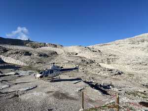
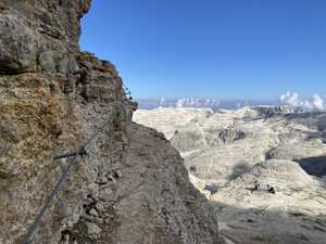
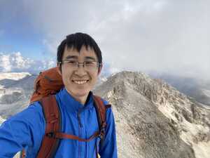
Perched atop the Piz Boè there’s a small hut, the Rifugio Capanna Piz Fassa. It’s quite primitive compared to many of the other rifugi, and especially in comparison to the Rifugio Boè below: this summit hut sleeps only twenty-two and has no showers. All supplies are, of course, brought in and out via a small concrete helipad built into the side of the mountain. The panoramic view from the summit of the Piz Boè is supposed to be quite grand, but unfortunately, just as we reached the summit, some heavy cloud cover rolled in, obscuring the view. We waited in vain for the clouds to clear; when it became apparent that they wouldn’t clear anytime soon, we gave up and continued the hike, going down the mountain toward the Rifugio Forcella Pordoi. Oh well, I suppose that being in the clouds has its own sort of mysterious feeling, leading to the cool effect of feeling like one is everywhere and nowhere at once. It reminded me a bit of my summit of Mont Ventoux by bike, which suffered from similar summit-cloud problems.
The hike down to the Rifugio Forcella Pordoi was fairly scenic but quite crowded, as there’s easy road access for day-trippers hiking in or taking the cable car from the Passo Pordoi. We even passed by an elderly Japanese lady, who hopefully asked me if I was Japanese. (I was sorry to disappoint her.) We made it to the Rifugio Forcella Pordoi without much difficulty at all. This was a fairly standard mountain hut, though for some reason they had a singular pig in a pen out in the back. Richard and I joked that they must use it for trash disposal or something.
From here, though, we accidentally made a wrong turn: reasoning that the path veering steeply downhill to the south was obviously too steep to be the correct one, we proceeded uphill to the Sass Pordoi (2,950 m), where we arrived at the cable car station somewhat confused. Eventually, we deduced that we’d taken a wrong turn and headed back downhill to the rifugio, from which we made the correct turn south down the mountain. I even pulled out my physical map and compass to double-check, which made me feel like a real explorer.
What followed was perhaps the most horrible and knee-destroying scree descent that I’ve ever done. From the top of the Sass Pordoi to the bottom of the Passo Pordoi, we did 700 meters straight of downhill, much of it on steep, loose terrain. It was here that I sorely regretted my foolish decision to not pack trekking poles.10 I then made another foolish decision on the way down: I saw what looked like a challenging little detour down the mountain and decided to take it for fun. I mean, I had fun, but I don’t know if it was worth my knees hurting for the rest of the trip. Later that day, I chatted with a local Italian couple whom I met on the trail, and they said that they’d taken the cable car rather than hike down this section. Turns out the locals knew something that I didn’t.
But at last the descent was over, and we arrived at the Passo Pordoi, where we stopped at a restaurant and had burgers and fries for lunch—a little taste of home. Alas, our misfortune was not yet over: as we were eating, a few drops of rain started to fall from the sky. It wasn’t so bad yet, but we were worried that it might develop into a storm later on, so we put on our pack rain covers, and I donned my rain jacket.
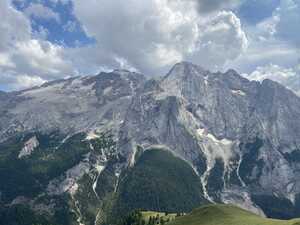
The rain came and went for a bit, but we didn’t really mind that, as there were incredible views to keep us happy. As we hiked a long, grassy traverse to the Lago di Fedaia, where we would be spending the night, to our right there was a perfect view of the Marmolada (3,343 m), the tallest mountain in the Dolomites. It’s not hard to see why this mountain is called the “Queen of the Dolomites.”
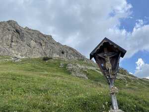
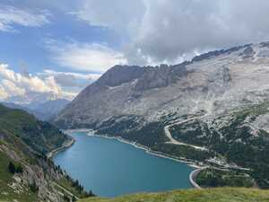
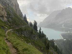
At this point, it was clear that the rain was about to intensify, as we could see heavier precipitation in the distance. I pressed on a bit harder, trying to at least make it off the mountain and into the valley before the storm struck. Sadly, I did not make it, and I got caught in the rain. It wasn’t so bad except for the aided stretches; I did those as quickly as possible, as the last thing you want to be standing next to during a thunderstorm is a steel cable running down the side of a mountain. Still, I made it into the valley, where I debated waiting for Richard at the Rifugio Castiglioni or hiking on to our destination for the night, the Rifugio Fedaia at the other end of the lake.
I decided to press on along the trail (along the northern end of the lake), but it quickly became evident that this was not the correct move, as the trail conditions were not ideal in the rain. So, I turned around and headed back to the west end of the lake, where I met up with Richard. From there, we hiked around the south end of the lake, along a road that was closed to cars due to a recent rockslide. This turned out to be the correct move.
When we finally arrived at the Rifugio Fedaia, wet and exhausted, we were greeted with fairly cozy accommodations. (Again, the lower-altitude huts typically have better conditions, as they are able to resupply by car. They usually don’t charge for hot showers!) We shared the upper floor with a Polish man and his two children, who were here on a different multi-day hike. Only having to share the bathroom with five people was quite the luxury. Upon finding out that we were Americans, the man did ask us a pretty reasonable question: why would Americans come to the Dolomites to trek, when there are so many amazing trails in the United States? This is kind of a good point; I’ll defer to Richard on why he chose the Alta Via 2 in particular. I’ll just say that I was toying with the idea of doing the Tour du Mont Blanc next year, but perhaps I should just do the John Muir Trail or something.
The next morning, we decided to take the bus from the Rifugio Fedaia to Malga Ciapela and start the day’s hike there. This was done for two reasons: for one, it allowed us to avoid hiking on the road. We weren’t the only ones with this idea; on the bus, we bumped into the Australian from the Rifugio Puez again. But more importantly, it gave us time to take the cable car from Malga Ciapela up to the top of the Marmolada!
Besides having a commanding view of the surrounding area (it is the tallest mountain in the Dolomites, after all), the Marmolada is also home to a World War I museum, which I found pretty interesting. I hadn’t realized that there was fighting on the mountain itself during the war. There was also a small grotto with a shrine to the Virgin Mary, which we visited. On the cable car ride down from the summit, I chatted with a Russian and a Belarusian who were also hiking the Alta Via 2. In fact, they were hiking to the same hotel as we were that night, although we didn’t set out together, as they had decided to get lunch before starting the hike. This turned out to be a rather fortuitous encounter, as later events would prove.
From Malga Ciapela, we began our hike for the day. The profile for the day was fairly straightforward, if a little intimidating: first, we would hike 1,000 meters straight up to the Forca Rossa. Then, we’d hike about half that downhill, before settling into a more flat section gently descending into the Passo San Pellegrino. The trail started off past a campground in the woods; after a little while, we came to a small hut where we stopped for lunch, and to take shelter from a brief bit of rain that thankfully didn’t persist. After lunch, I decided to pick up a stick from the nearby woods to use as a walking stick, as I was wary of the downhill section to come.
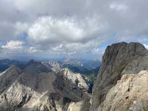
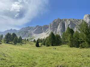
We continued on upward, passing through a forest trail that reminded me of the woodland hikes that are so common in Pennsylvania, where I went to school. The dense vegetation was a bit surprising after the dry, rocky terrain that we had gotten used to, but we weren’t complaining. (Although I did re-apply bug spray, just to be safe.) We were reunited here with the Russian and Belarusian, with whom we more or less traveled for a while. Eventually, we emerged from the forest onto a meadow dotted with sparse trees and graced with good mountain views.
Here, our new friends would prove quite useful, as the trail became a bit hard to follow through the tall grass. Fortunately, our Russian friend had downloaded the route on the AllTrails app, so we managed to get back onto the trail without much difficulty. We continued the hike upward to the Forca Rossa. Along the way, a great tragedy occurred: my stick was starting to give me a blister, so I decided to leave it on the side of the trail for the next hiker to use. Yes, I know what you’re thinking: Alas, poor your-stick!
At the Forca Rossa, there was a small “summit” register, which we signed. From there, we began the descent…and immediately I regretted throwing away my stick, as my knees were still in a precarious state after all the downhill from the previous day. There was nothing really to be done besides taking the descent slowly.
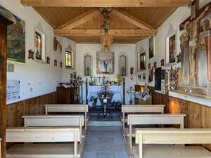
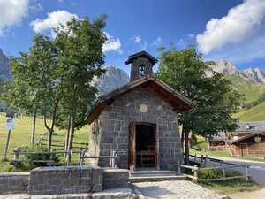
Finally, after what seemed like forever, we arrived at a quaint little village with gorgeous views of the surrounding area. This was not where we were staying for the night, but it was a welcome respite, and it marked the end of the steep descent; the rest of the day would be on a very gentle slope. The small chapel, besides being attractive, had a water fountain that Richard declared the best water he had ever tasted in his life. We also met the Italian couple again as we were passing through the village—they were staying at the charming Rifugio Fuciade.
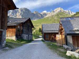
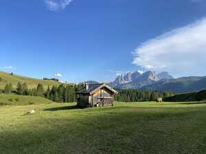
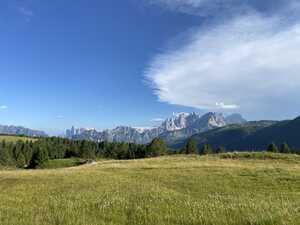
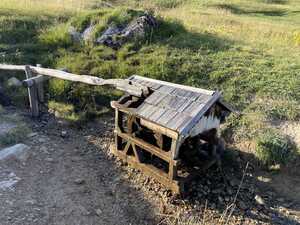
After this, it was an easy hike down to the Passo San Pellegrino, where we spent the night at the Hotel Monzoni. While the hotel room was nothing to write home about, it was the peak of luxury compared to some of the huts we’d stayed in on previous nights, and the food was not bad. There was an eggplant dish included in the buffet portion of the meal (the “appetizer”) that was absolutely divine. Apparently everyone else agreed, because when we went back for seconds, it was completely gone. We saw the Russian and Belarusian again; they were, in fact, hiking to the same hut as we were the next day as well, so we’d definitely be seeing them again.
The first thing that I did the next morning while in town was stop by an outdoors shop near our hotel and purchase a pair of trekking poles. My knees had absolutely had enough, and while there wasn’t much downhill scheduled for the day, there would be quite a bit of it—about 740 meters—on the next day (and the final day for me). The poles were clearly of very cheap construction, but they only really had to survive for two days, so oh well.
The day started off not super well; we almost went the wrong way up to the Col Margherita, though fortunately we realized fairly early on that our route was not lining up with the map. After locating the correct trail—a much smaller track that we had previously missed at the fork—we proceeded to climb the right way. This climb was not particularly eventful, and the views from the top were mostly just okay (by Dolomites standards), with the highlight being the nearby Lago di Cavia. Some cows were also around and were kind enough to pose for pictures.
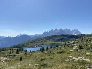
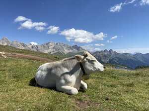
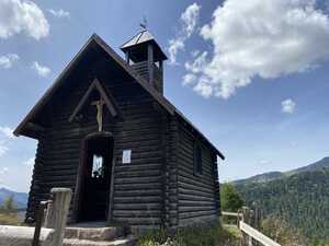
From there, we descended into the Passo Valles—a gentle descent, but I was still thankful to have the trekking poles. We stopped for lunch at the roadside rifugio at the pass, which served some incredible food. Richard was raving about his food, and I had a snail risotto that was probably the first risotto in my life that I’ve actually liked?11 There was also a small chapel in the pass, which we of course stopped by. (I love visiting random small chapels in the mountains.)
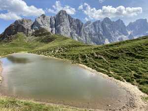
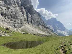
From here, it was mostly an undulating traverse to the base of the spectacular Pale di San Martino group, from which we’d climb about 350 meters to the Rifugio Mulaz for the night. Here, the terrain opened up to become truly magical: a grassy landscape where the pompous, stony grandeur of the mountains ahead met the quiet woodland enchantment of the hills below. As a result of the recent precipitation, there were small pools of water scattered throughout the countryside; in their muddy surface one could glimpse a reflection of this world, or perhaps a portal to another. It brought to mind the Narnian wood between the worlds. The going was easy here, affording us ample opportunity to admire the incredible massif that we were about to climb.
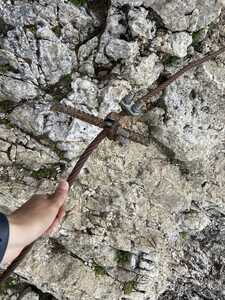
And climb we did, including an aided section. At one point, I noticed that the steel rebar holding the cable in place had been broken off of the mountain. Not exactly a reassuring sight when you’re holding onto said steel cable for protection…
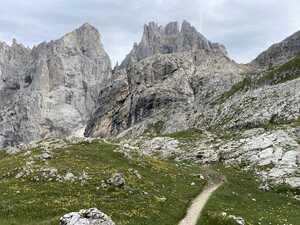
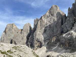
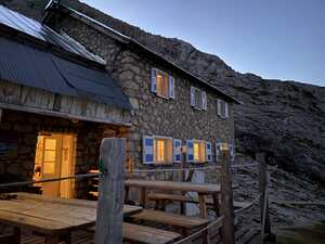
Anyway, the scenery here was rocky and mountainous, occasionally passing through patches of grass with small, blooming wildflowers. The Cicerone guidebook likens this area to the lunar surface, although it is my understanding that the lunar regolith is generally much finer in texture and doesn’t contain any wildflowers. The going here was substantially less easy than before, but eventually we rounded the last bend and the Rifugio Mulaz, our destination for the night, came into view.
When I went inside to check in, we were assigned some “beds” (really, mattresses on the floor) in a tiny little “dorm room” (really, a cramped extension of the attic), which we thankfully only had to share with the Belarusian and the Russian. It was so ridiculously cramped that I had to almost kneel down to get through the doorway, and I couldn’t fully stand inside the room. Two pictures of this are shown below. It would have been miserable at full capacity, but at half capacity it was okay. It did make me feel like we were true adventurers staying at a primitive hut in the mountains; our hotel accommodations the previous night had perhaps been just a little too luxurious.
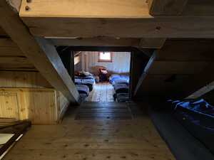
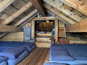
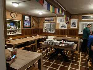
I went to do some chores (namely, my laundry), and I found out that we were in for a real treat: apparently, they had no water for showering that night, so we were all going to have to make do with wiping ourselves down the best we could with our towels. Ah yes, the joys of mountain life.
At the very least, dinner was okay. Our assigned seats ended up being next to our two new Eastern European friends, so we chatted about our future plans for the hike. It turned out that the Russian was going to go on, but the Belarusian, like me, was going to leave the trail the next day at the Rifugio Rosetta. There was also an, er, interesting incident that occurred during dinner: you see, during this trip I had had much success just ordering random beverages whose names I didn’t understand. I had discovered, for instance, the local speciality skiwasser (a sort of raspberry and lemon soda), and I enjoyed drinking the local elderflower water. So, I figured nothing could go wrong just ordering a random Italian thing off the menu, and so I settled on a grappa.
Dear reader, you’re going to have to believe me when I say that I genuinely didn’t know that grappa is a kind of Italian brandy. I was much surprised when the waitress handed me a tiny shot glass rather than the tall soda I had been expecting. But, well, having ordered it, it would have been silly for me not to drink it…
I woke up on the last day with a bit of a heavy heart. This would be my last day in the Dolomites, before having to head out of the mountains and back into reality. In just a few days, I would be trading magnificent limestone peaks for the cold steel and glass of downtown Manhattan. Yes, I know: all worlds draw to an end…
But before that, I was treated to something truly awesome, perhaps my favorite moment of the trip. In the early hours of the day outside of the hut, the clouds lifted to show just a sliver of the horizon in the distance, and with it perhaps the most glorious sunrise that I’ve ever seen. Another lady who was watching the sunrise as well described it well: the mountains looked like they were painted at that moment. If you’ll allow me to wax poetic, it really brought to mind that famous verse from Tennyson:
Here at the quiet limit of the world,
A white-hair’d shadow roaming like a dream
The ever-silent spaces of the East,
Far-folded mists, and gleaming halls of morn.Tithonus
I just sat there on the bench outside the rifugio contemplating the sunrise for some time. I did a short devotional reading and snapped a few pictures before heading back inside to eat breakfast and do morning chores—pack up, filter some tap water for drinking, etc.
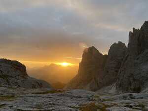
I started my hike a bit on the early side, as I wanted to make sure I made it to town in time to catch my bus at 4pm.12 To that end, Richard and I decided to part ways: I would be traveling a little bit faster to ensure that I arrived in time. This day was the shortest in distance—a meager 5.4 miles—but what it lacked in length it made up for with difficulty of terrain.13 This was supposed to be the most technically demanding day thus far, although some of the southernmost stages that I didn’t get to hike are supposed to be quite rugged as well.
After saying goodbye to Richard, the day started with a scree traverse and a fun scramble up to the Passo delle Farangole, a small notch between the rocks. I decided to don my helmet for the aided section, leaving my harness and lanyard in my bag. The pass marked the highest-elevation point of the day at 2,814 meters; it was quickly followed by an aided descent into yet more rugged, rocky terrain, following what appeared to be a dry stream bed with some still-visible snowpack. After a little more descending, I entered a grassy traverse overlooking a wooded gorge—the Val delle Comelle, at the bottom of which appeared to be a river of white scree. The trail here felt fairly exposed, with one wrong step potentially sending one plummeting into the valley below. I went slowly here, stowing my poles and hugging the rock wall in a few places where the trail became sketchy. At least if I fell, my last moments would be spent in wonder looking at the alpine valley below and the wildflower-studded slopes above.
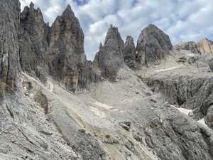
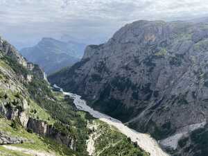
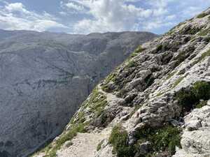
I knew I was going fairly slowly in this section because the Russian, who had left the Rifugio Mulaz later than I had, caught up to me here. We traveled together for a bit up some aided sections, where we helped each other hoist our bags over a narrow passageway through the rock that was difficult to navigate with a backpack on. We eventually parted ways when I sped up on the final climb up to the Rifugio Rosetta, mostly to ensure that my watch would not die and lose the workout recording. I made very good time in this section, and even so I just barely managed to make it before the watch died.
The Rifugio Rosetta was quite packed, with many day trippers who had come up via the nearby cable car, which I planned to take down into town to catch my bus. I was only able to snag a seat for lunch because I was a solo traveler; I had a traditional Tyrolean charcuterie board and a glass of elderflower water. The charcuterie was good, except for the cheese, which was a little too strong for my Chinese-American tastes. After this satisfying lunch, I did two errands: first, I stashed my trekking poles at the Rifugio Rosetta to leave them for Richard, who would be arriving later in the afternoon and could use them for the rest of his hike. Second, I went to use the restroom, where I was confronted with a truly astonishing sight: a squatting toilet! I’d only ever seen these in Asia before, so I was quite perplexed to see one in Europe. I took a picture to commemorate this, although I won’t post it here because it would look a bit distasteful next to all the beautiful mountain pictures.
I considered squeezing in a summit of the nearby Cima Rosetta (2,743 m) as my last hurrah before heading out of the mountains. However, I eventually decided against it, just in case it took longer than I expected and I ended up missing my bus. So, I began the sad walk to the cable car, stopping frequently to admire the mountains one last time.
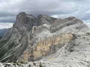
The cable car down the mountain was pretty short and uneventful. I felt a little awkward because I had hung my (laundered) socks on the outside of my backpack to dry in the sun. Hanging old socks to dry is fine in the mountains, but in a cable car with other people, it probably isn’t the best look. It was actually possible for me to hike down the mountain, but there was absolutely no way I was going to do that to my knees.
A few minutes later, I arrived in the small town of San Martino di Castrozza, where I walked to the bus station. At the bus station, I saw my new friend the Belarusian, and we chatted for a bit as we waited for the bus. This being Italy, the bus was obviously not on time, but a kind lady reassured us that we were at the right place for the bus to Venice.14
The bus did finally arrive, and it was actually quite an enjoyable ride. We wound our way through many small, cute Italian towns, with lots of neat sights that I couldn’t snap a good picture of as we went by (like a rail bridge over a gorge and a painted pink bicycle welcoming the Giro d’Italia). There was an old lady sitting next to me who tried to ask me something, but I had to explain that I didn’t speak any Italian. Otherwise, I arrived at the Piazzale Roma in Venice without much incident.
I’ve written up a separate brief epilogue on my adventures in Venice, if you’re interested in that. Otherwise, read on for my sappy thoughts on the main trekking part of the trip.
Since getting back, a lot of people have asked me how the trip was. The standard (and truthful) answer that I give is that it was a ton of fun, although I usually explain how the Alps, with their centuries of human development, are very different from, say, the High Sierra, with its vast expanse of true wilderness. It really was an incredible trip, and I’m very glad to have been able to experience it. The Dolomites are a wonderful natural treasure, a real treat for anyone who loves the mountains.
I guess I’ve gone on a couple of such adventures by now, such as bicycling from Pittsburgh to Washington, DC back in college. The truth is, such journeys always feel so ethereal to me: for a week, I’m on the trail, hiking through the mountains or riding along the river. For a fleeting moment—a week, a mere two percent of the year, give or take—this becomes my life. And then all of a sudden, I’m back in Manhattan, trying to convince the compiler to typecheck my GADT. I’m not going to complain about work; I actually quite enjoy my job. After all, how many people have the privilege of getting paid to play with functional programming, much less get paid ludicrous sums of money and eat free food? But it does make me almost wonder: did the trip even ever happen? Outside of a few memories and pictures and a pile of old gear, it’s almost as if it never occurred.
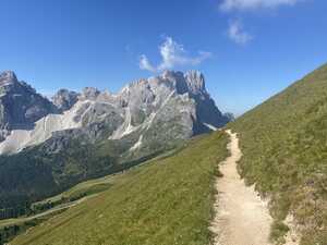
I sometimes wonder about the people I meet by chance on the trail. How are the Belarusian and his family doing? Will the Australian ever soften his stance toward religion? Is that woman still running a bar in rural Maryland (or was it West Virginia)? I don’t really know any of these people, but for a brief moment we shared something very special, even if it was just a sunrise from the top of a mountain.
Do I miss such trips after they happen? Perhaps. Besides the obviously gorgeous landscape, there’s a really beautiful simplicity to life on the trail: you start the day at point A, and your goal is to end it at point B. No exams or deadlines or projects to juggle. But there’s also much beauty in my everyday life: reading a good book, hearing a good sermon, catching up with old friends, meeting new ones, or even writing elegant code.15 One doesn’t have to go to a beautiful landscape to experience such beautiful moments, although of course it doesn’t hurt.
This blog post is already far too long, so I’ll just end with some brief thoughts on my gear and some of the logistical aspects of this trip. I don’t really imagine that very many people will read this post to the end, and of those who do, I can’t imagine that any will actually be planning a trip to the Dolomites. But still, I have fun pretending that I’m giving gear advice to aspiring alpine adventurists.
Overall, I was pretty happy with my gear choice. My base weight was nineteen pounds (measured on the airport luggage scale), which isn’t amazing but is perfectly manageable. Some honorable gear mentions:
My cycling jacket (from Bontrager) actually turned out to be a shockingly great windbreaker. (That’s the blue jacket in some of my photos—I swapped out the gray Columbia jacket in favor of it after taking the gear picture.) It’s designed for cycling, but it’s not too bad for hiking. It’s super lightweight and packable (it’s meant to fit inside a cycling jersey pocket) and blocks the wind decently well. The only downside is that it’s cut to fit on the bike, meaning that the back is much longer than the front, but if you don’t mind the unfashionable aspect it’s not a bad hiking jacket.
My cycling jacket was a little too light to be used as a proper rain jacket or an evening jacket in the mountains, so I paired it with a proper North Face rain jacket and a Patagonia puffer jacket. Between these three, I covered pretty much every conceivable summer weather condition in the Alps, and then some.
The Cicerone guidebook—and especially the detailed map book inside—was worth its weight in gold. Perhaps I’m old-fashioned, but we relied on the map book almost exclusively for navigation.
Having a backpacking water filter was shockingly useful. Many huts don’t have potable sink water and charge for bottled water, so being able to filter tap water is really useful. Natural water sources are few and far between in the Dolomites, but it’s also a real treat to be able to drink out of a fresh alpine spring when you happen to stumble across one.
Although I didn’t originally bring trekking poles, I realized my mistake midway through the hike and ended up buying some cheap ones at a local shop. They really do take a lot of weight off of your knees.
A short nylon cord, originally brought in case I needed to lash gear to the outside of my pack, turned out to be a great makeshift laundry line.
There are, of course, things that I probably wouldn’t bring again:
Via ferrata set: a controversial choice perhaps, but I think if you’re in decent shape and not too afraid of heights, you’d be better off saving yourself the weight and space in your pack and not bringing the via ferrata set. None of the sections that I went through really required any safety gear.
Two caveats, though: I’ve heard that the trail gets a bit more remote in the southern half, so perhaps the safety harness would be more useful there. Also, while none of the required sections on the trail really require climbing gear, there are some extensions and side-trips that are a little more perilous, for which climbing gear would be advisable.
I was kind of disappointed by my Apple Watch’s performance. I’ve noticed for a while that the battery life has been dwindling, especially when it gets cold out. On several days, I barely made it to the end of the day before the watch ran out of battery. In all fairness, I will say that this watch is now nearly five years old, so perhaps it’s just time for an upgrade.
I brought cotton shirts and socks. (Yes, I’m aware of the old adage, “cotton kills.”) It was fine during the day, but one thing that I didn’t really like: cotton dries fairly slowly, so after doing laundry one night, I would often have to hang my socks from the outside of my bag the next day to dry. Save yourself the effort and bring something faster-drying, such as synthetic fibers or merino wool.
I think that’s roughly all for gear opinions. I have few opinions on the itinerary: I think it was pretty fine. Thanks to Richard for booking most things! Also, of course, feel free to reach out if you happen to be planning a trip to the Dolomites, although of course I expect this condition to approximately never be triggered.
If you’ve read all the way to the end of my overly-sentimental and overly-long blog post, I feel like you deserve some prize, but I don’t really have anything to give, so you can just have my regards. Firefox’s reader mode suggests that it has taken you around an hour to read the whole thing.16 Thanks for reading!
Yeah, I’m not a huge fan of Strava’s recent user-hostile maneuvers. Probably I’ll invest some time in finding an open-source alternative at some point.↩︎
In fact, wild camping is generally illegal in Italy, although for the most part, as long as you’re discreet enough about it people don’t care. It’s not like there are police in the mountains. We saw a few people camping outside the rifugi.↩︎
On the bright side, I’ve probably racked up a pretty sizable membership dividend for next year…↩︎
As a loyal New Jersey native at heart, I typically prefer flying out of EWR, but with credit card points it turned out to be cheaper to fly Delta, so I flew out of JFK instead this time. I will admit that JFK is quite nice…I was shocked to see a Lego store inside the terminal!↩︎
This is an inside joke, for the benefit of those not from ACF.↩︎
My eighth grade English teacher, Mr. Ferraro, made us memorize the opening sonnet, which begins: “Two households, both alike in dignity / In fair Verona, where we lay our scene…” It’s still etched into my memory to this day.↩︎
The fifth-edition Cicerone guidebook has this listed as the Medalares Alm, but a cursory online search doesn’t turn up any other references to this name.↩︎
Well, I guess I can only speak for myself…↩︎
I say “we” booked, but really Richard did all the hut booking. Thanks Richard!↩︎
This was because I didn’t want to have to check in my luggage. The official TSA guidelines say that trekking poles are not allowed in carry-on luggage.↩︎
To be fair, I think I’d only ever eaten risotto once before, in Switzerland.↩︎
I did build in a day of buffer time in case I missed the bus and had to take the next one the following morning.↩︎
Although the Belarusian was going to take the same bus as I was, we hiked different routes to get there. He was not super comfortable with the exposure on this day, so he took an alternate route down the mountain.↩︎
Well, the Belarusian was only going as far as Treviso, but I was going to Venice.↩︎
Okay, maybe that last one was a bit too nerdy…↩︎
Also, in a post as long as this one, I’m sure I’ve made at least a few typos, so don’t hesitate to send any my way. It’s always appreciated.↩︎
Comments